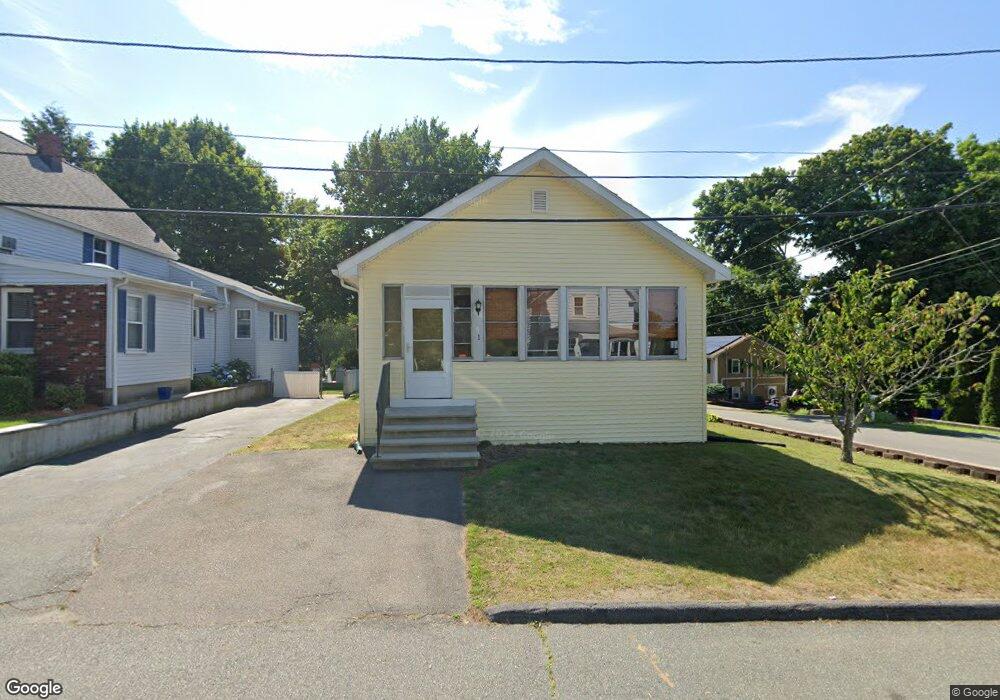
1 Laconia Ave Saugus, MA 01906
Downtown Saugus NeighborhoodEstimated Value: $512,000 - $547,000
2
Beds
1
Bath
910
Sq Ft
$585/Sq Ft
Est. Value
About This Home
This home is located at 1 Laconia Ave, Saugus, MA 01906 and is currently estimated at $532,009, approximately $584 per square foot. 1 Laconia Ave is a home located in Essex County with nearby schools including Saugus High School, Pioneer Charter School Of Science II, and Sacred Heart School.
Ownership History
Date
Name
Owned For
Owner Type
Purchase Details
Closed on
Jan 28, 2022
Sold by
Ogrady Matthew
Bought by
Surette Brenda L and Surette Donald P
Current Estimated Value
Home Financials for this Owner
Home Financials are based on the most recent Mortgage that was taken out on this home.
Original Mortgage
$196,377
Outstanding Balance
$180,147
Interest Rate
3.22%
Mortgage Type
FHA
Estimated Equity
$351,862
Purchase Details
Closed on
Jul 24, 2020
Sold by
Surette Brenda L and Surette Donald P
Bought by
Ogrady Matthew
Home Financials for this Owner
Home Financials are based on the most recent Mortgage that was taken out on this home.
Original Mortgage
$171,000
Interest Rate
3.2%
Mortgage Type
New Conventional
Purchase Details
Closed on
Jul 28, 1999
Sold by
Lebel Maria
Bought by
Surette Donald P and Surette Brenda Lee
Home Financials for this Owner
Home Financials are based on the most recent Mortgage that was taken out on this home.
Original Mortgage
$161,500
Interest Rate
7.61%
Mortgage Type
Purchase Money Mortgage
Purchase Details
Closed on
Jul 28, 1994
Sold by
Bergman Barbara and Doucette Dorothy C
Bought by
Lebel Maria
Create a Home Valuation Report for This Property
The Home Valuation Report is an in-depth analysis detailing your home's value as well as a comparison with similar homes in the area
Home Values in the Area
Average Home Value in this Area
Purchase History
| Date | Buyer | Sale Price | Title Company |
|---|---|---|---|
| Surette Brenda L | $200,000 | None Available | |
| Ogrady Matthew | $180,000 | None Available | |
| Surette Donald P | $170,000 | -- | |
| Lebel Maria | $92,000 | -- |
Source: Public Records
Mortgage History
| Date | Status | Borrower | Loan Amount |
|---|---|---|---|
| Open | Surette Brenda L | $196,377 | |
| Previous Owner | Ogrady Matthew | $171,000 | |
| Previous Owner | Lebel Maria | $204,449 | |
| Previous Owner | Lebel Maria | $180,000 | |
| Previous Owner | Lebel Maria | $161,500 | |
| Previous Owner | Lebel Maria | $15,087 |
Source: Public Records
Tax History
| Year | Tax Paid | Tax Assessment Tax Assessment Total Assessment is a certain percentage of the fair market value that is determined by local assessors to be the total taxable value of land and additions on the property. | Land | Improvement |
|---|---|---|---|---|
| 2025 | $5,029 | $470,900 | $295,100 | $175,800 |
| 2024 | $4,804 | $451,100 | $278,300 | $172,800 |
| 2023 | $4,628 | $411,000 | $244,500 | $166,500 |
| 2022 | $4,461 | $371,400 | $224,300 | $147,100 |
| 2021 | $4,219 | $341,900 | $194,800 | $147,100 |
| 2020 | $3,895 | $326,800 | $185,500 | $141,300 |
| 2019 | $3,711 | $304,700 | $168,700 | $136,000 |
| 2018 | $3,407 | $294,200 | $163,600 | $130,600 |
| 2017 | $3,087 | $256,200 | $152,600 | $103,600 |
| 2016 | $2,874 | $235,600 | $151,100 | $84,500 |
| 2015 | $2,697 | $224,400 | $143,900 | $80,500 |
| 2014 | $2,705 | $233,000 | $143,900 | $89,100 |
Source: Public Records
Map
Nearby Homes
- 25 Auburn St
- 7 Adams Ave
- 36 Jasper St
- 66 Springdale Ave
- 187 Hamilton St
- 4 Foss Ave
- 4 Oneil Way
- 1 Rhodes St
- 12 Atlantic Ave
- 52 Hesper St
- 62 Main St
- 62 Chestnut St Unit 2
- 141 Essex St Unit D6
- 12 Seagirt Ave
- 57 Vine St
- 23 Orchard Ave
- 6 Saugus Ave Unit A
- 38 Appleton St
- 0 Hampton St
- 32-34 Mount Vernon St
Your Personal Tour Guide
Ask me questions while you tour the home.