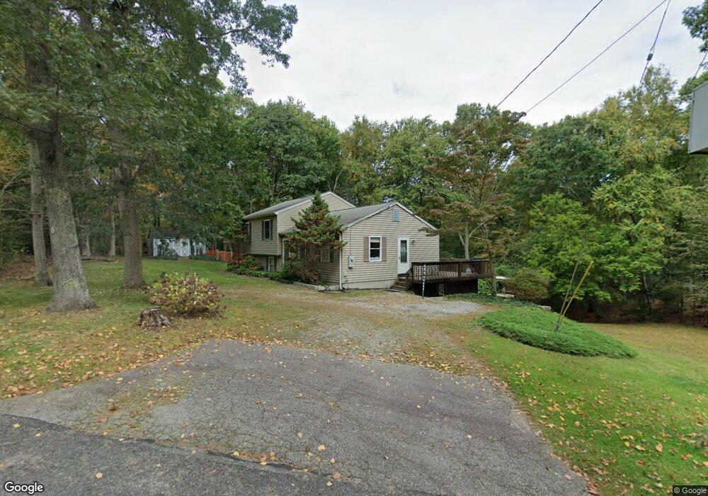
1 Laurel Rd Moodus, CT 06469
Estimated Value: $629,000 - $1,013,000
3
Beds
4
Baths
2,167
Sq Ft
$373/Sq Ft
Est. Value
About This Home
This home is located at 1 Laurel Rd, Moodus, CT 06469 and is currently estimated at $809,125, approximately $373 per square foot. 1 Laurel Rd is a home located in Middlesex County with nearby schools including East Haddam Elementary School, Nathan Hale-Ray Middle School, and Nathan Hale-Ray High School.
Ownership History
Date
Name
Owned For
Owner Type
Purchase Details
Closed on
Oct 14, 2014
Sold by
Taylor Jr Tr Daniel M and Lamothe-Taylor Deborah
Bought by
Sawyer William J and Sawyer Patricia J
Current Estimated Value
Purchase Details
Closed on
Mar 13, 2014
Sold by
Taylor Dean H
Bought by
Taylor Sheila
Purchase Details
Closed on
Oct 12, 2011
Sold by
Taylor Daniel
Bought by
Taylor Daniel and Lamothe-Taylor Deborah
Create a Home Valuation Report for This Property
The Home Valuation Report is an in-depth analysis detailing your home's value as well as a comparison with similar homes in the area
Home Values in the Area
Average Home Value in this Area
Purchase History
| Date | Buyer | Sale Price | Title Company |
|---|---|---|---|
| Sawyer William J | -- | -- | |
| Sawyer William J | -- | -- | |
| Taylor Sheila | -- | -- | |
| Taylor Sheila | -- | -- | |
| Taylor Daniel | -- | -- | |
| Sawyer William J | -- | -- | |
| Taylor Sheila | -- | -- | |
| Taylor Daniel | -- | -- |
Source: Public Records
Mortgage History
| Date | Status | Borrower | Loan Amount |
|---|---|---|---|
| Previous Owner | Taylor Daniel | $225,000 |
Source: Public Records
Tax History Compared to Growth
Tax History
| Year | Tax Paid | Tax Assessment Tax Assessment Total Assessment is a certain percentage of the fair market value that is determined by local assessors to be the total taxable value of land and additions on the property. | Land | Improvement |
|---|---|---|---|---|
| 2025 | $13,689 | $487,840 | $285,400 | $202,440 |
| 2024 | $13,055 | $487,840 | $285,400 | $202,440 |
| 2023 | $12,562 | $487,840 | $285,400 | $202,440 |
| 2022 | $11,119 | $349,760 | $182,950 | $166,810 |
| 2021 | $10,647 | $349,760 | $182,950 | $166,810 |
| 2020 | $10,647 | $349,760 | $182,950 | $166,810 |
| 2019 | $10,647 | $349,760 | $182,950 | $166,810 |
| 2018 | $10,374 | $349,760 | $182,950 | $166,810 |
| 2017 | $9,411 | $318,160 | $189,500 | $128,660 |
| 2016 | $9,338 | $318,160 | $189,500 | $128,660 |
| 2015 | $9,125 | $318,160 | $189,500 | $128,660 |
| 2014 | $8,876 | $318,150 | $189,490 | $128,660 |
Source: Public Records
Map
Nearby Homes
- 8 Tom Rd
- 114 Lakeside Dr
- 53 Falls Bashan Rd
- 42 Dogwood Rd
- 0 Lakeside Dr
- 45 Alger Rd
- 154 Falls Rd
- 112 Schulman Veslak Rd
- 53 Falls Rd
- 5 Joe Williams Rd
- 55 Bogel Rd
- 63 Schulman Veslak Rd
- 21 Olmstead Rd
- 23 Olmstead Rd
- 398 E Haddam Moodus Rd
- 80 Orchard Rd
- 213 Waterhole Rd
- 115 Lakeview Dr
- 53 Shanaghans Rd
- 145 Lakeview Dr