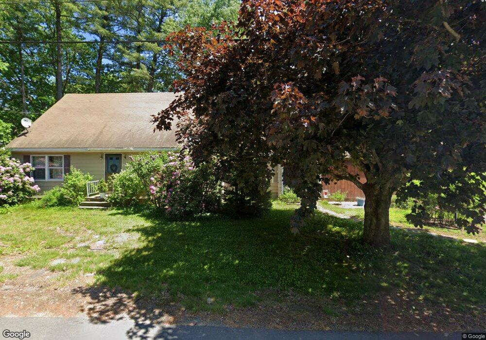
1 Lily Pond Rd Somersworth, NH 03878
Estimated Value: $452,000 - $477,000
3
Beds
2
Baths
1,700
Sq Ft
$271/Sq Ft
Est. Value
About This Home
This home is located at 1 Lily Pond Rd, Somersworth, NH 03878 and is currently estimated at $461,517, approximately $271 per square foot. 1 Lily Pond Rd is a home with nearby schools including Maple Wood Elementary School, Somersworth High School, and Tri-City Christian Academy.
Ownership History
Date
Name
Owned For
Owner Type
Purchase Details
Closed on
Sep 5, 2023
Sold by
Hagan Amie L
Bought by
Hagan Michael S
Current Estimated Value
Home Financials for this Owner
Home Financials are based on the most recent Mortgage that was taken out on this home.
Original Mortgage
$250,000
Outstanding Balance
$244,638
Interest Rate
6.9%
Mortgage Type
Stand Alone Refi Refinance Of Original Loan
Estimated Equity
$216,879
Purchase Details
Closed on
Feb 7, 2007
Sold by
Ambrose Ft
Bought by
Hagan Michael S and Hagan Amie L
Home Financials for this Owner
Home Financials are based on the most recent Mortgage that was taken out on this home.
Original Mortgage
$232,850
Interest Rate
6.22%
Mortgage Type
Purchase Money Mortgage
Create a Home Valuation Report for This Property
The Home Valuation Report is an in-depth analysis detailing your home's value as well as a comparison with similar homes in the area
Home Values in the Area
Average Home Value in this Area
Purchase History
| Date | Buyer | Sale Price | Title Company |
|---|---|---|---|
| Hagan Michael S | -- | None Available | |
| Hagan Michael S | -- | None Available | |
| Hagan Michael S | $245,000 | -- | |
| Hagan Michael S | $245,000 | -- |
Source: Public Records
Mortgage History
| Date | Status | Borrower | Loan Amount |
|---|---|---|---|
| Open | Hagan Michael S | $250,000 | |
| Closed | Hagan Michael S | $250,000 | |
| Previous Owner | Hagan Michael S | $232,850 |
Source: Public Records
Tax History Compared to Growth
Tax History
| Year | Tax Paid | Tax Assessment Tax Assessment Total Assessment is a certain percentage of the fair market value that is determined by local assessors to be the total taxable value of land and additions on the property. | Land | Improvement |
|---|---|---|---|---|
| 2024 | $7,641 | $408,600 | $102,800 | $305,800 |
| 2023 | $6,332 | $216,100 | $34,600 | $181,500 |
| 2022 | $6,070 | $216,100 | $34,600 | $181,500 |
| 2021 | $5,949 | $216,100 | $34,600 | $181,500 |
| 2020 | $8,350 | $216,100 | $34,600 | $181,500 |
| 2019 | $8,877 | $215,900 | $34,600 | $181,300 |
| 2018 | $9,178 | $190,800 | $47,900 | $142,900 |
| 2017 | $6,320 | $191,000 | $47,900 | $143,100 |
| 2016 | $6,135 | $191,000 | $47,900 | $143,100 |
| 2015 | $6,192 | $192,000 | $47,900 | $144,100 |
| 2014 | $5,979 | $192,000 | $47,900 | $144,100 |
Source: Public Records
Map
Nearby Homes
- 159 W High St
- 43 Otis Rd
- 395 Route 108
- 203 New Hampshire 108
- 94 Maple St Unit A
- 45 Crystal Springs Way
- 163 Rochester St
- 18 Lenox Dr Unit C
- 29 Chadwick Ln
- 38 Laurel Ln
- 13 Guy St
- 19B Birch Hill Ln Unit 19B
- 23A Birch Hill Ln Unit 23A
- 23B Birch Hill Ln Unit 23B
- 301 Sherwood Glen
- 200 Sherwood Glen
- 229 Sherwood Glen
- 206 Sherwood Glen
- 22A Birch Hill Ln Unit 22A
- 19A Birch Hill Ln Unit 19A