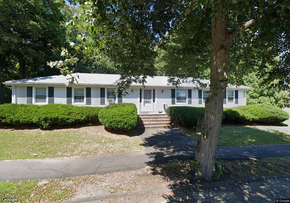
1 Linden Dr Danvers, MA 01923
Estimated Value: $711,000 - $906,000
4
Beds
2
Baths
2,856
Sq Ft
$293/Sq Ft
Est. Value
About This Home
This home is located at 1 Linden Dr, Danvers, MA 01923 and is currently estimated at $837,230, approximately $293 per square foot. 1 Linden Dr is a home located in Essex County with nearby schools including Danvers High School, St. Mary of the Annunciation School, and Bishop Fenwick High School.
Ownership History
Date
Name
Owned For
Owner Type
Purchase Details
Closed on
Nov 2, 2021
Sold by
Drummey George J Est and Drummey
Bought by
Oregan Connor E and Oregan Ryan J
Current Estimated Value
Home Financials for this Owner
Home Financials are based on the most recent Mortgage that was taken out on this home.
Original Mortgage
$645,909
Outstanding Balance
$585,161
Interest Rate
2.8%
Mortgage Type
FHA
Estimated Equity
$252,069
Purchase Details
Closed on
Feb 27, 2008
Sold by
Drummey Eleanor G and Drummey George J
Bought by
Drummey George J
Purchase Details
Closed on
May 15, 1995
Sold by
Eden Rt and Mcinnis
Bought by
Drummey George J and Drummey Eleanor G
Home Financials for this Owner
Home Financials are based on the most recent Mortgage that was taken out on this home.
Original Mortgage
$148,500
Interest Rate
8.31%
Mortgage Type
Purchase Money Mortgage
Create a Home Valuation Report for This Property
The Home Valuation Report is an in-depth analysis detailing your home's value as well as a comparison with similar homes in the area
Home Values in the Area
Average Home Value in this Area
Purchase History
| Date | Buyer | Sale Price | Title Company |
|---|---|---|---|
| Oregan Connor E | $690,000 | None Available | |
| Drummey George J | -- | -- | |
| Drummey George J | $165,000 | -- |
Source: Public Records
Mortgage History
| Date | Status | Borrower | Loan Amount |
|---|---|---|---|
| Open | Oregan Connor E | $645,909 | |
| Previous Owner | Drummey George J | $90,000 | |
| Previous Owner | Drummey George J | $148,500 |
Source: Public Records
Tax History
| Year | Tax Paid | Tax Assessment Tax Assessment Total Assessment is a certain percentage of the fair market value that is determined by local assessors to be the total taxable value of land and additions on the property. | Land | Improvement |
|---|---|---|---|---|
| 2025 | $8,178 | $744,100 | $325,400 | $418,700 |
| 2024 | $7,745 | $697,100 | $307,400 | $389,700 |
| 2023 | $7,519 | $639,900 | $277,300 | $362,600 |
| 2022 | $6,936 | $547,900 | $241,300 | $306,600 |
| 2021 | $6,813 | $510,300 | $231,700 | $278,600 |
| 2020 | $7,337 | $561,800 | $241,300 | $320,500 |
| 2019 | $5,304 | $399,400 | $196,900 | $202,500 |
| 2018 | $5,130 | $378,900 | $196,900 | $182,000 |
| 2017 | $5,155 | $363,300 | $181,300 | $182,000 |
| 2016 | $5,159 | $363,300 | $181,300 | $182,000 |
| 2015 | $5,068 | $339,900 | $157,300 | $182,600 |
Source: Public Records
Map
Nearby Homes
- 97 Sylvan St Unit 7
- 152 Endicott St
- 63 Adams St
- 47 Collins St Unit 50
- 21 Olsen Rd
- 108 Abington Rd Unit 108
- 22 Braman St
- 10 Clark St
- 18 Wadsworth St
- 6 Grant St
- 500 Northshore Rd Unit 6B
- 14 Williams St Unit C17
- 5 Holten St
- 43 Hobart St Unit B
- 61 High St
- 147 High St
- 35 High St Unit 3D
- 55 Hawthorne Cir
- 23 Tamarack Ln Unit 23
- 233 Lowell St Unit 1
- 135 Sylvan St
- 4 Linden Dr
- 4 Linden Dr Unit 1
- 4 Linden Dr Unit 2
- 133 1/2 Sylvan St
- 145 Sylvan St
- 145 Sylvan St Unit 1
- 146 Sylvan St
- 6 Linden Dr
- 6 Linden Dr Unit 3
- 6 Linden Dr Unit 2
- 133 Collins St
- 7 Linden Dr
- 148 Sylvan St
- 9 Linden Dr
- 131 Collins St
- 150 Sylvan St
- 150 Sylvan St Unit 2
- 150 Sylvan St Unit 1
- 136 Sylvan St
Your Personal Tour Guide
Ask me questions while you tour the home.