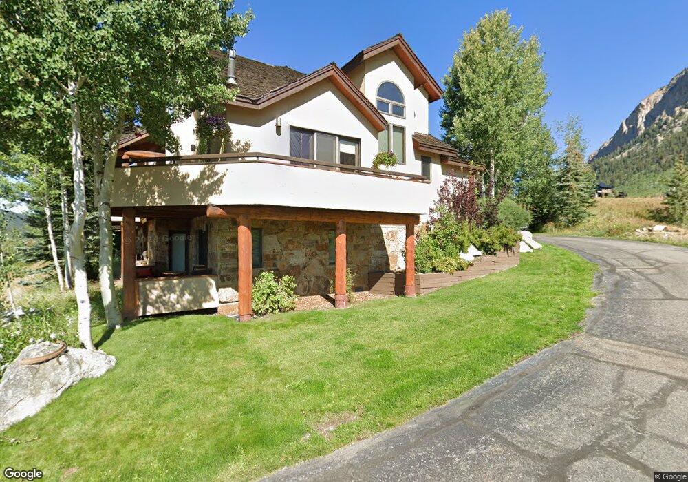
1 Links Ct Crested Butte, CO 81224
Estimated Value: $1,448,771 - $1,817,000
3
Beds
4
Baths
1,264
Sq Ft
$1,304/Sq Ft
Est. Value
About This Home
This home is located at 1 Links Ct, Crested Butte, CO 81224 and is currently estimated at $1,648,193, approximately $1,303 per square foot. 1 Links Ct is a home located in Gunnison County with nearby schools including Gunnison Elementary School, Crested Butte Community School, and Gunnison Middle School.
Ownership History
Date
Name
Owned For
Owner Type
Purchase Details
Closed on
Jun 4, 2021
Sold by
Haushill Scott E
Bought by
Sikora David and Sikora Lisa
Current Estimated Value
Purchase Details
Closed on
Feb 1, 2017
Sold by
Frame Kitty M
Bought by
Haushill Scott E
Home Financials for this Owner
Home Financials are based on the most recent Mortgage that was taken out on this home.
Original Mortgage
$325,000
Interest Rate
4.3%
Mortgage Type
New Conventional
Purchase Details
Closed on
Aug 29, 2012
Sold by
Filippone Judy J and Filippone Marion V
Bought by
Frame John R and Frame Katherine M
Home Financials for this Owner
Home Financials are based on the most recent Mortgage that was taken out on this home.
Original Mortgage
$319,900
Interest Rate
3.56%
Mortgage Type
New Conventional
Purchase Details
Closed on
Jun 23, 1998
Bought by
Baylis Arthur H
Create a Home Valuation Report for This Property
The Home Valuation Report is an in-depth analysis detailing your home's value as well as a comparison with similar homes in the area
Home Values in the Area
Average Home Value in this Area
Purchase History
| Date | Buyer | Sale Price | Title Company |
|---|---|---|---|
| Sikora David | $1,180,000 | Gunnison County Abstract Co | |
| Haushill Scott E | $645,000 | Stewart Title | |
| Frame John R | $457,000 | None Available | |
| Baylis Arthur H | $325,000 | -- |
Source: Public Records
Mortgage History
| Date | Status | Borrower | Loan Amount |
|---|---|---|---|
| Previous Owner | Haushill Scott E | $325,000 | |
| Previous Owner | Frame John R | $319,900 |
Source: Public Records
Tax History Compared to Growth
Tax History
| Year | Tax Paid | Tax Assessment Tax Assessment Total Assessment is a certain percentage of the fair market value that is determined by local assessors to be the total taxable value of land and additions on the property. | Land | Improvement |
|---|---|---|---|---|
| 2024 | $7,476 | $101,650 | $13,490 | $88,160 |
| 2023 | $7,476 | $97,970 | $13,000 | $84,970 |
| 2022 | $5,390 | $60,370 | $7,370 | $53,000 |
| 2021 | $4,961 | $62,100 | $7,580 | $54,520 |
| 2020 | $4,349 | $51,670 | $4,720 | $46,950 |
| 2019 | $4,289 | $51,670 | $4,720 | $46,950 |
| 2018 | $3,649 | $40,570 | $5,760 | $34,810 |
| 2017 | $3,673 | $40,570 | $5,760 | $34,810 |
| 2016 | $3,500 | $40,260 | $11,790 | $28,470 |
| 2015 | $1,703 | $40,260 | $11,790 | $28,470 |
| 2014 | $1,703 | $35,220 | $10,450 | $24,770 |
Source: Public Records
Map
Nearby Homes
- 350 Country Club Dr Unit 217A
- 350 Country Club Dr Unit 218A
- 350 Country Club Dr Unit 402A
- 434 Country Club Dr
- 0 Tbd Saddle Ridge Rd
- 412 Ridge Rd
- 315 Par Ln
- 168 W Silver Sage Dr
- 288 Forest Ln
- 402 Eagle Ln
- 491 Slate River Dr
- 253 W Silver Sage Dr
- 1665 Skyland Dr
- 166 & 168 Coyote Cir
- 180 Elk Valley Rd Unit 124
- 180 Elk Valley Rd Unit 109
- 180 Elk Valley Rd Unit 110
- 180 Elk Valley Rd Unit 102
- 180 Elk Valley Rd Unit 118
- 1294 County Road 734