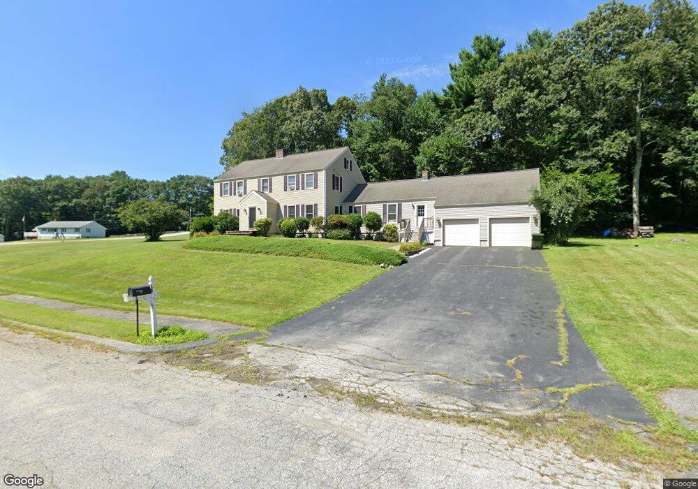
1 Lovett Cir Oxford, MA 01540
Estimated Value: $714,455 - $828,000
5
Beds
5
Baths
3,164
Sq Ft
$243/Sq Ft
Est. Value
About This Home
This home is located at 1 Lovett Cir, Oxford, MA 01540 and is currently estimated at $769,114, approximately $243 per square foot. 1 Lovett Cir is a home located in Worcester County with nearby schools including Alfred M Chaffee, Oxford High School, and Clara Barton Elementary School.
Ownership History
Date
Name
Owned For
Owner Type
Purchase Details
Closed on
Dec 8, 2023
Sold by
Horan Brian A and Horan Renee P
Bought by
Horan Brian A and Horan Renee P
Current Estimated Value
Purchase Details
Closed on
Jul 1, 1999
Sold by
Sand Richard A and Callan Elizabeth L
Bought by
Horan Brian A and Hora Renee P
Purchase Details
Closed on
Sep 9, 1988
Sold by
Corey Dennis
Bought by
Sand R A
Create a Home Valuation Report for This Property
The Home Valuation Report is an in-depth analysis detailing your home's value as well as a comparison with similar homes in the area
Home Values in the Area
Average Home Value in this Area
Purchase History
| Date | Buyer | Sale Price | Title Company |
|---|---|---|---|
| Horan Brian A | -- | None Available | |
| Horan Brian A | $287,500 | -- | |
| Sand R A | $300,000 | -- |
Source: Public Records
Mortgage History
| Date | Status | Borrower | Loan Amount |
|---|---|---|---|
| Previous Owner | Sand R A | $322,900 | |
| Previous Owner | Sand R A | $284,000 |
Source: Public Records
Tax History Compared to Growth
Tax History
| Year | Tax Paid | Tax Assessment Tax Assessment Total Assessment is a certain percentage of the fair market value that is determined by local assessors to be the total taxable value of land and additions on the property. | Land | Improvement |
|---|---|---|---|---|
| 2025 | $8,214 | $648,300 | $125,800 | $522,500 |
| 2024 | $8,149 | $604,500 | $116,400 | $488,100 |
| 2023 | $7,550 | $553,500 | $111,300 | $442,200 |
| 2022 | $7,521 | $465,400 | $86,200 | $379,200 |
| 2021 | $7,263 | $439,400 | $81,800 | $357,600 |
| 2020 | $7,004 | $420,400 | $81,800 | $338,600 |
| 2019 | $6,642 | $390,000 | $81,800 | $308,200 |
| 2018 | $6,335 | $366,800 | $81,800 | $285,000 |
| 2017 | $6,302 | $374,000 | $78,500 | $295,500 |
| 2016 | $6,452 | $381,100 | $78,500 | $302,600 |
| 2015 | $6,018 | $381,100 | $78,500 | $302,600 |
| 2014 | $5,898 | $393,200 | $76,400 | $316,800 |
Source: Public Records
Map
Nearby Homes
- 11 Lovett Rd
- 35 &33 Sutton Ave
- 15 Lind St
- 0 Dana Rd
- 18 Sutton Ave
- 11 Sutton Ave
- 12 New St
- 8 Turk Hollow Rd
- 5 Carlton Ct
- 397 Main St
- 6 Rawson Ave
- 3 Rhonda Rheault Dr
- L0T 11 History Dr
- L0T 3 History Dr
- 7 Tower Hill Rd
- 7 Millbury Blvd
- L0T 12 History Dr
- 0 Federal Hill Rd Unit 73422286
- 36 Locust St
- 9 Howarth Rd