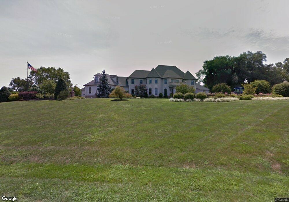
1 Manfredi Dr Kennett Square, PA 19348
Estimated Value: $775,000 - $981,000
2
Beds
3
Baths
3,805
Sq Ft
$228/Sq Ft
Est. Value
About This Home
This home is located at 1 Manfredi Dr, Kennett Square, PA 19348 and is currently estimated at $867,787, approximately $228 per square foot. 1 Manfredi Dr is a home located in Chester County with nearby schools including Kennett Middle School, Kennett High School, and St. Patrick School.
Ownership History
Date
Name
Owned For
Owner Type
Purchase Details
Closed on
Feb 5, 2019
Sold by
Manfredi Frank W and Manfredi John W
Bought by
Manfredi Francis W and Manfredi Christina M
Current Estimated Value
Home Financials for this Owner
Home Financials are based on the most recent Mortgage that was taken out on this home.
Original Mortgage
$300,000
Outstanding Balance
$263,754
Interest Rate
4.5%
Mortgage Type
New Conventional
Estimated Equity
$604,033
Create a Home Valuation Report for This Property
The Home Valuation Report is an in-depth analysis detailing your home's value as well as a comparison with similar homes in the area
Home Values in the Area
Average Home Value in this Area
Purchase History
| Date | Buyer | Sale Price | Title Company |
|---|---|---|---|
| Manfredi Francis W | $575,000 | Brendan Abstract Company Inc |
Source: Public Records
Mortgage History
| Date | Status | Borrower | Loan Amount |
|---|---|---|---|
| Open | Manfredi Francis W | $300,000 |
Source: Public Records
Tax History
| Year | Tax Paid | Tax Assessment Tax Assessment Total Assessment is a certain percentage of the fair market value that is determined by local assessors to be the total taxable value of land and additions on the property. | Land | Improvement |
|---|---|---|---|---|
| 2025 | $14,213 | $348,530 | $85,330 | $263,200 |
| 2024 | $14,213 | $348,530 | $85,330 | $263,200 |
| 2023 | $13,937 | $348,530 | $85,330 | $263,200 |
| 2022 | $13,565 | $348,530 | $85,330 | $263,200 |
| 2021 | $13,361 | $348,530 | $85,330 | $263,200 |
| 2020 | $13,111 | $348,530 | $85,330 | $263,200 |
| 2019 | $12,936 | $348,530 | $85,330 | $263,200 |
| 2018 | $12,668 | $348,530 | $85,330 | $263,200 |
| 2017 | $11,784 | $348,530 | $85,330 | $263,200 |
| 2016 | $1,382 | $348,530 | $85,330 | $263,200 |
| 2015 | $1,382 | $348,530 | $85,330 | $263,200 |
| 2014 | $1,382 | $348,530 | $85,330 | $263,200 |
Source: Public Records
Map
Nearby Homes
- 102 Knoxlyn Farm Dr
- 1261 Benjamin Dr
- 118 Pleasant Bank Ln
- 2 Farron Dr
- 103 Pierce Ln
- 115 Chandler Mill Rd
- 105 Waywood Dr
- 531 Chandler Mill Rd
- 117 Chandler Mill Rd
- 114 Chandler Mill Rd
- 109 Chandler Mill Rd
- 103 Waywood Dr Unit 36
- 103 Waywood Dr
- 535 Kenview Ave
- 115 Waywood Dr Unit 31
- 113 Waywood Dr Unit 32
- 111 Waywood Dr Unit 33
- 311 E State St
- 118 Austin Dr
- 126 Austin Dr
- 1 Manfredi Dr
- 724 Creek Rd
- 722 Creek Rd
- 720 Creek Rd
- 726 Creek Rd
- 2 Manfredi Dr
- 716 Creek Rd
- 718 Creek Rd
- 157 Old Kennett Rd
- 0 Creek Rd Unit 5251031
- 0 Creek Rd Unit 5251001
- 0 Creek Rd Unit 5251135
- 0 Creek Rd Unit 5251121
- 0 Creek Rd Unit 5480158
- 0 Creek Rd Unit 5480155
- 0 Creek Rd Unit 5565389
- 0 Creek Rd Unit 5565384
- 0 Creek Rd Unit 5565363
- 0 Creek Rd Unit 5565361
- 0 Creek Rd Unit 5565365
Your Personal Tour Guide
Ask me questions while you tour the home.