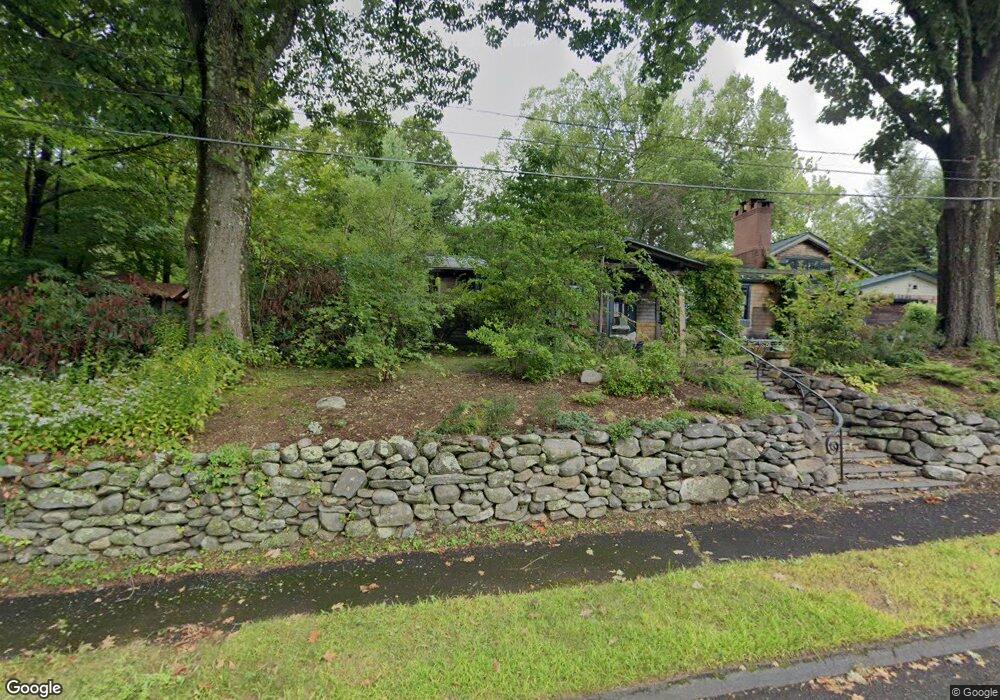
1 Maplewood Dr Amherst, MA 01002
Estimated Value: $836,000 - $1,054,000
6
Beds
3
Baths
4,053
Sq Ft
$222/Sq Ft
Est. Value
About This Home
This home is located at 1 Maplewood Dr, Amherst, MA 01002 and is currently estimated at $898,993, approximately $221 per square foot. 1 Maplewood Dr is a home located in Hampshire County with nearby schools including Wildwood Elementary School, Amherst Regional Middle School, and Amherst Regional High School.
Ownership History
Date
Name
Owned For
Owner Type
Purchase Details
Closed on
Nov 30, 2020
Sold by
Winship Donkin Ft
Bought by
Donkin Ellen and Winship Lawrence J
Current Estimated Value
Purchase Details
Closed on
Apr 16, 2019
Sold by
Winship Lawrence J and Donkin Ellen
Bought by
Winship Donkin Ft
Purchase Details
Closed on
Apr 15, 2019
Sold by
Winship Lawrence J and Donkin Ellen
Bought by
Donkin Ellen and Winship Lawrence J
Purchase Details
Closed on
Mar 2, 2012
Sold by
Winship Lawrence J and Donkin Ellen
Bought by
Winship Lawrence J and Donkin Ellen
Home Financials for this Owner
Home Financials are based on the most recent Mortgage that was taken out on this home.
Original Mortgage
$239,000
Interest Rate
3.88%
Mortgage Type
New Conventional
Purchase Details
Closed on
May 19, 1987
Bought by
Winship Lawrence J and Donkin Ellen
Create a Home Valuation Report for This Property
The Home Valuation Report is an in-depth analysis detailing your home's value as well as a comparison with similar homes in the area
Home Values in the Area
Average Home Value in this Area
Purchase History
| Date | Buyer | Sale Price | Title Company |
|---|---|---|---|
| Donkin Ellen | -- | None Available | |
| Winship Donkin Ft | -- | -- | |
| Donkin Ellen | -- | -- | |
| Winship Lawrence J | -- | -- | |
| Winship Lawrence J | -- | -- |
Source: Public Records
Mortgage History
| Date | Status | Borrower | Loan Amount |
|---|---|---|---|
| Previous Owner | Winship Lawrence J | $239,000 | |
| Previous Owner | Winship Lawrence J | $240,000 | |
| Previous Owner | Winship Lawrence J | $134,400 |
Source: Public Records
Tax History
| Year | Tax Paid | Tax Assessment Tax Assessment Total Assessment is a certain percentage of the fair market value that is determined by local assessors to be the total taxable value of land and additions on the property. | Land | Improvement |
|---|---|---|---|---|
| 2025 | $14,152 | $788,400 | $205,900 | $582,500 |
| 2024 | $13,307 | $718,900 | $194,300 | $524,600 |
| 2023 | $12,655 | $629,600 | $176,700 | $452,900 |
| 2022 | $12,181 | $572,700 | $160,600 | $412,100 |
| 2021 | $12,237 | $560,800 | $148,700 | $412,100 |
| 2020 | $11,956 | $560,800 | $148,700 | $412,100 |
| 2019 | $11,410 | $523,400 | $148,700 | $374,700 |
| 2018 | $11,065 | $523,400 | $148,700 | $374,700 |
| 2017 | $10,753 | $492,600 | $141,700 | $350,900 |
| 2016 | $10,453 | $492,600 | $141,700 | $350,900 |
| 2015 | $10,118 | $492,600 | $141,700 | $350,900 |
Source: Public Records
Map
Nearby Homes
- 0 Red Gate Ln Unit 73348273
- 50 Mount Pleasant
- 104 Spring St
- 0 Main St
- 32 N Prospect St Unit 5
- 185 Cherry Ln
- Lot A Kingman Rd
- 0 Amherst Rd
- 0 Heatherstone Rd
- 43 Morgan Cir
- 9 Harkness Rd
- 208 Pine St Unit 53
- 33 Bridge St
- 148 Aubinwood Rd
- 30 Greenleaves Dr
- 26 Greenleaves Dr Unit 635
- 26 Greenleaves Dr Unit 624
- 27 Greenleaves Dr Unit 709
- 23 Greenleaves Dr Unit 105
- 23 Greenleaves Dr Unit 107
- 233 Strong St
- 5 Maplewood Dr
- 255 Strong St
- 221 Strong St
- 15 Maplewood Dr
- 20 Maplewood Dr
- 232 Strong St
- 219 Strong St
- 265 Strong St
- 258 Strong St
- 159 Maplewood Cir
- 35 Maplewood Cir
- 21 Maplewood Dr
- 286 Strong St
- 25 Maplewood Dr
- 226 Strong St
- 38 Maplewood Cir
- 268 Strong St
- 218 Strong St
- 161 Red Gate Ln
Your Personal Tour Guide
Ask me questions while you tour the home.