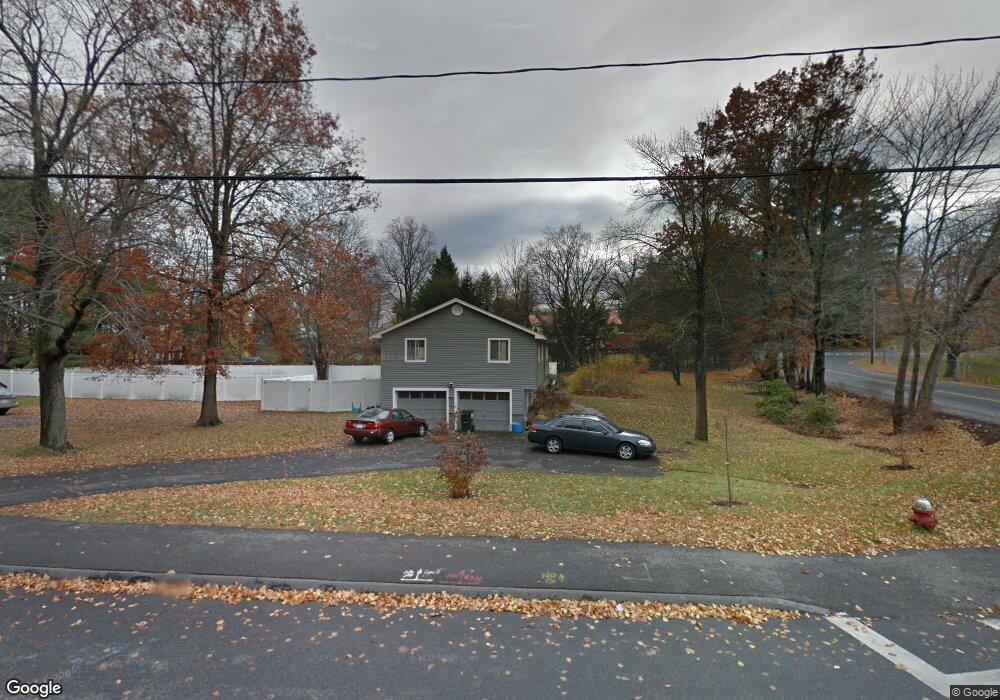
1 Matoon St Amherst, MA 01002
Estimated Value: $463,845 - $549,000
3
Beds
2
Baths
1,180
Sq Ft
$436/Sq Ft
Est. Value
About This Home
This home is located at 1 Matoon St, Amherst, MA 01002 and is currently estimated at $514,711, approximately $436 per square foot. 1 Matoon St is a home located in Hampshire County with nearby schools including Wildwood Elementary School, Amherst Regional Middle School, and Amherst Regional High School.
Ownership History
Date
Name
Owned For
Owner Type
Purchase Details
Closed on
Jul 18, 2001
Sold by
Masonjones Heather D and Masonjones Michael C
Bought by
Cox Susan
Current Estimated Value
Purchase Details
Closed on
Aug 20, 1999
Sold by
Yoo Seong Bock and Young Jae
Bought by
Masonjones Heather D and Masonjones Michael C
Purchase Details
Closed on
Sep 15, 1997
Sold by
Newell Marion M and Newell Norman D
Bought by
Yoo Seong Bock and Yoo Young Jae
Create a Home Valuation Report for This Property
The Home Valuation Report is an in-depth analysis detailing your home's value as well as a comparison with similar homes in the area
Home Values in the Area
Average Home Value in this Area
Purchase History
| Date | Buyer | Sale Price | Title Company |
|---|---|---|---|
| Cox Susan | $175,000 | -- | |
| Masonjones Heather D | $144,000 | -- | |
| Yoo Seong Bock | $125,000 | -- |
Source: Public Records
Mortgage History
| Date | Status | Borrower | Loan Amount |
|---|---|---|---|
| Open | Yoo Seong Bock | $30,700 | |
| Open | Yoo Seong Bock | $128,500 | |
| Closed | Yoo Seong Bock | $136,600 |
Source: Public Records
Tax History
| Year | Tax Paid | Tax Assessment Tax Assessment Total Assessment is a certain percentage of the fair market value that is determined by local assessors to be the total taxable value of land and additions on the property. | Land | Improvement |
|---|---|---|---|---|
| 2025 | $75 | $415,500 | $204,300 | $211,200 |
| 2024 | $7,252 | $391,800 | $192,800 | $199,000 |
| 2023 | $6,820 | $339,300 | $175,400 | $163,900 |
| 2022 | $6,672 | $313,700 | $159,400 | $154,300 |
| 2021 | $6,343 | $290,700 | $147,800 | $142,900 |
| 2020 | $6,198 | $290,700 | $147,800 | $142,900 |
| 2019 | $6,052 | $277,600 | $147,800 | $129,800 |
| 2018 | $5,868 | $277,600 | $147,800 | $129,800 |
| 2017 | $6,053 | $277,300 | $140,800 | $136,500 |
| 2016 | $5,884 | $277,300 | $140,800 | $136,500 |
| 2015 | $5,696 | $277,300 | $140,800 | $136,500 |
Source: Public Records
Map
Nearby Homes
- 48 Gray St
- 0 Main St
- 0 Red Gate Ln Unit 73348273
- 60 Red Gate Ln
- 75 Amity Place Unit 75
- 63 Amity Place Unit 63
- 270 N East St
- 310 Belchertown Rd
- 24 Greenleaves Dr Unit 418
- 30 Greenleaves Dr
- 26 Greenleaves Dr Unit 635
- 27 Greenleaves Dr Unit 726
- 185 Cherry Ln
- 0 Heatherstone Rd
- 39 Valley Ln
- 0 Amherst Rd
- 9 Harkness Rd
- 53 Pine Grove Unit 53
- 67 Pine Grove Unit 67
- Lot 3 Roosevelt St
Your Personal Tour Guide
Ask me questions while you tour the home.