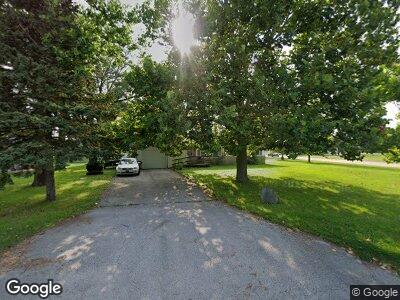
1 McDonald Ave Forsyth, IL 62535
Estimated Value: $51,000 - $177,000
--
Bed
--
Bath
1,370
Sq Ft
$96/Sq Ft
Est. Value
About This Home
This home is located at 1 McDonald Ave, Forsyth, IL 62535 and is currently estimated at $132,000, approximately $96 per square foot. 1 McDonald Ave is a home located in Macon County with nearby schools including Maroa-Forsyth Grade School, Maroa-Forsyth Middle School, and Maroa-Forsyth Senior High School.
Ownership History
Date
Name
Owned For
Owner Type
Purchase Details
Closed on
Nov 5, 2024
Sold by
Skyline Real Estate Inc
Bought by
Hendrian Andrew R
Current Estimated Value
Purchase Details
Closed on
Sep 5, 2022
Sold by
Francisco Lopez
Bought by
Skyline Real Estate Inc
Purchase Details
Closed on
Apr 21, 2021
Sold by
Hampsmire Trust
Bought by
Bolanos Francisco Lopez
Purchase Details
Closed on
Sep 27, 2005
Sold by
Hampsmire Alice J
Bought by
Hampsmire Alice J
Create a Home Valuation Report for This Property
The Home Valuation Report is an in-depth analysis detailing your home's value as well as a comparison with similar homes in the area
Home Values in the Area
Average Home Value in this Area
Purchase History
| Date | Buyer | Sale Price | Title Company |
|---|---|---|---|
| Hendrian Andrew R | $50,000 | None Listed On Document | |
| Skyline Real Estate Inc | -- | -- | |
| Bolanos Francisco Lopez | $36,500 | None Available | |
| Hampsmire Alice J | -- | None Available |
Source: Public Records
Tax History Compared to Growth
Tax History
| Year | Tax Paid | Tax Assessment Tax Assessment Total Assessment is a certain percentage of the fair market value that is determined by local assessors to be the total taxable value of land and additions on the property. | Land | Improvement |
|---|---|---|---|---|
| 2024 | $1,272 | $16,666 | $11,951 | $4,715 |
| 2023 | $3,302 | $42,085 | $10,986 | $31,099 |
| 2022 | $3,089 | $39,032 | $10,189 | $28,843 |
| 2021 | $2,871 | $36,231 | $9,528 | $26,703 |
| 2020 | $951 | $35,482 | $9,331 | $26,151 |
| 2019 | $951 | $35,482 | $9,331 | $26,151 |
| 2018 | $937 | $35,736 | $9,398 | $26,338 |
| 2017 | $933 | $35,576 | $9,356 | $26,220 |
| 2016 | $943 | $35,662 | $9,379 | $26,283 |
| 2015 | $926 | $35,239 | $9,268 | $25,971 |
| 2014 | $905 | $35,239 | $9,268 | $25,971 |
| 2013 | $1,066 | $33,421 | $8,790 | $24,631 |
Source: Public Records
Map
Nearby Homes
- 7 McDonald Ave
- 5354 N Macarthur Rd
- 0 Route 51 Unit 6241333
- 5307 Yavapai Dr
- 1302 Clement Ave
- 4612 Havenwood Dr
- 4545 Havenwood Dr
- 1104 Clement Ave
- 4624 Redbud Ct
- 490 Shadow Ln
- 4404 Havenwood Dr
- 4605 Redbud Ct
- 291 Michael Ave
- 749 Christopher Dr
- 676 Wolf Rd
- 1250 W Hickory Point Rd
- 4554 Nicklaus Ct
- 160 Hickory Point Ct
- 95 Hickory Point Ct
- 4027 N Buckingham Dr
- 1 McDonald Ave
- 3 McDonald Ave
- 445 W Hickory Point Rd
- 5 McDonald Ave
- 2 Woodland Dr
- 4 Woodland Dr
- 362 W Hickory Point Rd
- 400 W Hickory Point Rd
- 322 W Hickory Point Rd
- 6 Woodland Dr
- 9 McDonald Ave
- 8 Woodland Dr
- 1 Woodland Dr
- 16 Surrey Ln
- 312 W Hickory Point Rd
- 416 W Hickory Point Rd
- 5 Woodland Dr
- 18 Surrey Ln
- 525 W Hickory Point Rd
- 11 McDonald Ave
