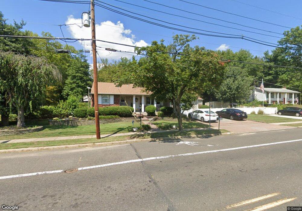
1 N Fork Landing Rd Cinnaminson, NJ 08077
Estimated Value: $355,016 - $471,000
--
Bed
--
Bath
1,625
Sq Ft
$258/Sq Ft
Est. Value
About This Home
This home is located at 1 N Fork Landing Rd, Cinnaminson, NJ 08077 and is currently estimated at $419,004, approximately $257 per square foot. 1 N Fork Landing Rd is a home located in Burlington County with nearby schools including New Albany Elementary School, Eleanor Rush Intermediate School, and Cinnaminson Middle School.
Ownership History
Date
Name
Owned For
Owner Type
Purchase Details
Closed on
Jan 22, 2024
Sold by
Pollard Ruth M
Bought by
Pollard Family Irrevocable Trust and Pollard
Current Estimated Value
Create a Home Valuation Report for This Property
The Home Valuation Report is an in-depth analysis detailing your home's value as well as a comparison with similar homes in the area
Home Values in the Area
Average Home Value in this Area
Purchase History
| Date | Buyer | Sale Price | Title Company |
|---|---|---|---|
| Pollard Family Irrevocable Trust | -- | None Listed On Document | |
| Pollard Family Irrevocable Trust | -- | None Listed On Document |
Source: Public Records
Tax History Compared to Growth
Tax History
| Year | Tax Paid | Tax Assessment Tax Assessment Total Assessment is a certain percentage of the fair market value that is determined by local assessors to be the total taxable value of land and additions on the property. | Land | Improvement |
|---|---|---|---|---|
| 2025 | $8,277 | $217,300 | $67,500 | $149,800 |
| 2024 | $8,077 | $217,300 | $67,500 | $149,800 |
| 2023 | $8,077 | $217,300 | $67,500 | $149,800 |
| 2022 | $7,901 | $217,300 | $67,500 | $149,800 |
| 2021 | $7,588 | $217,300 | $67,500 | $149,800 |
| 2020 | $7,762 | $217,300 | $67,500 | $149,800 |
| 2019 | $7,653 | $217,300 | $67,500 | $149,800 |
| 2018 | $7,599 | $217,300 | $67,500 | $149,800 |
| 2017 | $7,271 | $217,300 | $67,500 | $149,800 |
| 2016 | $7,166 | $217,300 | $67,500 | $149,800 |
| 2015 | $6,932 | $217,300 | $67,500 | $149,800 |
| 2014 | $6,588 | $217,300 | $67,500 | $149,800 |
Source: Public Records
Map
Nearby Homes
- 4 Smethwycke Dr
- 2414 Church Rd
- 3 Glacier Dr
- 2308 Branch Pike
- Ballad Plan at Villages at Moorestown
- Cadence Plan at Villages at Moorestown
- Odessa Plan at Villages at Moorestown
- 1801 Madison St
- 21 Kohlmyer Dr
- 83 Kohlmyer Dr
- 1631 Adams St
- 1119 Fernwood Ave
- 502 Pomona Rd
- 831 Windsor Dr
- 12 Collins Ln
- 2716 Branch Pike
- 4 W Germantown Ave
- 43 E Henry St
- 168 Fairfax Dr
- 923 Garfield Ave
- 2306 Lenola Rd
- 3 N Fork Landing Rd
- 0 Forklanding Rd Unit 6005527
- 0 Forklanding Rd Unit 6005521
- 2304 Lenola Rd
- 2100 Derby Dr
- 5 N Fork Landing Rd
- 2305 Lenola Rd
- 2106 Berwick Dr
- 2101 Derby Dr
- 2108 Berwick Dr
- 2102 Derby Dr
- 2302 Lenola Rd
- 9 S Fork Landing Rd
- 7 N Fork Landing Rd
- 2104 Berwick Dr
- 2110 Berwick Dr
- 2104 Derby Dr
- 11 S Fork Landing Rd
- 3 S Fork Landing Rd