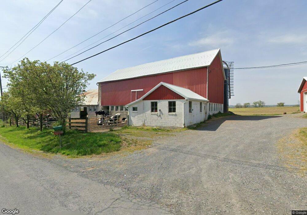
1 N Forrest Dr Mertztown, PA 19539
Longswamp NeighborhoodEstimated Value: $431,000 - $493,000
4
Beds
2
Baths
2,180
Sq Ft
$216/Sq Ft
Est. Value
About This Home
This home is located at 1 N Forrest Dr, Mertztown, PA 19539 and is currently estimated at $470,930, approximately $216 per square foot. 1 N Forrest Dr is a home located in Berks County with nearby schools including Brandywine Heights Elementary School, Brandywine Intermediate School, and Brandywine Heights High School.
Ownership History
Date
Name
Owned For
Owner Type
Purchase Details
Closed on
Oct 11, 2024
Sold by
Gangawere Richard A
Bought by
Gangawere Andrew P and Gangawere Megan S
Current Estimated Value
Create a Home Valuation Report for This Property
The Home Valuation Report is an in-depth analysis detailing your home's value as well as a comparison with similar homes in the area
Home Values in the Area
Average Home Value in this Area
Purchase History
| Date | Buyer | Sale Price | Title Company |
|---|---|---|---|
| Gangawere Andrew P | -- | None Listed On Document |
Source: Public Records
Mortgage History
| Date | Status | Borrower | Loan Amount |
|---|---|---|---|
| Previous Owner | Gangawere Richard A | $101,065 |
Source: Public Records
Tax History Compared to Growth
Tax History
| Year | Tax Paid | Tax Assessment Tax Assessment Total Assessment is a certain percentage of the fair market value that is determined by local assessors to be the total taxable value of land and additions on the property. | Land | Improvement |
|---|---|---|---|---|
| 2025 | $1,413 | $118,100 | $29,200 | $88,900 |
| 2024 | $5,584 | $118,100 | $29,200 | $88,900 |
| 2023 | $5,470 | $118,100 | $29,200 | $88,900 |
| 2022 | $5,348 | $118,100 | $29,200 | $88,900 |
| 2021 | $5,308 | $118,100 | $29,200 | $88,900 |
| 2020 | $5,268 | $118,100 | $29,200 | $88,900 |
| 2019 | $75 | $118,100 | $29,200 | $88,900 |
| 2018 | $5,136 | $118,100 | $29,200 | $88,900 |
| 2017 | $5,045 | $118,100 | $29,200 | $88,900 |
| 2016 | $1,177 | $118,100 | $29,200 | $88,900 |
| 2015 | $1,177 | $118,100 | $29,200 | $88,900 |
| 2014 | $1,177 | $118,100 | $29,200 | $88,900 |
Source: Public Records
Map
Nearby Homes
- 0 State St Unit PABK2055498
- 0 State St Unit PABK2047158
- 101 Cider Mill Rd
- 106 Hoch Ave
- 37 S Herbein Dr
- 13 Timothy Dr
- 116 W Franklin St
- 210 S Home Ave
- 32 N Main St
- 11 Woodland Ln
- 3 Woodland Ln
- 573 State St
- 44 S Park Ave
- 334 Old Topton Rd
- 0 S Park Ave
- 149 Smoketown Rd
- 0 Chestnut St
- 145 Fredericksville Rd
- 608 Old Topton Rd
- 25 Roth Ave
- 54 N Forrest Dr
- 620 W State St
- 121 Cider Mill Rd
- 14 Zimmerman Ln
- 111 Cider Mill Rd
- 117 Cider Mill Rd
- 117 Cider Mill Rd Unit 14
- 0 State St Unit 5611470
- 0 State St Unit 5772945
- 0 State St Unit 5899137
- 0 State St Unit PABK2015488
- 0 State St Unit PABK2015480
- 0 State St Unit PABK2013196
- 0 State St Unit PABK376906
- 0 State St Unit PABK341646
- 0 State St Unit 346955
- 0 State St Unit 1008885296
- 62 N Forrest Dr
- 124 Cider Mill Rd
- 45 N Forrest Dr
