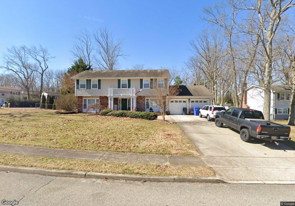
1 N Tunesbrook Dr Toms River, NJ 08753
Estimated Value: $612,284 - $695,000
4
Beds
3
Baths
2,536
Sq Ft
$255/Sq Ft
Est. Value
About This Home
This home is located at 1 N Tunesbrook Dr, Toms River, NJ 08753 and is currently estimated at $646,321, approximately $254 per square foot. 1 N Tunesbrook Dr is a home located in Ocean County with nearby schools including St Joseph Grade School and Donovan Catholic High School.
Ownership History
Date
Name
Owned For
Owner Type
Purchase Details
Closed on
Oct 4, 2007
Sold by
Coviello Robert K
Bought by
Stanisz Michael and Stanisz Lindsey
Current Estimated Value
Home Financials for this Owner
Home Financials are based on the most recent Mortgage that was taken out on this home.
Original Mortgage
$189,900
Outstanding Balance
$120,286
Interest Rate
6.49%
Mortgage Type
Purchase Money Mortgage
Estimated Equity
$526,035
Purchase Details
Closed on
Mar 2, 2006
Sold by
Deshefy John F and Deshefy Donna M
Bought by
Coviello Robert K
Home Financials for this Owner
Home Financials are based on the most recent Mortgage that was taken out on this home.
Original Mortgage
$422,750
Interest Rate
9.62%
Mortgage Type
Stand Alone First
Create a Home Valuation Report for This Property
The Home Valuation Report is an in-depth analysis detailing your home's value as well as a comparison with similar homes in the area
Home Values in the Area
Average Home Value in this Area
Purchase History
| Date | Buyer | Sale Price | Title Company |
|---|---|---|---|
| Stanisz Michael | $369,900 | None Available | |
| Coviello Robert K | $445,000 | Fidelity Natl Title Ins Co |
Source: Public Records
Mortgage History
| Date | Status | Borrower | Loan Amount |
|---|---|---|---|
| Open | Stanisz Michael | $189,900 | |
| Previous Owner | Coviello Robert K | $422,750 |
Source: Public Records
Tax History Compared to Growth
Tax History
| Year | Tax Paid | Tax Assessment Tax Assessment Total Assessment is a certain percentage of the fair market value that is determined by local assessors to be the total taxable value of land and additions on the property. | Land | Improvement |
|---|---|---|---|---|
| 2025 | $7,007 | $384,800 | $152,000 | $232,800 |
| 2024 | $6,661 | $384,800 | $152,000 | $232,800 |
| 2023 | $6,422 | $384,800 | $152,000 | $232,800 |
| 2022 | $6,422 | $384,800 | $152,000 | $232,800 |
| 2021 | $7,575 | $302,400 | $106,500 | $195,900 |
| 2020 | $7,542 | $302,400 | $106,500 | $195,900 |
| 2019 | $7,215 | $302,400 | $106,500 | $195,900 |
| 2018 | $6,838 | $290,500 | $106,500 | $184,000 |
| 2017 | $6,780 | $290,500 | $106,500 | $184,000 |
| 2016 | $6,603 | $290,500 | $106,500 | $184,000 |
| 2015 | $6,353 | $290,500 | $106,500 | $184,000 |
| 2014 | $6,048 | $290,500 | $106,500 | $184,000 |
Source: Public Records
Map
Nearby Homes
- 918 Briar Ave
- 883 Astoria Dr
- 977 Stafford Dr
- 855 Derry Dr
- 984 Westminster Dr
- 968 Goose Creek Rd
- 1013 Bay Ave
- 1004 Sheila Dr
- 904 Nantucket Ct
- 886 Ocean View Dr
- 741 Michigan Ave
- 1016 Sheila Dr
- 1050 Sheila Dr
- 696 Schoolhouse Ln
- 693 Vaughn Ave
- 308 Tradewinds Ave
- 919 Somerset Dr
- 1042 Roxbury Ln
- 786 Nebraska Ave
- 837 Naryshkin Way