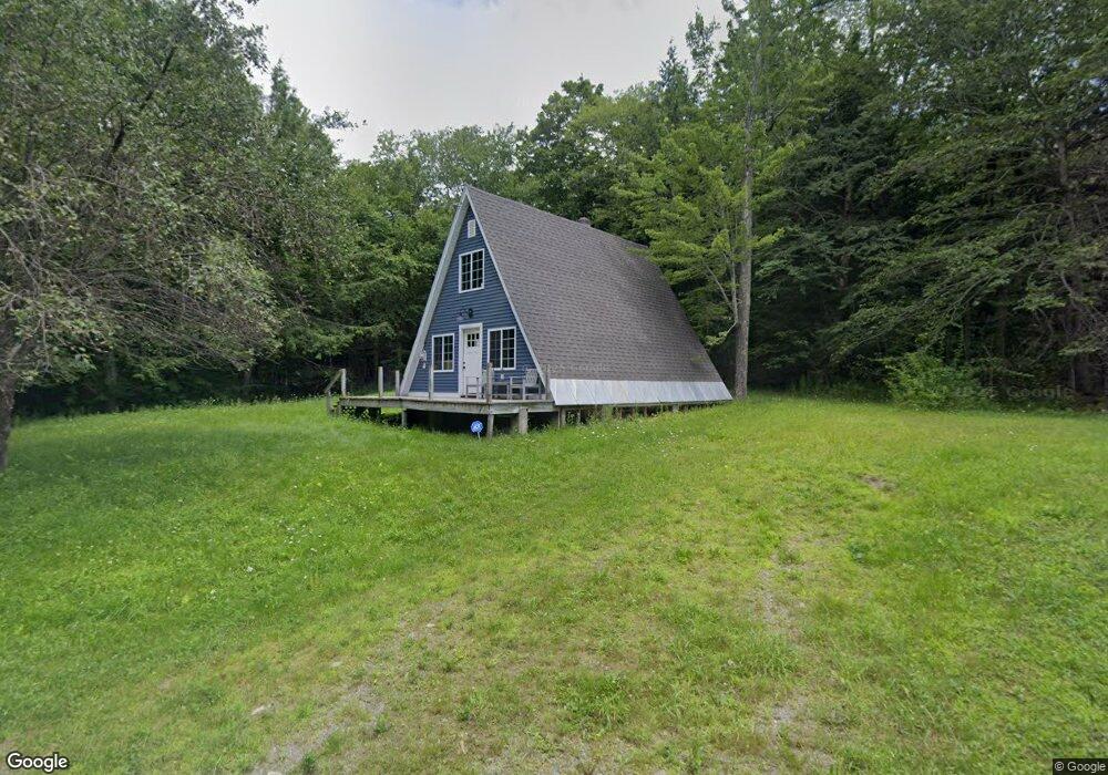
1 Papoose Lake Rd Heath, MA 01346
Heath NeighborhoodEstimated Value: $90,000 - $196,000
About This Home
This home is located at 1 Papoose Lake Rd, Heath, MA 01346 and is currently estimated at $149,528, approximately $164 per square foot. 1 Papoose Lake Rd is a home with nearby schools including Mohawk Trail Regional High School.
Ownership History
We collect this data history from publicly available records. To have your information removed, we recommend requesting removal directly through your county’s website.
Purchase Details
Purchase Details
Home Financials for this Owner
Home Financials are based on the most recent Mortgage that was taken out on this home.Home Values in the Area
Average Home Value in this Area
Purchase History
We collect this data history from publicly available records. To have your information removed, we recommend requesting removal directly through your county’s website.
| Date | Buyer | Sale Price | Title Company |
|---|---|---|---|
| -- | -- | ||
| $45,000 | -- |
Mortgage History
We collect this data history from publicly available records. To have your information removed, we recommend requesting removal directly through your county’s website.
| Date | Status | Borrower | Loan Amount |
|---|---|---|---|
| Previous Owner | $14,000 |
Tax History
We collect this data history from publicly available records. To have your information removed, we recommend requesting removal directly through your county’s website.
| Year | Tax Paid | Tax Assessment Tax Assessment Total Assessment is a certain percentage of the fair market value that is determined by local assessors to be the total taxable value of land and additions on the property. | Land | Improvement |
|---|---|---|---|---|
| 2025 | $1,424 | $75,700 | $19,300 | $56,400 |
| 2024 | $521 | $25,500 | $19,300 | $6,200 |
| 2023 | $577 | $25,200 | $19,300 | $5,900 |
| 2022 | $542 | $25,200 | $19,300 | $5,900 |
| 2021 | $568 | $25,200 | $19,300 | $5,900 |
| 2020 | $563 | $25,300 | $19,300 | $6,000 |
| 2019 | $544 | $25,200 | $19,000 | $6,200 |
| 2018 | $550 | $25,200 | $19,000 | $6,200 |
| 2017 | $963 | $45,900 | $18,800 | $27,100 |
| 2016 | $1,169 | $57,000 | $18,800 | $38,200 |
| 2015 | $1,146 | $57,400 | $18,800 | $38,600 |
Map
- 54 Papoose Lake Dr
- 3 Flagg Hill Rd
- 30 W Brook Dr
- 2 Modoc Dr
- 35 Cheyenne St
- 8 Deer Run Path
- 34 Deer Run Path
- 144 Branch Hill Rd
- 14 South Rd
- 0 Sadoga Rd Unit 249488
- 0 Sadoga Rd Unit 73507720
- 594 Massachusetts 8a
- 0 Hawk Hill Rd Unit 73524208
- 24 W Oxbow Rd
- 31 W Oxbow Rd
- Lot 121 Davis Mine Rd
- 2155 Massachusetts 2
- 2151 Route 2
- 143 Charlemont Rd
- 251 Phillips Hill Rd
- 1 Papoose Lake Dr
- 17 Papoose Lake Dr
- 42 Papoose Lake Dr
- 2 Papoose Lake Rd
- 50 Papoose Lake Dr
- 62 Papoose Lake Dr
- 62 & 66 Papoose Lake Dr
- 33 Papoose Lake Dr
- 14 Papoose Lake Dr
- 43 Swamp Rd
- 22 Swamp Rd
- 42 Papoose Lake Dr
- 16 Swamp Rd
- 0 Swamp Rd Unit 30718664
- 15 Swamp Rd
- 6 Chippewa Dr
- 44 Swamp Rd
- 146 Colrain Stage Rd
- 146 Colrain Stage Rd
- 148 Taylor Brook Rd
Ask me questions while you tour the home.