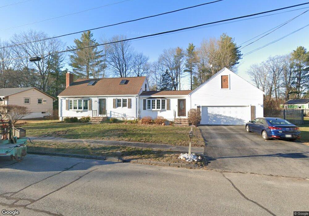
1 Patriot Rd Westbrook, ME 04092
Estimated Value: $482,000 - $554,000
3
Beds
2
Baths
1,496
Sq Ft
$344/Sq Ft
Est. Value
About This Home
This home is located at 1 Patriot Rd, Westbrook, ME 04092 and is currently estimated at $514,728, approximately $344 per square foot. 1 Patriot Rd is a home located in Cumberland County with nearby schools including Westbrook High School, St. Brigid School, and Breakwater School.
Ownership History
Date
Name
Owned For
Owner Type
Purchase Details
Closed on
Jul 2, 2018
Sold by
Profenno John R and Profenno Barbara J
Bought by
Profenno Ft
Current Estimated Value
Create a Home Valuation Report for This Property
The Home Valuation Report is an in-depth analysis detailing your home's value as well as a comparison with similar homes in the area
Purchase History
| Date | Buyer | Sale Price | Title Company |
|---|---|---|---|
| Profenno Ft | -- | -- |
Source: Public Records
Tax History
| Year | Tax Paid | Tax Assessment Tax Assessment Total Assessment is a certain percentage of the fair market value that is determined by local assessors to be the total taxable value of land and additions on the property. | Land | Improvement |
|---|---|---|---|---|
| 2023 | $5,184 | $310,800 | $93,300 | $217,500 |
| 2022 | $4,695 | $259,400 | $77,700 | $181,700 |
| 2021 | $4,625 | $259,400 | $77,700 | $181,700 |
| 2020 | $4,633 | $259,400 | $77,700 | $181,700 |
| 2019 | $4,633 | $259,400 | $77,700 | $181,700 |
| 2018 | $3,694 | $218,900 | $67,500 | $151,400 |
| 2017 | $4,133 | $218,900 | $67,500 | $151,400 |
| 2016 | $4,028 | $218,900 | $67,500 | $151,400 |
| 2015 | $3,931 | $218,900 | $67,500 | $151,400 |
| 2014 | $3,765 | $218,900 | $67,500 | $151,400 |
| 2013 | $3,765 | $218,900 | $67,500 | $151,400 |
Source: Public Records
Map
Nearby Homes
- 7 Kasseys Way Unit 5
- 22 Collins Place Dr Unit 4
- 0 Reed St
- 84 Hillside Rd
- 7 Collins Place Unit 6
- 290 Bridgton Rd Unit 1
- 858 Riverside St
- 7 Apex Dr Unit 2
- 5 Apex Dr Unit 1
- 60 Euclid Ave
- Lot 15&16 Chickadee Ln
- 106 Euclid Ave
- Lot TBD Epping St
- 95 Lane Ave
- 151 Brooks Edge Farm Rd Unit 68
- 3 Collins Place Unit 5
- 37 Bailey Ave
- 171 Brook St Unit 49
- 171 Brook St Unit 44
- 171 Brook St Unit 50
- 3 Patriot Rd
- 19 Constitution Dr
- 11 Settlers Rd
- 4 Patriot Rd
- 16 Constitution Dr
- 13 Settlers Rd
- 15 Constitution Dr
- 5 Patriot Rd
- 18 Constitution Dr
- 6 Patriot Rd
- 526 E Bridge St
- 15 Settlers Rd
- 520 E Bridge St
- 14 Constitution Dr
- 11 Constitution Dr
- 540 E Bridge St
- 514 E Bridge St
- 7 Constitution Dr
- 12 Settlers Rd
- 3 Settlers Rd
Your Personal Tour Guide
Ask me questions while you tour the home.