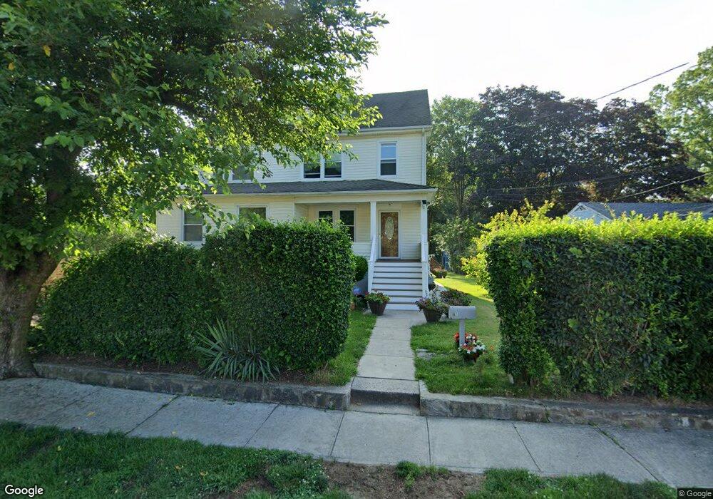
1 Pershing Ave Stamford, CT 06905
Belltown NeighborhoodEstimated Value: $437,000 - $1,080,000
2
Beds
1
Bath
2,826
Sq Ft
$287/Sq Ft
Est. Value
About This Home
This home is located at 1 Pershing Ave, Stamford, CT 06905 and is currently estimated at $810,639, approximately $286 per square foot. 1 Pershing Ave is a home located in Fairfield County with nearby schools including Julia A. Stark Elementary School, Dolan School, and Stamford High School.
Ownership History
Date
Name
Owned For
Owner Type
Purchase Details
Closed on
Jun 6, 2018
Sold by
Koszkul Ewa and Koszkul Rudolf
Bought by
Koszkul Rudolf and Koszkul Ewa
Current Estimated Value
Purchase Details
Closed on
Jun 13, 1986
Bought by
Koszkul Rudy
Create a Home Valuation Report for This Property
The Home Valuation Report is an in-depth analysis detailing your home's value as well as a comparison with similar homes in the area
Home Values in the Area
Average Home Value in this Area
Purchase History
| Date | Buyer | Sale Price | Title Company |
|---|---|---|---|
| Koszkul Rudolf | -- | -- | |
| Koszkul Rudolf | -- | -- | |
| Koszkul Rudy | -- | -- |
Source: Public Records
Mortgage History
| Date | Status | Borrower | Loan Amount |
|---|---|---|---|
| Previous Owner | Koszkul Rudy | $160,000 |
Source: Public Records
Tax History
| Year | Tax Paid | Tax Assessment Tax Assessment Total Assessment is a certain percentage of the fair market value that is determined by local assessors to be the total taxable value of land and additions on the property. | Land | Improvement |
|---|---|---|---|---|
| 2025 | $12,785 | $540,360 | $277,100 | $263,260 |
| 2024 | $12,504 | $540,360 | $277,100 | $263,260 |
| 2023 | $13,433 | $540,360 | $277,100 | $263,260 |
| 2022 | $10,832 | $405,090 | $208,380 | $196,710 |
| 2021 | $10,715 | $405,090 | $208,380 | $196,710 |
| 2020 | $10,439 | $405,090 | $208,380 | $196,710 |
| 2019 | $10,439 | $405,090 | $208,380 | $196,710 |
| 2018 | $10,054 | $405,090 | $208,380 | $196,710 |
| 2017 | $8,752 | $336,630 | $192,960 | $143,670 |
| 2016 | $8,507 | $336,630 | $192,960 | $143,670 |
| 2015 | $8,284 | $336,630 | $192,960 | $143,670 |
| 2014 | $8,008 | $336,630 | $192,960 | $143,670 |
Source: Public Records
Map
Nearby Homes
- 173 Belltown Rd
- 10 Turner Rd
- 78 Elizabeth Ave
- 42 Hastings Ln
- 51 Saint Charles Ave
- 1 Megan Ln
- 11 Belltown Rd Unit 1
- 102 Hirsch Rd
- 71 Deleo Dr
- 680 Hope St Unit 12
- 153 Oaklawn Ave
- 20 Norman Rd
- 28 Crestview Ave
- 39 Crane Rd
- 760 Hope St
- 408 Strawberry Hill Ave
- 7 Barnstable Ln
- 91 Dann Dr
- 8 Barnstable Ln
- 455 Hope St Unit 4B
- 1 Pershing Ave Unit UPPER
- 191 Belltown Rd
- 179 Belltown Rd
- 15 Pershing Ave
- 63 Pershing Ave
- 19 Pershing Ave
- 11 Pershing Ave
- 55 Pershing Ave
- 185 Belltown Rd
- 177 Belltown Rd
- 65 Pershing Ave
- 27 Pershing Ave
- 23 Pershing Ave
- 53 Pershing Ave
- 180 Belltown Rd
- 57 Pershing Ave
- 219 Belltown Rd
- 73 Pershing Ave
- 18 Pershing Ave
- 67 Pershing Ave
Your Personal Tour Guide
Ask me questions while you tour the home.