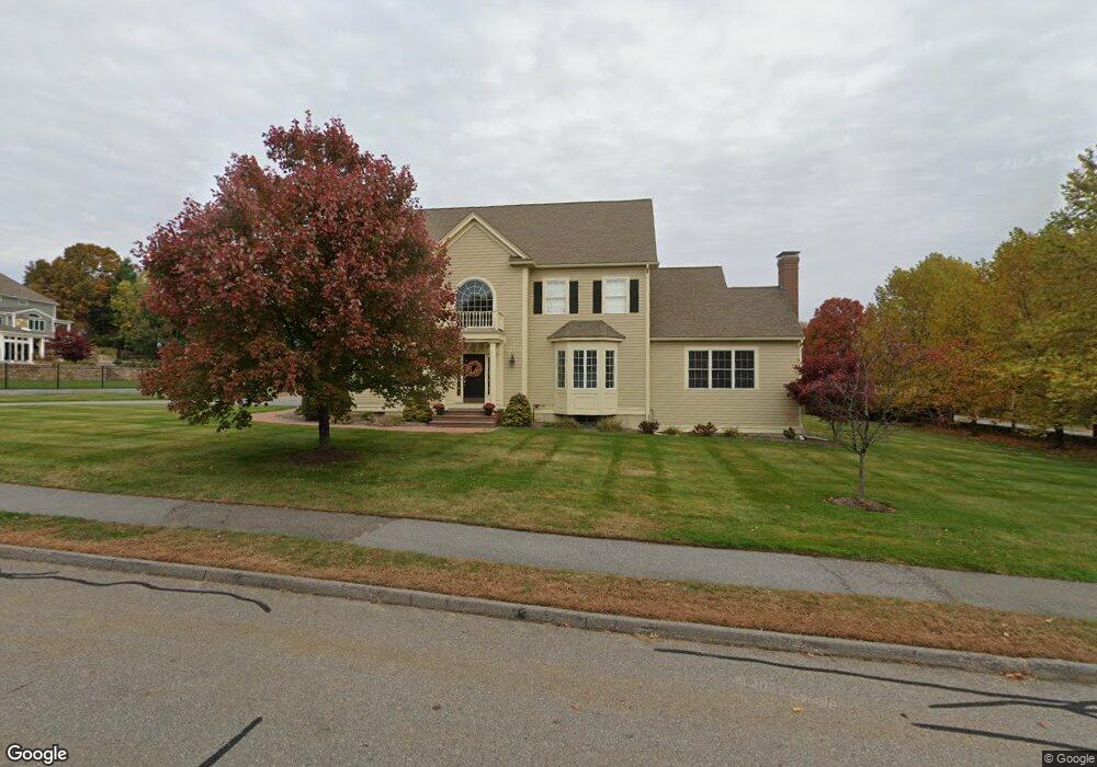
1 Pheasant Trail Hudson, MA 01749
Estimated Value: $953,543 - $1,158,000
4
Beds
3
Baths
3,600
Sq Ft
$295/Sq Ft
Est. Value
About This Home
This home is located at 1 Pheasant Trail, Hudson, MA 01749 and is currently estimated at $1,062,886, approximately $295 per square foot. 1 Pheasant Trail is a home located in Middlesex County with nearby schools including David J. Quinn Middle School, Hudson High School, and First Steps Children's Center.
Ownership History
Date
Name
Owned For
Owner Type
Purchase Details
Closed on
Aug 21, 2009
Sold by
Smarto John E and Smarto Darlene K
Bought by
Haley Thomas J and Haley Dorothy M
Current Estimated Value
Purchase Details
Closed on
May 17, 2007
Sold by
Hayes Dev Corp
Bought by
Smarto Darlene K and Smarto John E
Home Financials for this Owner
Home Financials are based on the most recent Mortgage that was taken out on this home.
Original Mortgage
$330,000
Interest Rate
6.18%
Mortgage Type
Purchase Money Mortgage
Purchase Details
Closed on
Sep 21, 2004
Sold by
Hayes Dev Corp
Bought by
10 Carriage Lane Rt and Mitchell
Create a Home Valuation Report for This Property
The Home Valuation Report is an in-depth analysis detailing your home's value as well as a comparison with similar homes in the area
Home Values in the Area
Average Home Value in this Area
Purchase History
| Date | Buyer | Sale Price | Title Company |
|---|---|---|---|
| Haley Thomas J | $587,000 | -- | |
| Haley Thomas J | $587,000 | -- | |
| Smarto Darlene K | $635,000 | -- | |
| Smarto Darlene K | $635,000 | -- | |
| Hayes Dev Corp | $125,000 | -- | |
| 10 Carriage Lane Rt | $125,000 | -- | |
| 10 Carriage Lane Rt | $125,000 | -- |
Source: Public Records
Mortgage History
| Date | Status | Borrower | Loan Amount |
|---|---|---|---|
| Previous Owner | Smarto Darlene K | $330,000 |
Source: Public Records
Tax History
| Year | Tax Paid | Tax Assessment Tax Assessment Total Assessment is a certain percentage of the fair market value that is determined by local assessors to be the total taxable value of land and additions on the property. | Land | Improvement |
|---|---|---|---|---|
| 2025 | $12,599 | $907,700 | $188,100 | $719,600 |
| 2024 | $12,090 | $863,600 | $170,900 | $692,700 |
| 2023 | $11,084 | $759,200 | $164,600 | $594,600 |
| 2022 | $11,659 | $735,100 | $149,300 | $585,800 |
| 2021 | $11,072 | $667,400 | $142,400 | $525,000 |
| 2020 | $11,964 | $720,300 | $139,500 | $580,800 |
| 2019 | $19,189 | $656,000 | $139,500 | $516,500 |
| 2018 | $11,447 | $654,100 | $141,400 | $512,700 |
| 2017 | $21,015 | $633,200 | $139,900 | $493,300 |
| 2016 | $10,251 | $592,900 | $139,900 | $453,000 |
| 2015 | $10,049 | $581,900 | $139,900 | $442,000 |
| 2014 | $9,823 | $563,900 | $122,900 | $441,000 |
Source: Public Records
Map
Nearby Homes
- 122 Chapin Rd
- 638 Pleasant St
- 168 River Rd E Unit Lot 15A
- 168 River Rd E Unit Lot 5
- 168 River Rd E Unit Lot 3
- 168 River Rd E Unit Lot 11
- 168 River Rd E Unit Lot 2
- 168 River Rd E Unit Lot 6
- 0 Washington St
- 369 Berlin Rd
- 0 Pleasant St
- 56 Park St
- 110 River St
- 41 Walnut St
- 656 Bolton St
- 17 School St Unit C
- 17 School St Unit A
- 4 Linden St
- 18-24 River St Unit 12
- 207 Bigelow St
- 245 Brigham St
- 3 Pheasant Trail
- 2 Pheasant Trail
- 96 Brigham St
- 5 Pheasant Trail
- 4 Pheasant Trail
- 273 Brigham St
- 98 Brigham St
- 98 Brigham St
- 6 Pheasant Trail
- 286 Brigham St
- 14 Pheasant Trail
- 12 Pheasant Trail
- 275 Brigham St
- 2 Field Stream Ln
- 293 Brigham St
- 8 Pheasant Trail
- 14 Kattail Rd
- 274 Brigham St
- 297 Brigham St
Your Personal Tour Guide
Ask me questions while you tour the home.