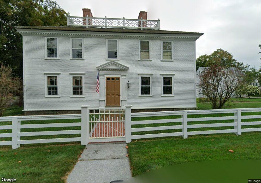
1 Pierce Ln Amherst, NH 03031
Estimated Value: $1,108,000 - $1,994,000
5
Beds
6
Baths
6,621
Sq Ft
$230/Sq Ft
Est. Value
About This Home
This home is located at 1 Pierce Ln, Amherst, NH 03031 and is currently estimated at $1,523,277, approximately $230 per square foot. 1 Pierce Ln is a home with nearby schools including Wilkins Elementary School, Amherst Middle School, and Souhegan Cooperative High School.
Ownership History
Date
Name
Owned For
Owner Type
Purchase Details
Closed on
Sep 19, 2012
Sold by
Veillette William P and Veillette Tracy W
Bought by
Tracy W Veillette Ret and Veillette Tracy W
Current Estimated Value
Create a Home Valuation Report for This Property
The Home Valuation Report is an in-depth analysis detailing your home's value as well as a comparison with similar homes in the area
Home Values in the Area
Average Home Value in this Area
Purchase History
| Date | Buyer | Sale Price | Title Company |
|---|---|---|---|
| Tracy W Veillette Ret | -- | -- | |
| Veillette William P | -- | -- |
Source: Public Records
Tax History
| Year | Tax Paid | Tax Assessment Tax Assessment Total Assessment is a certain percentage of the fair market value that is determined by local assessors to be the total taxable value of land and additions on the property. | Land | Improvement |
|---|---|---|---|---|
| 2024 | $31,779 | $1,385,900 | $213,700 | $1,172,200 |
| 2023 | $30,323 | $1,385,900 | $213,700 | $1,172,200 |
| 2022 | $29,284 | $1,385,900 | $213,700 | $1,172,200 |
| 2021 | $29,534 | $1,385,900 | $213,700 | $1,172,200 |
| 2020 | $31,394 | $1,102,300 | $165,800 | $936,500 |
| 2019 | $29,718 | $1,102,300 | $165,800 | $936,500 |
| 2018 | $30,016 | $1,102,300 | $165,800 | $936,500 |
| 2017 | $28,671 | $1,102,300 | $165,800 | $936,500 |
| 2016 | $27,668 | $1,102,300 | $165,800 | $936,500 |
| 2015 | $24,563 | $927,600 | $208,600 | $719,000 |
| 2014 | $24,730 | $927,600 | $208,600 | $719,000 |
| 2013 | $24,535 | $927,600 | $208,600 | $719,000 |
Source: Public Records
Map
Nearby Homes
- 27 Nathan Lord Rd
- 9 Northfield Rd
- 2A Renee Dr
- 1A Debbie Ln
- 3 Renee Dr
- 36 Buckridge Dr
- 0 Claude Rd
- 57 Patch Hill Ln
- 7-101 MacK Hill Rd
- 94 MacK Hill Rd
- 18 Souhegan St
- 30 Pond Parish Rd
- 38 Old Manchester Rd
- 229 Mont Vernon Rd
- 30 Perkins St Unit 4
- 322 Nashua St Unit 14
- 322 Nashua St Unit 21
- 3 Abby Ln Unit 1
- 5 Monticello Dr
- 377 Nashua St