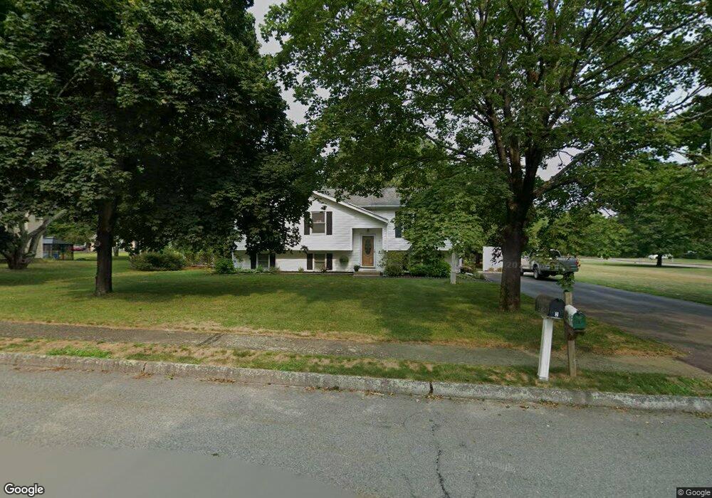
1 Pinto Way Mansfield, MA 02048
Estimated Value: $604,000 - $818,000
3
Beds
2
Baths
1,184
Sq Ft
$568/Sq Ft
Est. Value
About This Home
This home is located at 1 Pinto Way, Mansfield, MA 02048 and is currently estimated at $672,107, approximately $567 per square foot. 1 Pinto Way is a home located in Bristol County with nearby schools including Everett W. Robinson Elementary School, Jordan/Jackson Elementary School, and Harold L. Qualters Middle School.
Create a Home Valuation Report for This Property
The Home Valuation Report is an in-depth analysis detailing your home's value as well as a comparison with similar homes in the area
Home Values in the Area
Average Home Value in this Area
Tax History Compared to Growth
Tax History
| Year | Tax Paid | Tax Assessment Tax Assessment Total Assessment is a certain percentage of the fair market value that is determined by local assessors to be the total taxable value of land and additions on the property. | Land | Improvement |
|---|---|---|---|---|
| 2025 | $7,180 | $545,200 | $266,000 | $279,200 |
| 2024 | $6,700 | $496,300 | $253,900 | $242,400 |
| 2023 | $6,556 | $465,300 | $253,900 | $211,400 |
| 2022 | $6,353 | $418,800 | $235,000 | $183,800 |
| 2021 | $2,861 | $405,300 | $223,900 | $181,400 |
| 2020 | $5,869 | $382,100 | $195,900 | $186,200 |
| 2019 | $5,849 | $384,300 | $186,500 | $197,800 |
| 2018 | $5,611 | $360,400 | $177,800 | $182,600 |
| 2017 | $5,389 | $358,800 | $172,800 | $186,000 |
| 2016 | $5,159 | $334,800 | $164,500 | $170,300 |
| 2015 | $4,819 | $310,900 | $164,500 | $146,400 |
Source: Public Records
Map
Nearby Homes
- 24 Maverick Dr
- 150 Gilbert St
- 4 Buckskin Dr
- 116 George St
- 11 Landry Ave
- 16 Treasure Island Rd
- 196 Donald Tennant Cir
- 406 South St
- 5 Old Wood Rd
- 15 Old Wood Rd
- 255 Mckeon Dr
- 28 Messenger St
- 9 Oak Dr
- 57 Vine St
- 115 Westfield Dr
- 9 Sunnyside Dr Unit 9
- Lot 5 Jeffrey Dr
- 11 Buckthorn Ln
- Lot 2 Jeffrey Dr
- 450 West St