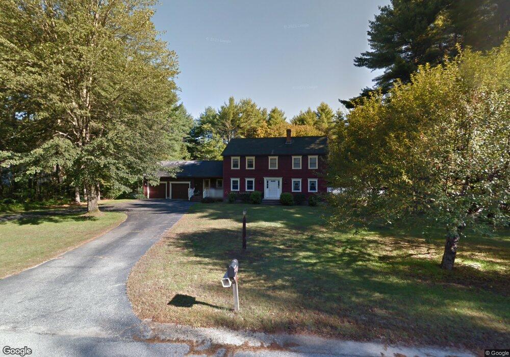
1 Rivermeadow Cir Steep Falls, ME 04085
Estimated Value: $522,000 - $660,296
4
Beds
3
Baths
2,693
Sq Ft
$227/Sq Ft
Est. Value
About This Home
This home is located at 1 Rivermeadow Cir, Steep Falls, ME 04085 and is currently estimated at $611,074, approximately $226 per square foot. 1 Rivermeadow Cir is a home located in Cumberland County with nearby schools including Bonny Eagle High School and Standish Baptist Academy.
Ownership History
Date
Name
Owned For
Owner Type
Purchase Details
Closed on
May 23, 2023
Sold by
Fields Paul K and Fields Marie E
Bought by
Varney Jacob A and Dean-Littlefield Alyssa L
Current Estimated Value
Home Financials for this Owner
Home Financials are based on the most recent Mortgage that was taken out on this home.
Original Mortgage
$594,000
Outstanding Balance
$575,816
Interest Rate
6.27%
Mortgage Type
Purchase Money Mortgage
Estimated Equity
$35,258
Purchase Details
Closed on
May 1, 2008
Sold by
Curranj Richard J and Curran Judy A
Bought by
Fields Paul K and Fields Marie E
Home Financials for this Owner
Home Financials are based on the most recent Mortgage that was taken out on this home.
Original Mortgage
$252,000
Interest Rate
5.43%
Mortgage Type
Purchase Money Mortgage
Create a Home Valuation Report for This Property
The Home Valuation Report is an in-depth analysis detailing your home's value as well as a comparison with similar homes in the area
Home Values in the Area
Average Home Value in this Area
Purchase History
| Date | Buyer | Sale Price | Title Company |
|---|---|---|---|
| Varney Jacob A | $660,000 | None Available | |
| Varney Jacob A | $660,000 | None Available | |
| Fields Paul K | -- | -- | |
| Fields Paul K | -- | -- |
Source: Public Records
Mortgage History
| Date | Status | Borrower | Loan Amount |
|---|---|---|---|
| Open | Varney Jacob A | $594,000 | |
| Closed | Varney Jacob A | $594,000 | |
| Previous Owner | Fields Paul K | $25,000 | |
| Previous Owner | Fields Paul K | $252,000 |
Source: Public Records
Tax History Compared to Growth
Tax History
| Year | Tax Paid | Tax Assessment Tax Assessment Total Assessment is a certain percentage of the fair market value that is determined by local assessors to be the total taxable value of land and additions on the property. | Land | Improvement |
|---|---|---|---|---|
| 2024 | $6,195 | $491,700 | $81,500 | $410,200 |
| 2023 | $5,710 | $412,300 | $67,500 | $344,800 |
| 2022 | $5,024 | $347,700 | $60,500 | $287,200 |
| 2021 | $4,940 | $329,300 | $55,300 | $274,000 |
| 2019 | $4,776 | $334,000 | $65,800 | $268,200 |
| 2018 | $4,552 | $327,500 | $59,300 | $268,200 |
| 2017 | $3,294 | $327,500 | $59,300 | $268,200 |
| 2016 | $4,199 | $327,500 | $59,300 | $268,200 |
| 2015 | $4,189 | $327,500 | $59,300 | $268,200 |
| 2013 | -- | $327,500 | $59,300 | $268,200 |
Source: Public Records
Map
Nearby Homes
- 1044 Ossipee Trail W
- 110 Saco Rd
- 78 Ossipee Trail
- 10 Chase Mill Rd
- 3 Lincoln Trail
- 8 Maplewood Dr
- 584 Sokokis Ave
- 34 Whispering Pine Dr
- 13 Airport Dr Unit O
- 13 Airport Dr Unit Q
- 697 Sokokis Ave
- 599 Pequawket Trail
- 419 Middle Rd
- 683 Sokokis Ave
- 31 Dorothy Dr
- 471 Sokokis Ave
- 21 Holiday Ln
- 9 Macie Dr
- 1079 Pequawket Trail
- 324 Ossipee Trail W Unit 2
- 3 Rivermeadow Dr
- 0 Rivermeadow Cir
- 2 River Meadows Dr
- 3 River Meadows Dr
- 3 Rivermeadow Cir
- 6 Rivermeadow Cir
- 4 Rivermeadow Dr
- 4 Rivermeadow Dr
- 11 Rivermeadow Dr
- 11 Rivermeadow Dr
- 15 River Meadows Dr
- 8 Rivermeadow Dr
- 9 Rivermeadow Dr
- 8 River Meadows Dr
- 14 Rivermeadow Dr
- 1 Rivermeadow Dr
- 1 River Meadows Dr
- 2 Rivermeadow Cir
- 5 Rivermeadow Cir
- 5 Rivermeadow Cir