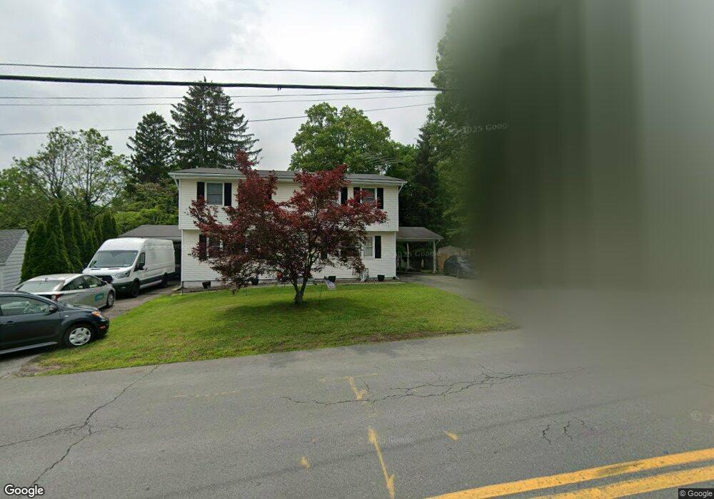
1 Robertson Dr Middletown, NY 10940
Estimated Value: $447,000 - $508,000
6
Beds
2
Baths
2,812
Sq Ft
$168/Sq Ft
Est. Value
About This Home
This home is located at 1 Robertson Dr, Middletown, NY 10940 and is currently estimated at $472,667, approximately $168 per square foot. 1 Robertson Dr is a home located in Orange County with nearby schools including Presidential Park Elementary School, Middletown Twin Towers Middle School, and Monhagen Middle School.
Ownership History
Date
Name
Owned For
Owner Type
Purchase Details
Closed on
Aug 14, 2014
Sold by
Grazioso Pasquale
Bought by
Grazioso Pasquale and Grazioso
Current Estimated Value
Home Financials for this Owner
Home Financials are based on the most recent Mortgage that was taken out on this home.
Original Mortgage
$144,000
Interest Rate
5%
Mortgage Type
New Conventional
Purchase Details
Closed on
Apr 23, 1997
Sold by
Baggatta Gerald A and Baggatta Doreen
Bought by
Grazioso Pasquale and Reissig Deborah J
Create a Home Valuation Report for This Property
The Home Valuation Report is an in-depth analysis detailing your home's value as well as a comparison with similar homes in the area
Home Values in the Area
Average Home Value in this Area
Purchase History
| Date | Buyer | Sale Price | Title Company |
|---|---|---|---|
| Grazioso Pasquale | -- | -- | |
| Grazioso Pasquale | $139,000 | -- |
Source: Public Records
Mortgage History
| Date | Status | Borrower | Loan Amount |
|---|---|---|---|
| Previous Owner | Grazioso Pasquale | $144,000 |
Source: Public Records
Tax History Compared to Growth
Tax History
| Year | Tax Paid | Tax Assessment Tax Assessment Total Assessment is a certain percentage of the fair market value that is determined by local assessors to be the total taxable value of land and additions on the property. | Land | Improvement |
|---|---|---|---|---|
| 2024 | $11,722 | $42,700 | $7,900 | $34,800 |
| 2023 | $11,722 | $42,700 | $7,900 | $34,800 |
| 2022 | $11,481 | $42,700 | $7,900 | $34,800 |
| 2021 | $12,078 | $42,700 | $7,900 | $34,800 |
| 2020 | $4,945 | $42,700 | $7,900 | $34,800 |
| 2019 | $10,605 | $42,700 | $7,900 | $34,800 |
| 2018 | $10,605 | $42,700 | $7,900 | $34,800 |
| 2017 | $10,272 | $42,700 | $7,900 | $34,800 |
| 2016 | $10,319 | $42,700 | $7,900 | $34,800 |
| 2015 | -- | $42,700 | $7,900 | $34,800 |
Source: Public Records
Map
Nearby Homes
- 80 Beattie Ave
- 105 Sheffield Dr
- 57 Overhill Rd
- 47 Prince St
- 77 Prince St
- 47 Carpenter Ave
- 31 Beattie Ave
- 115 Vincent Dr
- 256 E Main St
- 221 E Main St
- 13 Smith St
- 1 Polly Kay Dr
- 17 Magnolia Park Rd
- 10 Royce Ave
- TBD Silver Lake-Scotchtown Rd
- 92 Linden Ave
- 143 N Beacon St
- 37 Wisner Ave Unit 39
- 10 Myrtle Ave
- 15 Clark St
- 233 Wickham Ave
- 5 Fairlawn Ave
- 238 Wickham Ave
- 7 Fairlawn Ave
- 229 Wickham Ave
- 228 Wickham Ave Unit Middletown
- 237 Wickham Ave
- 226 Wickham Ave
- 4 Fairlawn Ave
- 224 Wickham Ave
- 11 Fairlawn Ave
- 5 Robertson Dr
- 4 Stratton Ave
- 4 Stratton Ave
- 13 Fairlawn Ave
- 222 Wickham Ave
- 24 Estate Dr
- 26 Estate Dr
- 28 Estate Dr Unit F1
- 6 Stratton Ave