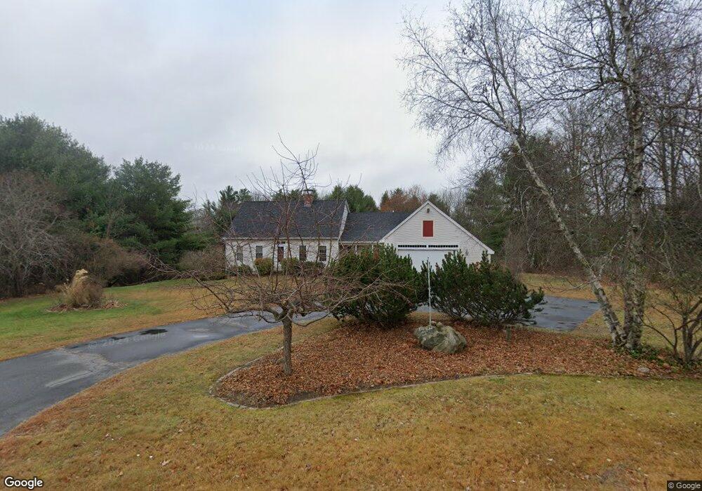
1 Rocklinn Dr Windham, ME 04062
Estimated Value: $645,000 - $706,000
3
Beds
3
Baths
2,730
Sq Ft
$247/Sq Ft
Est. Value
About This Home
This home is located at 1 Rocklinn Dr, Windham, ME 04062 and is currently estimated at $673,445, approximately $246 per square foot. 1 Rocklinn Dr is a home located in Cumberland County with nearby schools including Manchester School, Windham Primary School, and Windham Middle School.
Ownership History
Date
Name
Owned For
Owner Type
Purchase Details
Closed on
Sep 18, 2007
Sold by
Benson Judith L and Benson Robert A
Bought by
Mcinnes Lois M and Mcinnes Duncan
Current Estimated Value
Home Financials for this Owner
Home Financials are based on the most recent Mortgage that was taken out on this home.
Original Mortgage
$175,000
Interest Rate
6.7%
Mortgage Type
Unknown
Create a Home Valuation Report for This Property
The Home Valuation Report is an in-depth analysis detailing your home's value as well as a comparison with similar homes in the area
Home Values in the Area
Average Home Value in this Area
Purchase History
| Date | Buyer | Sale Price | Title Company |
|---|---|---|---|
| Mcinnes Lois M | -- | -- |
Source: Public Records
Mortgage History
| Date | Status | Borrower | Loan Amount |
|---|---|---|---|
| Open | Mcinnes Lois M | $170,000 | |
| Closed | Mcinnes Lois M | $175,000 |
Source: Public Records
Tax History Compared to Growth
Tax History
| Year | Tax Paid | Tax Assessment Tax Assessment Total Assessment is a certain percentage of the fair market value that is determined by local assessors to be the total taxable value of land and additions on the property. | Land | Improvement |
|---|---|---|---|---|
| 2024 | $7,052 | $614,800 | $195,300 | $419,500 |
| 2023 | $6,524 | $582,500 | $181,400 | $401,100 |
| 2022 | $6,034 | $519,700 | $162,600 | $357,100 |
| 2021 | $5,494 | $436,000 | $138,900 | $297,100 |
| 2020 | $5,229 | $348,600 | $89,900 | $258,700 |
| 2019 | $5,104 | $348,600 | $89,900 | $258,700 |
| 2018 | $4,763 | $313,800 | $74,400 | $239,400 |
| 2017 | $4,656 | $283,400 | $66,200 | $217,200 |
| 2016 | $4,449 | $283,400 | $66,200 | $217,200 |
| 2015 | $4,294 | $283,400 | $66,200 | $217,200 |
| 2014 | $4,011 | $283,400 | $66,200 | $217,200 |
| 2013 | -- | $283,400 | $66,200 | $217,200 |
Source: Public Records
Map
Nearby Homes
- 336 Pope Rd Unit 3
- 27 Whipple Rd
- 32 Middle Jam Rd
- 3 Peavey Ave
- 16 Brookhaven Dr
- 55 Page Rd
- 4 Paxton Way Unit 4
- 52 Sabatus Ln
- 763 River Rd
- 39 Varney Mill Rd
- 0 Turning Leaf Dr Unit 1640377
- Lot 14 Aerie Dr
- 10 Arlene Ln
- 34 Robin Ln
- 86 Brookwood Dr
- 103 Basin Rd
- Lot 5 N Gorham Rd
- Lot #1 Chamberlain Dr
- 34 Stoneridge Dr
- 48 Conifer Dr