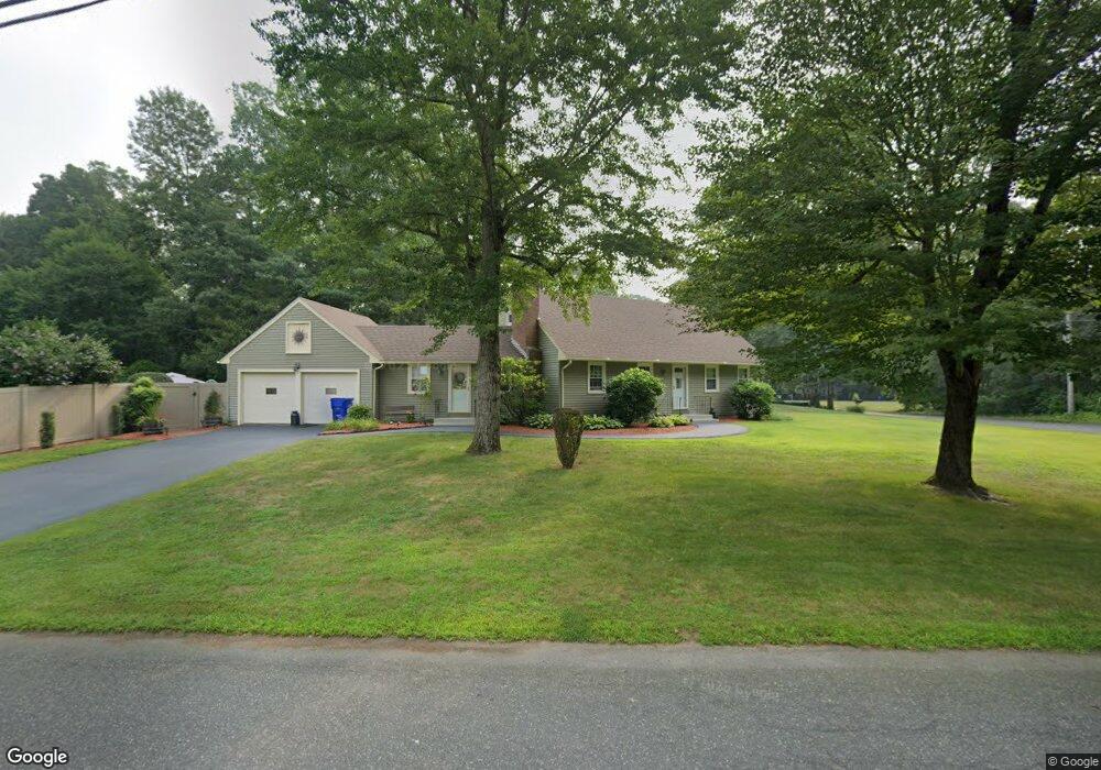
1 Ruth Dr Wilbraham, MA 01095
Estimated Value: $485,000 - $541,000
4
Beds
2
Baths
1,844
Sq Ft
$280/Sq Ft
Est. Value
About This Home
This home is located at 1 Ruth Dr, Wilbraham, MA 01095 and is currently estimated at $515,677, approximately $279 per square foot. 1 Ruth Dr is a home located in Hampden County with nearby schools including Minnechaug Regional High School and Wilbraham & Monson Academy.
Ownership History
Date
Name
Owned For
Owner Type
Purchase Details
Closed on
Mar 24, 2009
Sold by
Ryan Barry M and Ryan Dionne K
Bought by
Ryan Barry M
Current Estimated Value
Home Financials for this Owner
Home Financials are based on the most recent Mortgage that was taken out on this home.
Original Mortgage
$260,000
Interest Rate
5.25%
Purchase Details
Closed on
Oct 7, 2004
Sold by
Labroad Martha E and Labroad Robert J
Bought by
Ryan Barry M and Ryan Dionne K
Home Financials for this Owner
Home Financials are based on the most recent Mortgage that was taken out on this home.
Original Mortgage
$216,000
Interest Rate
5.84%
Mortgage Type
Purchase Money Mortgage
Create a Home Valuation Report for This Property
The Home Valuation Report is an in-depth analysis detailing your home's value as well as a comparison with similar homes in the area
Home Values in the Area
Average Home Value in this Area
Purchase History
| Date | Buyer | Sale Price | Title Company |
|---|---|---|---|
| Ryan Barry M | -- | -- | |
| Ryan Barry M | -- | -- | |
| Ryan Barry M | $270,000 | -- | |
| Ryan Barry M | -- | -- | |
| Ryan Barry M | $270,000 | -- |
Source: Public Records
Mortgage History
| Date | Status | Borrower | Loan Amount |
|---|---|---|---|
| Open | Ryan Barry M | $249,200 | |
| Closed | Ryan Barry M | $260,000 | |
| Previous Owner | Ryan Barry M | $216,000 |
Source: Public Records
Tax History
| Year | Tax Paid | Tax Assessment Tax Assessment Total Assessment is a certain percentage of the fair market value that is determined by local assessors to be the total taxable value of land and additions on the property. | Land | Improvement |
|---|---|---|---|---|
| 2025 | $7,013 | $392,200 | $96,000 | $296,200 |
| 2024 | $6,305 | $340,800 | $96,000 | $244,800 |
| 2023 | $6,059 | $318,300 | $96,000 | $222,300 |
| 2022 | $6,059 | $295,700 | $96,000 | $199,700 |
| 2021 | $5,862 | $255,300 | $103,200 | $152,100 |
| 2020 | $5,714 | $255,300 | $103,200 | $152,100 |
| 2019 | $5,566 | $255,300 | $103,200 | $152,100 |
| 2018 | $5,397 | $238,400 | $103,200 | $135,200 |
| 2017 | $5,245 | $238,400 | $103,200 | $135,200 |
| 2016 | $5,311 | $245,900 | $114,800 | $131,100 |
| 2015 | $5,134 | $245,900 | $114,800 | $131,100 |
Source: Public Records
Map
Nearby Homes
- 6 Katie St
- 230V Burleigh Rd
- 24 Mcintosh Dr
- 85 Baldwin Dr
- 107 Baldwin Dr
- 325 Allen St
- 46 Holland Dr
- 140 Slumber Ln
- 16 Deerfoot Dr
- 5 Edgewood Rd
- 25 Angelica Dr
- 0 Mountain Rd Unit 73267162
- 0 Mountain Rd Unit 72942534
- 75 North Rd
- 25 Winding Brook Ln
- 23 Rachael St
- 6 Hilltop Park
- 34 Flora St
- 141 Tanglewood Dr
- 8 Patriot Ridge Ln
Your Personal Tour Guide
Ask me questions while you tour the home.