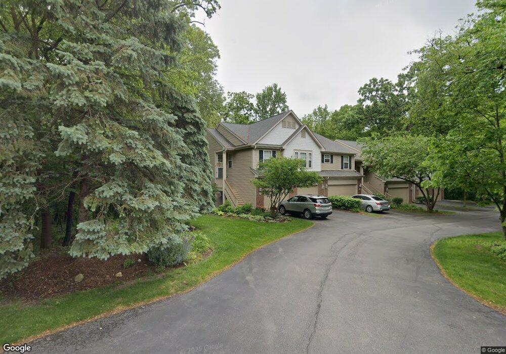
1 Samuel Dr Unit 191 Streamwood, IL 60107
Estimated Value: $313,151 - $378,000
2
Beds
2
Baths
1,800
Sq Ft
$198/Sq Ft
Est. Value
About This Home
This home is located at 1 Samuel Dr Unit 191, Streamwood, IL 60107 and is currently estimated at $355,788, approximately $197 per square foot. 1 Samuel Dr Unit 191 is a home located in Cook County with nearby schools including Heritage Elementary School, Tefft Middle School, and Streamwood High School.
Ownership History
Date
Name
Owned For
Owner Type
Purchase Details
Closed on
Dec 5, 2019
Sold by
Westlund Maribeth and Howard Elizabeth L
Bought by
Westlund Maribeth and Howard Elizabeth
Current Estimated Value
Purchase Details
Closed on
Sep 8, 2003
Sold by
Remington At Hidden Glen Llc
Bought by
Westlund Maribeth and Howard Elizabeth L
Home Financials for this Owner
Home Financials are based on the most recent Mortgage that was taken out on this home.
Original Mortgage
$236,000
Interest Rate
6.01%
Mortgage Type
Purchase Money Mortgage
Create a Home Valuation Report for This Property
The Home Valuation Report is an in-depth analysis detailing your home's value as well as a comparison with similar homes in the area
Home Values in the Area
Average Home Value in this Area
Purchase History
| Date | Buyer | Sale Price | Title Company |
|---|---|---|---|
| Westlund Maribeth | -- | First American Title Ins Co | |
| Westlund Maribeth | $295,000 | Cti |
Source: Public Records
Mortgage History
| Date | Status | Borrower | Loan Amount |
|---|---|---|---|
| Previous Owner | Westlund Maribeth | $236,000 |
Source: Public Records
Tax History Compared to Growth
Tax History
| Year | Tax Paid | Tax Assessment Tax Assessment Total Assessment is a certain percentage of the fair market value that is determined by local assessors to be the total taxable value of land and additions on the property. | Land | Improvement |
|---|---|---|---|---|
| 2024 | $6,444 | $24,182 | $2,915 | $21,267 |
| 2023 | $6,244 | $24,182 | $2,915 | $21,267 |
| 2022 | $6,244 | $24,182 | $2,915 | $21,267 |
| 2021 | $5,515 | $18,402 | $2,186 | $16,216 |
| 2020 | $5,503 | $18,402 | $2,186 | $16,216 |
| 2019 | $5,475 | $20,551 | $2,186 | $18,365 |
| 2018 | $4,566 | $16,390 | $1,913 | $14,477 |
| 2017 | $4,525 | $16,390 | $1,913 | $14,477 |
| 2016 | $4,504 | $16,390 | $1,913 | $14,477 |
| 2015 | $4,279 | $14,677 | $1,730 | $12,947 |
| 2014 | $4,233 | $14,677 | $1,730 | $12,947 |
| 2013 | $4,081 | $14,677 | $1,730 | $12,947 |
Source: Public Records
Map
Nearby Homes
- 53 Samuel Dr Unit 163
- 55 Samuel Dr Unit 162
- 134 Virginia Ct
- 2056 Essex Ct
- 8 Lasalle Ct
- 2073 Essex Ct
- 113 Samuel Ct Unit 263
- 6 Wild Rose Ct
- 2104 Falmouth Ct
- 406 Locksley Dr
- 434 Locksley Dr
- 9N Merry Oaks Rd
- 4018 Oxford Ct
- 3098 Lynnwood Ct
- 121 E Briarwood Dr
- 106 Brittany Dr Unit 17E1
- 3075 Kingston Ct
- 69 Colonial Ct
- 600 W Lake St
- 1005 S Park Blvd
- 3 Samuel Dr Unit 192
- 5 Samuel Dr Unit 193
- 7 Samuel Dr Unit 194
- 25 Samuel Dr Unit 181
- 25 Samuel Dr Unit END
- 23 Samuel Dr Unit 182
- 21 Samuel Dr Unit 183
- 2 Samuel Dr Unit 11
- 2 Samuel Dr Unit 33
- 2 Samuel Dr Unit 2
- 4 Samuel Dr Unit 12
- 6 Samuel Dr Unit 13
- 16 Samuel Dr Unit 24
- 14 Samuel Dr Unit 23
- 14 Samuel Dr Unit 3
- 8 Samuel Dr Unit 14
- 8 Samuel Dr Unit 8
- 31 Samuel Dr Unit 176
- 12 Samuel Dr Unit 22
- 50 Cambridge Ave