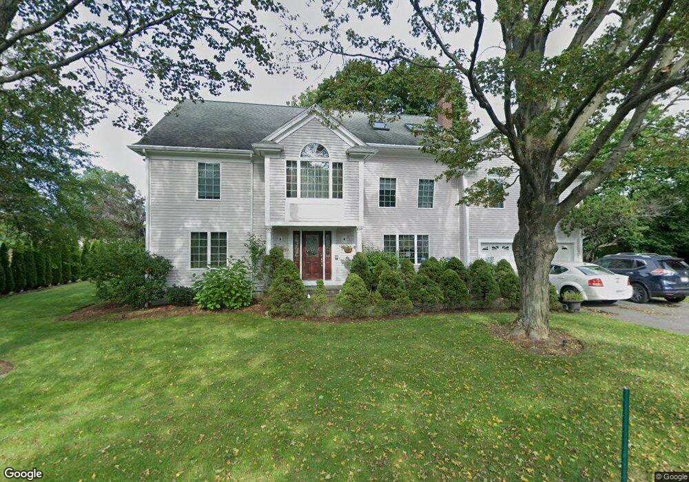
1 Stearns Rd Lexington, MA 02421
Follen Heights NeighborhoodEstimated Value: $1,129,000 - $2,229,000
5
Beds
4
Baths
3,927
Sq Ft
$450/Sq Ft
Est. Value
About This Home
This home is located at 1 Stearns Rd, Lexington, MA 02421 and is currently estimated at $1,767,376, approximately $450 per square foot. 1 Stearns Rd is a home located in Middlesex County with nearby schools including Bowman Elementary School, Jonas Clarke Middle School, and Lexington High School.
Ownership History
Date
Name
Owned For
Owner Type
Purchase Details
Closed on
Dec 31, 2012
Sold by
Stearns Road Rt
Bought by
Jayaswal Umesh K
Current Estimated Value
Purchase Details
Closed on
Mar 21, 2006
Sold by
Jayaswal Umesh K
Bought by
Stearns Road Rt
Purchase Details
Closed on
Jun 4, 1999
Sold by
Ramsay Helen M
Bought by
Jayaswal Umesh K
Home Financials for this Owner
Home Financials are based on the most recent Mortgage that was taken out on this home.
Original Mortgage
$306,000
Interest Rate
6.85%
Mortgage Type
Purchase Money Mortgage
Create a Home Valuation Report for This Property
The Home Valuation Report is an in-depth analysis detailing your home's value as well as a comparison with similar homes in the area
Home Values in the Area
Average Home Value in this Area
Purchase History
| Date | Buyer | Sale Price | Title Company |
|---|---|---|---|
| Jayaswal Umesh K | -- | -- | |
| Stearns Road Rt | $340,000 | -- | |
| Jayaswal Umesh K | $340,000 | -- |
Source: Public Records
Mortgage History
| Date | Status | Borrower | Loan Amount |
|---|---|---|---|
| Previous Owner | Jayaswal Umesh K | $868,000 | |
| Previous Owner | Jayaswal Umesh K | $306,000 |
Source: Public Records
Tax History Compared to Growth
Tax History
| Year | Tax Paid | Tax Assessment Tax Assessment Total Assessment is a certain percentage of the fair market value that is determined by local assessors to be the total taxable value of land and additions on the property. | Land | Improvement |
|---|---|---|---|---|
| 2025 | $18,859 | $1,542,000 | $640,000 | $902,000 |
| 2024 | $18,877 | $1,541,000 | $609,000 | $932,000 |
| 2023 | $18,577 | $1,429,000 | $554,000 | $875,000 |
| 2022 | $17,374 | $1,259,000 | $504,000 | $755,000 |
| 2021 | $7,535 | $1,156,000 | $480,000 | $676,000 |
| 2020 | $6,248 | $1,141,000 | $480,000 | $661,000 |
| 2019 | $9,972 | $1,090,000 | $457,000 | $633,000 |
| 2018 | $4,655 | $1,075,000 | $435,000 | $640,000 |
| 2017 | $14,838 | $1,024,000 | $401,000 | $623,000 |
| 2016 | $14,556 | $997,000 | $382,000 | $615,000 |
| 2015 | $14,043 | $945,000 | $347,000 | $598,000 |
| 2014 | $14,719 | $949,000 | $309,000 | $640,000 |
Source: Public Records
Map
Nearby Homes
- 41 Webster Rd
- 18 Potter Pond Unit 18
- 121 Concord Ave
- 37 Philip Rd
- 19 Crescent Rd
- 311 Concord Ave
- 24 Rockville Ave
- 6 Linc Cole Ln
- 9 Linc Cole Ln
- 5 April Ln Unit 12
- 55 Pleasant St
- 6 April Ln Unit 34
- 1105 Lexington St Unit 9-2
- 22 Abbott Rd
- 21 Circle Dr
- 34 Allen St
- 600 Trapelo Rd Unit 1
- 144 Kingston Rd
- 155 Marguerite Ave
- 73 Lionel Ave Unit F
- 1 Webster Rd
- 145 Pleasant St
- 149 Pleasant St
- 3 Webster Rd
- 3 Webster Rd Unit 3
- 3 Webster Rd Unit A
- 148 Pleasant St
- 47 Webster Rd
- 146 Pleasant St
- 141 Pleasant St
- 150 Pleasant St
- 43 Lawrence Ln
- 2 Webster Rd
- 142 Pleasant St
- 151 Pleasant St
- 48 Webster Rd
- 4 Webster Rd
- 41 Lawrence Ln
- 5 Webster Rd
- 45 Webster Rd