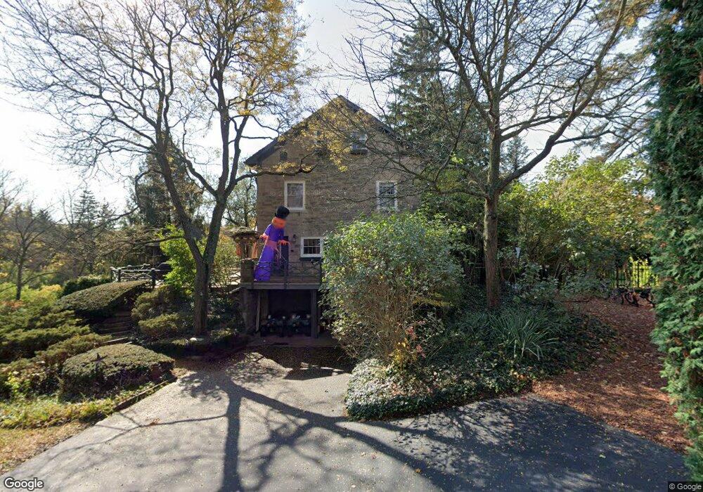
1 Stone House Ln Unit 21 Beverly Hills, MI 48025
Estimated Value: $886,000 - $1,187,069
4
Beds
3
Baths
4,000
Sq Ft
$276/Sq Ft
Est. Value
About This Home
This home is located at 1 Stone House Ln Unit 21, Beverly Hills, MI 48025 and is currently estimated at $1,102,267, approximately $275 per square foot. 1 Stone House Ln Unit 21 is a home located in Oakland County with nearby schools including Bingham Farms Elementary School, Wylie E. Groves High School, and Berkshire Middle School.
Ownership History
Date
Name
Owned For
Owner Type
Purchase Details
Closed on
Oct 29, 2009
Sold by
Abn Amro Mortgage Group Inc
Bought by
Hsbc Bank Usa National Association
Current Estimated Value
Purchase Details
Closed on
May 12, 2009
Sold by
Franklin Scott D and Franklin Tracy
Bought by
Abn Amro Mortgage Group Inc and Citimortgage Inc
Purchase Details
Closed on
Jan 24, 2007
Sold by
Grinnan Joseph E and Grinnan Antonia
Bought by
Franklin Scott D and Franklin Tracy
Purchase Details
Closed on
Nov 3, 1997
Sold by
Westwood Land Co Inc
Bought by
Grinnan Joseph E
Create a Home Valuation Report for This Property
The Home Valuation Report is an in-depth analysis detailing your home's value as well as a comparison with similar homes in the area
Home Values in the Area
Average Home Value in this Area
Purchase History
| Date | Buyer | Sale Price | Title Company |
|---|---|---|---|
| Hsbc Bank Usa National Association | -- | E Title | |
| Abn Amro Mortgage Group Inc | $803,514 | None Available | |
| Franklin Scott D | $950,000 | Devon Title Agency | |
| Grinnan Joseph E | -- | -- |
Source: Public Records
Tax History Compared to Growth
Tax History
| Year | Tax Paid | Tax Assessment Tax Assessment Total Assessment is a certain percentage of the fair market value that is determined by local assessors to be the total taxable value of land and additions on the property. | Land | Improvement |
|---|---|---|---|---|
| 2024 | $10,289 | $571,860 | $0 | $0 |
| 2023 | $9,872 | $499,140 | $0 | $0 |
| 2022 | $10,560 | $447,280 | $0 | $0 |
| 2021 | $10,646 | $441,090 | $0 | $0 |
| 2020 | $8,918 | $403,550 | $0 | $0 |
| 2019 | $7,045 | $389,580 | $0 | $0 |
| 2018 | $10,060 | $368,710 | $0 | $0 |
| 2017 | $10,021 | $368,710 | $0 | $0 |
| 2016 | $10,062 | $355,170 | $0 | $0 |
| 2015 | -- | $338,440 | $0 | $0 |
| 2014 | -- | $292,040 | $0 | $0 |
| 2011 | -- | $218,110 | $0 | $0 |
Source: Public Records
Map
Nearby Homes
- 21700 W 13 Mile Rd
- 21993 Riverview Dr
- 31111 Lahser Rd
- 31430 Lahser Rd
- 000 Beverly Rd
- 30372 Georgetown Dr
- 22601 Highbank Dr
- 0000 Farmbrook Rd
- 31065 Old Stage Rd
- 29585 Woodhaven Ln
- 31264 Coachlight Ln
- 31301 Coachlight Ln
- 20666 Southome St
- 22025 Orchard Way
- 32175 Spruce Ln
- 29140 Briarbank Ct
- 32326 Spruce Ln Unit 31
- 29600 Bristol Ln
- 30435 Oakview Way
- 30915 Timberbrook Ln
- 30650 Lahser Rd
- 21 Riverbank Dr
- 23 Riverbank Dr Unit 19
- 19 Riverbank Dr Unit 17
- 25 Riverbank Dr Unit 20
- 17 Riverbank Dr
- 15 Riverbank Dr
- 18 Riverbank Dr Unit 1
- 11 Riverbank Dr Unit 14
- 16 Riverbank Dr
- 9 Riverbank Dr
- 6 Riverbank Dr
- 8 Riverbank Dr
- 4 Riverbank Dr Unit 8
- 10 Riverbank Dr
- 10 Riverbank Dr Unit 5
- 12 Riverbank Dr
- 2 Riverbank Dr Unit 9
- 2 Riverbank Dr
- 7 Riverbank Dr Unit 12