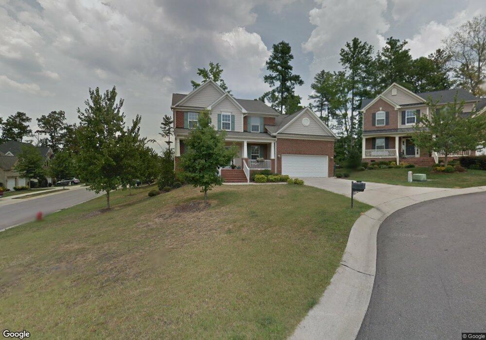
1 Strowd Ct Durham, NC 27703
Eastern Durham NeighborhoodEstimated Value: $563,867 - $656,000
4
Beds
3
Baths
2,902
Sq Ft
$212/Sq Ft
Est. Value
About This Home
This home is located at 1 Strowd Ct, Durham, NC 27703 and is currently estimated at $614,467, approximately $211 per square foot. 1 Strowd Ct is a home located in Durham County with nearby schools including Spring Valley Elementary School, John W Neal Middle School, and Southern School of Energy & Sustainability.
Ownership History
Date
Name
Owned For
Owner Type
Purchase Details
Closed on
May 20, 2016
Sold by
Calendo-Spaeth Bridget E
Bought by
Snively Quentin H and Snively Cheryl A
Current Estimated Value
Home Financials for this Owner
Home Financials are based on the most recent Mortgage that was taken out on this home.
Original Mortgage
$334,848
Interest Rate
3.41%
Mortgage Type
VA
Purchase Details
Closed on
Jan 17, 2008
Sold by
The Drees Co
Bought by
Calendo Bridget E
Home Financials for this Owner
Home Financials are based on the most recent Mortgage that was taken out on this home.
Original Mortgage
$295,792
Interest Rate
5.94%
Mortgage Type
Purchase Money Mortgage
Purchase Details
Closed on
Apr 11, 2007
Sold by
Rhein Brightleaf Llc
Bought by
The Drees Co and The Drees Homes Co
Create a Home Valuation Report for This Property
The Home Valuation Report is an in-depth analysis detailing your home's value as well as a comparison with similar homes in the area
Home Values in the Area
Average Home Value in this Area
Purchase History
| Date | Buyer | Sale Price | Title Company |
|---|---|---|---|
| Snively Quentin H | $327,000 | -- | |
| Calendo Bridget E | $311,500 | None Available | |
| The Drees Co | $349,500 | None Available |
Source: Public Records
Mortgage History
| Date | Status | Borrower | Loan Amount |
|---|---|---|---|
| Previous Owner | Snively Quentin H | $334,848 | |
| Previous Owner | Calendo Bridget E | $295,792 |
Source: Public Records
Tax History
| Year | Tax Paid | Tax Assessment Tax Assessment Total Assessment is a certain percentage of the fair market value that is determined by local assessors to be the total taxable value of land and additions on the property. | Land | Improvement |
|---|---|---|---|---|
| 2025 | $5,472 | $551,990 | $107,085 | $444,905 |
| 2024 | $5,162 | $370,050 | $78,650 | $291,400 |
| 2023 | $4,847 | $370,050 | $78,650 | $291,400 |
| 2022 | $4,736 | $370,050 | $78,650 | $291,400 |
| 2021 | $4,714 | $370,050 | $78,650 | $291,400 |
| 2020 | $4,603 | $370,050 | $78,650 | $291,400 |
| 2019 | $4,603 | $370,050 | $78,650 | $291,400 |
| 2018 | $4,361 | $321,494 | $60,500 | $260,994 |
| 2017 | $4,329 | $321,494 | $60,500 | $260,994 |
| 2016 | $4,183 | $321,494 | $60,500 | $260,994 |
| 2015 | $4,312 | $311,500 | $73,583 | $237,917 |
| 2014 | $4,312 | $311,500 | $73,583 | $237,917 |
Source: Public Records
Map
Nearby Homes
- 1602 Eagle Lodge Ln
- 1607 Eagle Lodge Ln
- 4 Seawell Ct
- 1020 Constellation Cir
- 1029 Constellation Cir
- 1031 Constellation Cir
- 1808 Pennypacker Ln
- 1118 Constellation Cir
- 1116 Constellation Cir
- 2608 Kestrel Heights Ct
- 2018 Morehead Hill Ct
- 106 Token House Rd
- 140 Token House Rd
- 142 Token House Rd
- 809 Doggard Ln
- 232 Cross Blossom Rd
- 1918 Woodsdale Dr
- 1821 S Mineral Springs Rd
- 205 Spring Flower Ln
- 408 Timpson Ave
- 3 Strowd Ct
- 1615 Hemlock Hill Dr
- 1616 Hemlock Hill Dr
- 1613 Hemlock Hill Dr
- 1614 Hemlock Hill Dr
- 1618 Hemlock Hill Dr
- 7 Zumwalt Ct
- 5 Strowd Ct
- 5 Zumwalt Ct
- 1612 Hemlock Hill Dr
- 2 Strowd Ct
- 1702 Hemlock Hill Dr
- 1611 Hemlock Hill Dr
- 8 Zumwalt Ct
- 1610 Hemlock Hill Dr
- 1704 Hemlock Hill Dr
- 1704 Eagle Lodge Ln
- 1706 Eagle Lodge Ln
- 1705 Hemlock Hill Dr
- 1607 Hemlock Hill Dr
Your Personal Tour Guide
Ask me questions while you tour the home.