
Seller's Agent in 2025
Tony Palmerino
Real Broker MA, LLC
(774) 230-5021
2 in this area
39 Total Sales

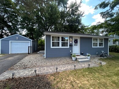
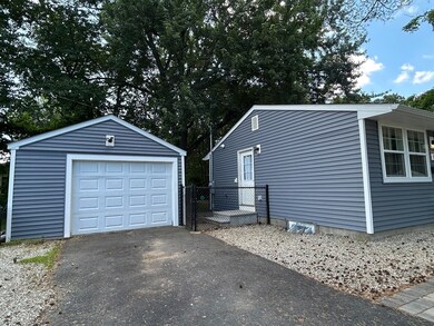
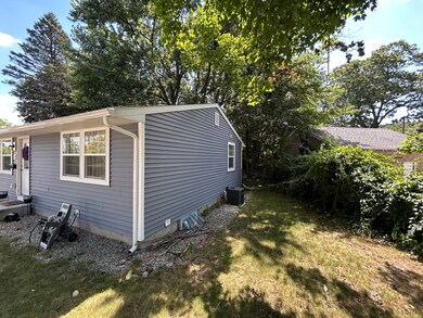
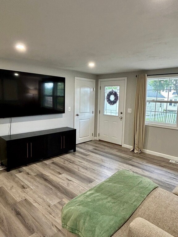


**Location, Location, Location!** Discover the charm of this adorable house in an unbeatable neighborhood. This inviting 2-bedroom, 1-bath ranch-style home features a convenient 1-car garage. Completely remodeled just 4 years ago, it boasts all-new features including doors, windows, roof, siding, electrical, plumbing, and modern central heating and air conditioning. With high-quality foam insulation, this home is designed for exceptional energy efficiency. The beautifully yard is perfect for relaxation, while the fenced-in backyard offers a safe haven for children and pets to play freely. Plus, the basement is a blank canvas, waiting for your creative touch to transform it into additional living space. Don't miss out on this remarkable opportunity—this home truly is a must-see!
| Date | Type | Sale Price | Title Company |
|---|---|---|---|
| Quit Claim Deed | $418,000 | -- | |
| Deed | $418,000 | -- | |
| Quit Claim Deed | $282,000 | None Available | |
| Quit Claim Deed | $282,000 | None Available | |
| Quit Claim Deed | $85,000 | None Available | |
| Quit Claim Deed | $85,000 | None Available |
| Date | Status | Loan Amount | Loan Type |
|---|---|---|---|
| Open | $426,987 | VA | |
| Closed | $426,987 | VA | |
| Previous Owner | $267,900 | Purchase Money Mortgage |
| Date | Event | Price | List to Sale | Price per Sq Ft |
|---|---|---|---|---|
| 08/18/2025 08/18/25 | Sold | $418,000 | +4.5% | $581 / Sq Ft |
| 07/06/2025 07/06/25 | Pending | -- | -- | -- |
| 07/02/2025 07/02/25 | For Sale | $400,000 | -- | $556 / Sq Ft |
| Year | Tax Paid | Tax Assessment Tax Assessment Total Assessment is a certain percentage of the fair market value that is determined by local assessors to be the total taxable value of land and additions on the property. | Land | Improvement |
|---|---|---|---|---|
| 2025 | $4,731 | $358,700 | $117,600 | $241,100 |
| 2024 | $4,646 | $337,900 | $117,600 | $220,300 |
| 2023 | $2,606 | $181,700 | $102,300 | $79,400 |
| 2022 | $2,283 | $150,100 | $81,800 | $68,300 |
| 2021 | $2,374 | $145,800 | $65,400 | $80,400 |
| 2020 | $2,338 | $137,500 | $65,400 | $72,100 |
| 2019 | $2,281 | $126,700 | $58,800 | $67,900 |
| 2018 | $2,269 | $120,000 | $58,800 | $61,200 |
| 2017 | $2,276 | $118,400 | $58,800 | $59,600 |
| 2016 | $2,139 | $103,800 | $42,800 | $61,000 |
| 2015 | $2,083 | $103,800 | $42,800 | $61,000 |
| 2014 | $2,028 | $103,800 | $42,800 | $61,000 |
Seller's Agent in 2025
Tony Palmerino
Real Broker MA, LLC
(774) 230-5021
2 in this area
39 Total Sales
Buyer's Agent in 2025
Amy Bisson
Lamacchia Realty, Inc.
(508) 340-3861
3 in this area
142 Total Sales
Source: MLS Property Information Network (MLS PIN)
MLS Number: 73399036
APN: WORC-000041-000032-000026
Disclaimer: Certain information contained herein is derived from information provided by parties other than Homes.com. All information provided is deemed reliable, but is not guaranteed to be accurate and should be independently verified.
![]() The property listing data and information, or the Images, set forth herein were provided to MLS Property Information Network, Inc. from third party sources, including sellers, lessors and public records, and were compiled by MLS Property Information Network, Inc. The property listing data and information, and the Images, are for the personal, non-commercial use of consumers having a good faith interest in purchasing or leasing listed properties of the type displayed to them and may not be used for any purpose other than to identify prospective properties which such consumers may have a good faith interest in purchasing or leasing. MLS Property Information Network, Inc. and its subscribers disclaim any and all representations and warranties as to the accuracy of the property listing data and information, or as to the accuracy of any of the Images, set forth herein.
The property listing data and information, or the Images, set forth herein were provided to MLS Property Information Network, Inc. from third party sources, including sellers, lessors and public records, and were compiled by MLS Property Information Network, Inc. The property listing data and information, and the Images, are for the personal, non-commercial use of consumers having a good faith interest in purchasing or leasing listed properties of the type displayed to them and may not be used for any purpose other than to identify prospective properties which such consumers may have a good faith interest in purchasing or leasing. MLS Property Information Network, Inc. and its subscribers disclaim any and all representations and warranties as to the accuracy of the property listing data and information, or as to the accuracy of any of the Images, set forth herein.
Ask me questions while you tour the home.