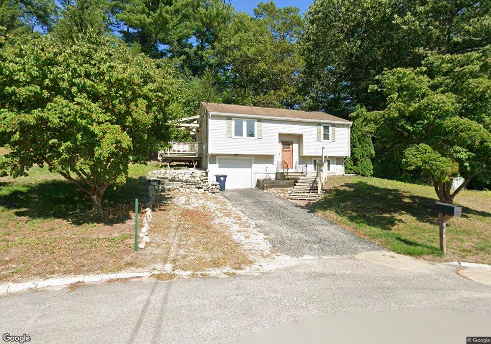
1 Teak Dr Nashua, NH 03062
West Hollis NeighborhoodEstimated Value: $452,000 - $473,000
2
Beds
1
Bath
948
Sq Ft
$487/Sq Ft
Est. Value
About This Home
This home is located at 1 Teak Dr, Nashua, NH 03062 and is currently estimated at $461,946, approximately $487 per square foot. 1 Teak Dr is a home located in Hillsborough County with nearby schools including Main Dunstable School, Elm Street Middle School, and Nashua High School South.
Ownership History
Date
Name
Owned For
Owner Type
Purchase Details
Closed on
Oct 26, 2021
Sold by
Maniff Bryan P
Bought by
Bryan P Maniff Ret and Maniff
Current Estimated Value
Purchase Details
Closed on
Aug 12, 2019
Sold by
Olejezak Stanley
Bought by
Maniff Bryan P
Home Financials for this Owner
Home Financials are based on the most recent Mortgage that was taken out on this home.
Original Mortgage
$242,250
Interest Rate
3.73%
Mortgage Type
New Conventional
Purchase Details
Closed on
Feb 21, 1986
Bought by
Olejczak Stanley
Create a Home Valuation Report for This Property
The Home Valuation Report is an in-depth analysis detailing your home's value as well as a comparison with similar homes in the area
Home Values in the Area
Average Home Value in this Area
Purchase History
| Date | Buyer | Sale Price | Title Company |
|---|---|---|---|
| Bryan P Maniff Ret | -- | None Available | |
| Maniff Bryan P | $255,000 | -- | |
| Olejczak Stanley | $99,500 | -- |
Source: Public Records
Mortgage History
| Date | Status | Borrower | Loan Amount |
|---|---|---|---|
| Previous Owner | Maniff Bryan P | $242,250 |
Source: Public Records
Tax History
| Year | Tax Paid | Tax Assessment Tax Assessment Total Assessment is a certain percentage of the fair market value that is determined by local assessors to be the total taxable value of land and additions on the property. | Land | Improvement |
|---|---|---|---|---|
| 2025 | $7,227 | $429,400 | $168,000 | $261,400 |
| 2024 | $6,827 | $429,400 | $168,000 | $261,400 |
| 2023 | $6,490 | $356,000 | $134,400 | $221,600 |
| 2022 | $6,433 | $356,000 | $134,400 | $221,600 |
| 2021 | $5,763 | $248,200 | $94,100 | $154,100 |
| 2020 | $5,539 | $245,000 | $94,100 | $150,900 |
| 2019 | $5,364 | $246,500 | $94,100 | $152,400 |
| 2018 | $5,230 | $246,600 | $94,200 | $152,400 |
| 2017 | $5,235 | $203,000 | $73,000 | $130,000 |
| 2016 | $5,089 | $203,000 | $73,000 | $130,000 |
| 2015 | $4,980 | $203,000 | $73,000 | $130,000 |
| 2014 | $4,882 | $203,000 | $73,000 | $130,000 |
Source: Public Records
Map
Nearby Homes
- 17 Twilight Dr
- 36 Silverton Dr Unit U85
- 25 Silverton Dr Unit U73
- 26 Old Coach Rd
- 16 Champagne Dr Unit U31
- 4 Heather Ct Unit U34
- 30 Ledgewood Hills Dr Unit 104
- 47 Dogwood Dr Unit U205
- 47 Dogwood Dr Unit U202
- 23 Spring Cove Rd Unit U152
- 12 Ledgewood Hills Dr Unit 105
- 45 Dogwood Dr Unit U208
- 4 Burlington Rd
- 14 Millbrook Dr
- 288 Main Dunstable Rd
- 668 W Hollis St
- 5 Ronnie Dr
- 244 Harris Rd
- 4 Henry David Dr Unit 203
- 12 Pioneer Dr
- 3 Teak Dr
- 2 Teak Dr
- 10 Redwood Cir Unit U10
- 9 Redwood Cir Unit U9
- 8 Redwood Cir Unit U8
- 11 Redwood Cir Unit U11
- 7 Redwood Cir Unit U7
- 6 Redwood Cir Unit U6
- 5 Redwood Cir Unit U5
- 12 Redwood Cir Unit U12
- 5 Teak Dr
- 4 Teak Dr
- 1 Twilight Dr
- 4 Redwood Cir Unit U4
- 14 Redwood Cir Unit U14
- 15 Redwood Cir Unit U15
- 2 Redwood Cir Unit U2
- 16 Redwood Cir Unit U16
- 22 Gosselin Rd
- 1 Echo Ave
Your Personal Tour Guide
Ask me questions while you tour the home.