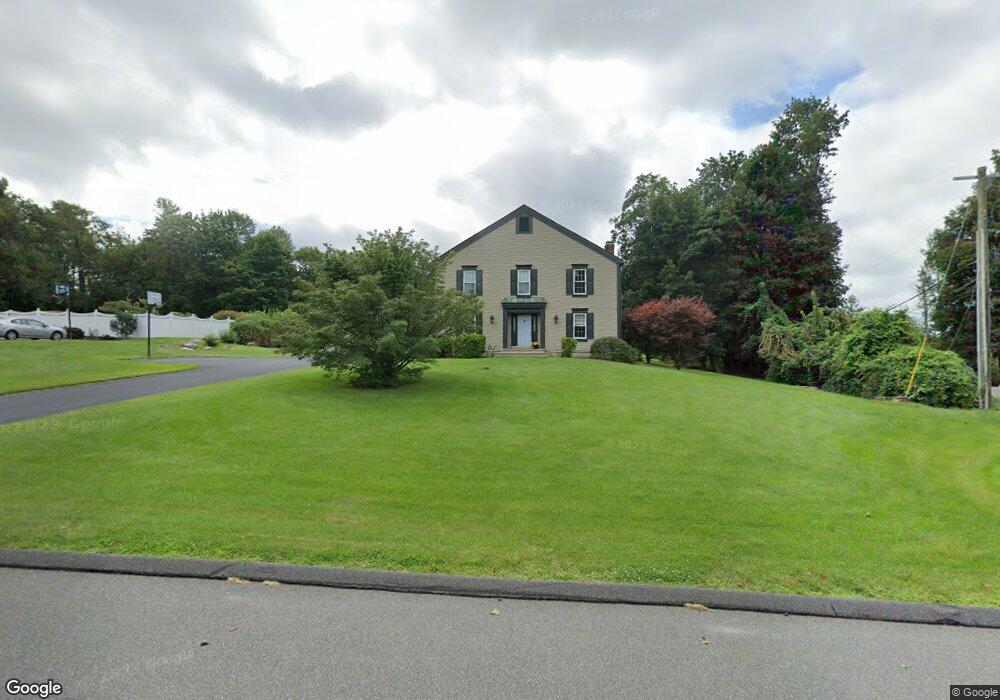
1 Tremont Rd Brookfield, CT 06804
Estimated Value: $708,597 - $818,000
4
Beds
3
Baths
2,740
Sq Ft
$285/Sq Ft
Est. Value
About This Home
This home is located at 1 Tremont Rd, Brookfield, CT 06804 and is currently estimated at $780,149, approximately $284 per square foot. 1 Tremont Rd is a home located in Fairfield County with nearby schools including Whisconier Middle School, Brookfield High School, and Montessori Community School at Brookfield.
Ownership History
Date
Name
Owned For
Owner Type
Purchase Details
Closed on
Feb 27, 2006
Sold by
Kaufman Edward and Kaufman Karen
Bought by
Soyland Kenneth and Soyland Susan
Current Estimated Value
Purchase Details
Closed on
Jul 3, 1989
Sold by
Charter Group Inc
Bought by
Kaufman Edward
Create a Home Valuation Report for This Property
The Home Valuation Report is an in-depth analysis detailing your home's value as well as a comparison with similar homes in the area
Home Values in the Area
Average Home Value in this Area
Purchase History
| Date | Buyer | Sale Price | Title Company |
|---|---|---|---|
| Soyland Kenneth | $590,000 | -- | |
| Soyland Kenneth | $590,000 | -- | |
| Kaufman Edward | $363,000 | -- |
Source: Public Records
Mortgage History
| Date | Status | Borrower | Loan Amount |
|---|---|---|---|
| Closed | Kaufman Edward | $90,000 | |
| Open | Kaufman Edward | $282,685 | |
| Closed | Kaufman Edward | $59,000 |
Source: Public Records
Tax History
| Year | Tax Paid | Tax Assessment Tax Assessment Total Assessment is a certain percentage of the fair market value that is determined by local assessors to be the total taxable value of land and additions on the property. | Land | Improvement |
|---|---|---|---|---|
| 2025 | $9,915 | $342,720 | $115,770 | $226,950 |
| 2024 | $9,562 | $342,720 | $115,770 | $226,950 |
| 2023 | $9,205 | $342,720 | $115,770 | $226,950 |
| 2022 | $8,870 | $342,720 | $115,770 | $226,950 |
| 2021 | $9,396 | $312,160 | $128,630 | $183,530 |
| 2020 | $8,520 | $312,160 | $128,630 | $183,530 |
| 2019 | $9,096 | $312,160 | $128,630 | $183,530 |
| 2018 | $8,847 | $312,160 | $128,630 | $183,530 |
| 2017 | $8,519 | $312,160 | $128,630 | $183,530 |
| 2016 | $8,855 | $335,400 | $154,280 | $181,120 |
| 2015 | $8,620 | $335,400 | $154,280 | $181,120 |
| 2014 | $8,620 | $335,400 | $154,280 | $181,120 |
Source: Public Records
Map
Nearby Homes
- 112 A Stony Hill Rd
- 5 Woodland Hills Terrace
- 1 Essex Ct Unit 1
- 2 Old Grays Bridge Rd
- 16 Homestead Ln
- 4 Arlington Ct
- 23 Sunset Hill Rd
- 12 Oak Crest Dr
- 8 Marilyn Rd
- 2 Autumn's Way
- 29 Ledgewood Dr
- 23 Farrell Rd
- 16 Farrell Rd
- 6 Comstock Trail Unit 6
- 43 Bramble Way
- 54 Redwood Dr
- 32 Redwood Dr
- 10 Elmwood Ct
- 6 Bramble Way Unit Homesite 30
- 6 Bramble Way
- 3 Tremont Rd
- 18 Pocono Ridge Rd
- 11 Pocono Ridge Rd
- 2 Tremont Rd
- 16 Pocono Ridge Rd
- 5 Tremont Rd
- 20 Pocono Ridge Rd
- 9 Pocono Ridge Rd
- 24 Pocono Ridge Rd
- 4 Tremont Rd
- 14 Pocono Ridge Rd
- 17 Pocono Ridge Rd
- 26 Pocono Ridge Rd
- 7 Pocono Ridge Rd
- 7 Tremont Rd
- 19 Pocono Ridge Rd
- 12 Pocono Ridge Rd
- 15 Stony Brook Rd
- 12 Knollcrest Dr
- 13 Stony Brook Rd
Your Personal Tour Guide
Ask me questions while you tour the home.