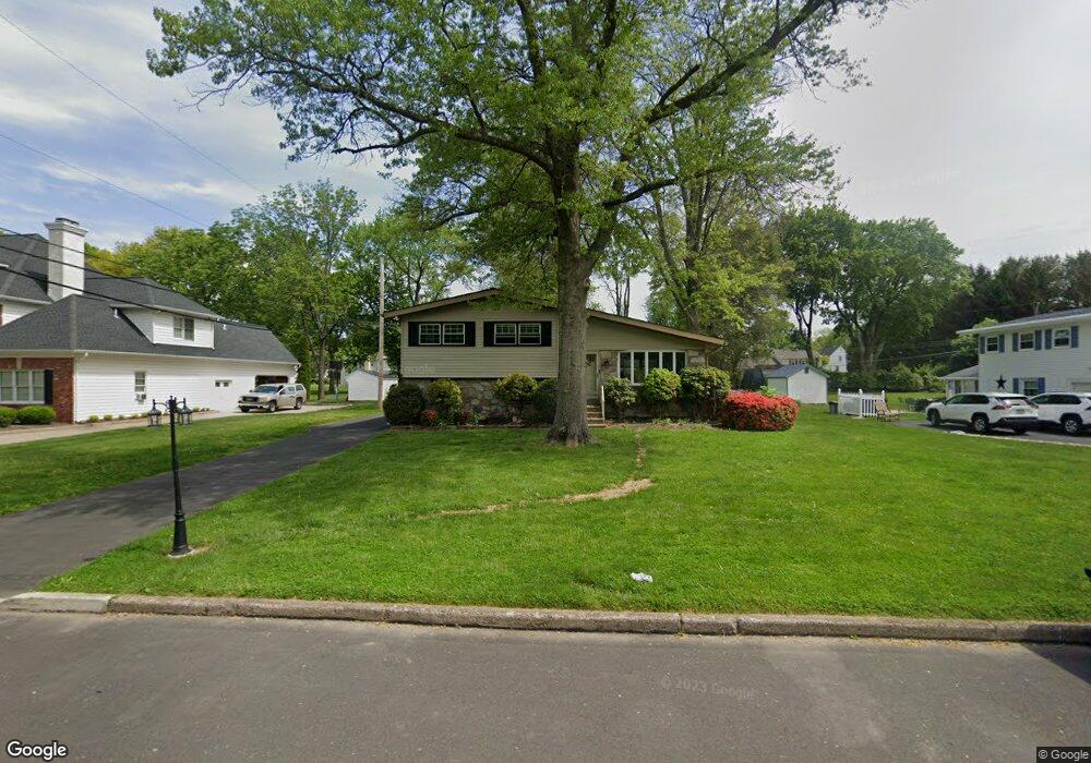
1 Upland Dr Southampton, PA 18966
Estimated Value: $549,000 - $605,000
3
Beds
3
Baths
1,372
Sq Ft
$415/Sq Ft
Est. Value
About This Home
This home is located at 1 Upland Dr, Southampton, PA 18966 and is currently estimated at $570,029, approximately $415 per square foot. 1 Upland Dr is a home located in Bucks County with nearby schools including Maureen M. Welch Elementary School, Richboro Middle School, and Council Rock High School - South.
Ownership History
Date
Name
Owned For
Owner Type
Purchase Details
Closed on
Oct 14, 2022
Sold by
Mccann Kevin and Mccann Holly
Bought by
Laporte Joseph J and Laporte Lourdes
Current Estimated Value
Home Financials for this Owner
Home Financials are based on the most recent Mortgage that was taken out on this home.
Original Mortgage
$467,000
Outstanding Balance
$448,174
Interest Rate
5.66%
Mortgage Type
VA
Estimated Equity
$121,855
Purchase Details
Closed on
Nov 24, 2021
Sold by
Bentz Denise K and Estate Of Joseph J Bentz
Bought by
Mccann Kevin and Mccann Holly
Home Financials for this Owner
Home Financials are based on the most recent Mortgage that was taken out on this home.
Original Mortgage
$384,750
Interest Rate
3.14%
Mortgage Type
New Conventional
Purchase Details
Closed on
Feb 18, 1959
Bought by
Bentz Jos J and Bentz Kathryn C
Create a Home Valuation Report for This Property
The Home Valuation Report is an in-depth analysis detailing your home's value as well as a comparison with similar homes in the area
Home Values in the Area
Average Home Value in this Area
Purchase History
| Date | Buyer | Sale Price | Title Company |
|---|---|---|---|
| Laporte Joseph J | $467,000 | Cu Abstract | |
| Mccann Kevin | $405,000 | None Available | |
| Bentz Jos J | -- | -- |
Source: Public Records
Mortgage History
| Date | Status | Borrower | Loan Amount |
|---|---|---|---|
| Open | Laporte Joseph J | $467,000 | |
| Previous Owner | Mccann Kevin | $384,750 |
Source: Public Records
Tax History Compared to Growth
Tax History
| Year | Tax Paid | Tax Assessment Tax Assessment Total Assessment is a certain percentage of the fair market value that is determined by local assessors to be the total taxable value of land and additions on the property. | Land | Improvement |
|---|---|---|---|---|
| 2025 | $5,470 | $28,400 | $5,560 | $22,840 |
| 2024 | $5,470 | $28,400 | $5,560 | $22,840 |
| 2023 | $5,155 | $28,400 | $5,560 | $22,840 |
| 2022 | $5,108 | $28,400 | $5,560 | $22,840 |
| 2021 | $4,947 | $28,400 | $5,560 | $22,840 |
| 2020 | $4,835 | $28,400 | $5,560 | $22,840 |
| 2019 | $4,628 | $28,400 | $5,560 | $22,840 |
| 2018 | $4,546 | $28,400 | $5,560 | $22,840 |
| 2017 | $4,371 | $28,400 | $5,560 | $22,840 |
| 2016 | $4,371 | $28,400 | $5,560 | $22,840 |
| 2015 | -- | $28,400 | $5,560 | $22,840 |
| 2014 | -- | $28,400 | $5,560 | $22,840 |
Source: Public Records
Map
Nearby Homes
- 29 Devon Rd
- 448 W Bristol Rd
- 1310 Dennis Rd
- 225 Green Dr
- 215 Surrey Rd
- 249 New Rd
- 559 Maple Ave
- 18 Daffodil Dr
- 371 N 2nd Street Pike
- 955 Bristol Rd
- 800 New Rd
- 161 New Rd
- 1495 Estate Ln
- 67 Woodland Dr
- 1031 Willopenn Dr
- 148 Laurel Rd
- 47 Creek Rd
- 55 Mount Pleasant Dr
- 1020 Pennsylvania Ave
- 290 Hatboro Rd