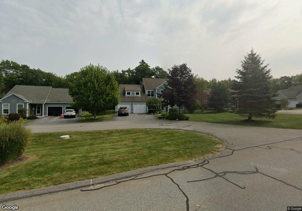
1 Waxwing Dr Topsham, ME 04086
Estimated Value: $492,000 - $1,005,000
3
Beds
3
Baths
2,834
Sq Ft
$263/Sq Ft
Est. Value
About This Home
This home is located at 1 Waxwing Dr, Topsham, ME 04086 and is currently estimated at $746,290, approximately $263 per square foot. 1 Waxwing Dr is a home located in Sagadahoc County with nearby schools including Mt Ararat High School and St. John's Catholic School.
Create a Home Valuation Report for This Property
The Home Valuation Report is an in-depth analysis detailing your home's value as well as a comparison with similar homes in the area
Home Values in the Area
Average Home Value in this Area
Tax History Compared to Growth
Tax History
| Year | Tax Paid | Tax Assessment Tax Assessment Total Assessment is a certain percentage of the fair market value that is determined by local assessors to be the total taxable value of land and additions on the property. | Land | Improvement |
|---|---|---|---|---|
| 2024 | $10,060 | $804,800 | $110,000 | $694,800 |
| 2023 | $10,087 | $742,800 | $98,400 | $644,400 |
| 2022 | $9,063 | $628,500 | $81,100 | $547,400 |
| 2021 | $8,890 | $560,200 | $81,100 | $479,100 |
| 2020 | $9,877 | $553,000 | $81,100 | $471,900 |
| 2019 | $10,134 | $529,200 | $75,300 | $453,900 |
| 2018 | $9,704 | $518,100 | $63,700 | $454,400 |
| 2017 | $11,465 | $632,700 | $63,700 | $569,000 |
| 2016 | $11,382 | $632,700 | $63,700 | $569,000 |
| 2015 | $11,306 | $629,500 | $63,700 | $565,800 |
| 2014 | $10,859 | $626,600 | $70,100 | $556,500 |
| 2013 | $10,538 | $632,900 | $76,400 | $556,500 |
Source: Public Records
Map
Nearby Homes
- 2 Jasper Dr
- 211 Augusta Rd
- 210 Augusta Rd
- 55 Munroe Ln
- 26 Union Park Rd
- 15 Royal Oak Cir
- 282 Middlesex Rd
- 67 Tedford Rd
- 34 Compass Ln
- 36 Tedford Rd
- 118 Main St
- 10 Somerset Place
- 67 Forest Glen Ln
- 75 Adams Landing Rd
- 23 Forest Glen Ln
- 4 Wilson St
- 55 Somerset Place
- 2 Haskell Cir
- 71 Somerset Place
- 428 Cathance Rd