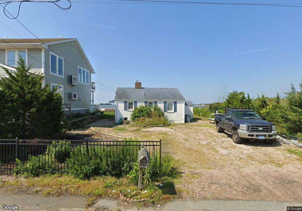
1 West Rd Clinton, CT 06413
Estimated Value: $549,000 - $832,000
2
Beds
1
Bath
672
Sq Ft
$985/Sq Ft
Est. Value
About This Home
This home is located at 1 West Rd, Clinton, CT 06413 and is currently estimated at $662,090, approximately $985 per square foot. 1 West Rd is a home located in Middlesex County with nearby schools including Lewin G. Joel Jr. School and The Morgan School.
Ownership History
Date
Name
Owned For
Owner Type
Purchase Details
Closed on
Sep 29, 2017
Sold by
London Jonathan B
Bought by
London Means Ret
Current Estimated Value
Purchase Details
Closed on
Oct 29, 1999
Sold by
London Hannah F
Bought by
London Jonathan B
Purchase Details
Closed on
May 11, 1993
Sold by
Durso Anthony
Bought by
London Hannah F
Create a Home Valuation Report for This Property
The Home Valuation Report is an in-depth analysis detailing your home's value as well as a comparison with similar homes in the area
Home Values in the Area
Average Home Value in this Area
Purchase History
| Date | Buyer | Sale Price | Title Company |
|---|---|---|---|
| London Means Ret | -- | -- | |
| London Means Ret | -- | -- | |
| London Jonathan B | $200,000 | -- | |
| London Jonathan B | $200,000 | -- | |
| London Hannah F | $200,000 | -- | |
| London Hannah F | $200,000 | -- |
Source: Public Records
Tax History
| Year | Tax Paid | Tax Assessment Tax Assessment Total Assessment is a certain percentage of the fair market value that is determined by local assessors to be the total taxable value of land and additions on the property. | Land | Improvement |
|---|---|---|---|---|
| 2025 | $12,463 | $400,223 | $336,923 | $63,300 |
| 2024 | $12,111 | $400,223 | $336,923 | $63,300 |
| 2023 | $11,939 | $400,223 | $336,923 | $63,300 |
| 2022 | $11,939 | $400,223 | $336,923 | $63,300 |
| 2021 | $10,441 | $350,000 | $290,200 | $59,800 |
| 2020 | $10,938 | $350,000 | $290,200 | $59,800 |
| 2019 | $10,938 | $350,000 | $290,200 | $59,800 |
| 2018 | $10,689 | $350,000 | $290,200 | $59,800 |
| 2017 | $10,469 | $350,000 | $290,200 | $59,800 |
| 2016 | $9,499 | $350,000 | $290,200 | $59,800 |
| 2015 | $9,458 | $353,300 | $294,800 | $58,500 |
| 2014 | $9,281 | $353,300 | $294,800 | $58,500 |
Source: Public Records
Map
Nearby Homes
- 49 + 51 Uncas Rd
- 9 Loop Rd
- 24 Indian Dr
- 192 E Main St
- 13 Waterside Ln
- 75 Shore Rd
- 0 E Main St
- 144 E Main St Unit 5
- 110 E Main St
- 153 E Main St Unit 10
- 153 E Main St Unit 13
- 153 E Main St Unit 31
- 153 E Main St Unit 8
- 153 E Main St Unit 9
- 153 E Main St Unit 6
- 153 E Main St Unit 7
- 153 E Main St Unit 11
- 153 E Main St Unit 32
- 153 E Main St Unit 5
- 0 151 - 153 East Main St Unit 15
Your Personal Tour Guide
Ask me questions while you tour the home.