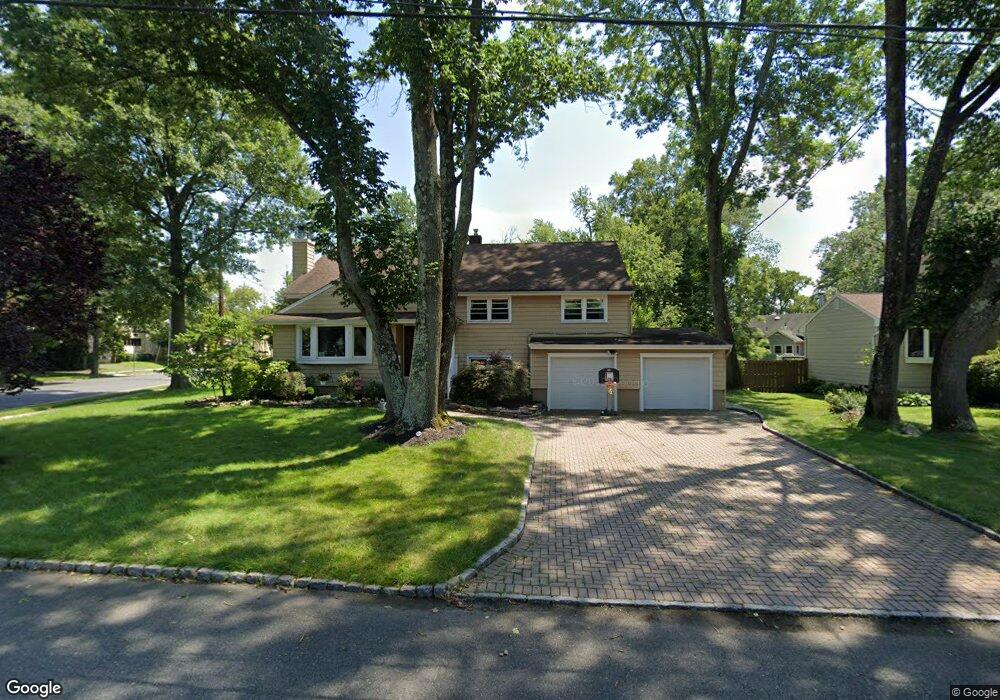
1 Westbrook Rd Westfield, NJ 07090
Estimated Value: $1,150,928 - $1,261,000
--
Bed
--
Bath
2,387
Sq Ft
$508/Sq Ft
Est. Value
About This Home
This home is located at 1 Westbrook Rd, Westfield, NJ 07090 and is currently estimated at $1,212,732, approximately $508 per square foot. 1 Westbrook Rd is a home located in Union County with nearby schools including Tamaques Elementary School, Edison Intermediate School, and Westfield Senior High School.
Ownership History
Date
Name
Owned For
Owner Type
Purchase Details
Closed on
Mar 25, 2011
Sold by
Healey Michael and Healey Toni
Bought by
Gibbons Robert and Gibbons Jennifer A
Current Estimated Value
Home Financials for this Owner
Home Financials are based on the most recent Mortgage that was taken out on this home.
Original Mortgage
$500,000
Outstanding Balance
$347,568
Interest Rate
5.04%
Mortgage Type
New Conventional
Estimated Equity
$865,164
Purchase Details
Closed on
Sep 6, 2002
Sold by
Widows Richard
Bought by
Healey Michael and Healey Toni
Home Financials for this Owner
Home Financials are based on the most recent Mortgage that was taken out on this home.
Original Mortgage
$300,700
Interest Rate
6.25%
Create a Home Valuation Report for This Property
The Home Valuation Report is an in-depth analysis detailing your home's value as well as a comparison with similar homes in the area
Home Values in the Area
Average Home Value in this Area
Purchase History
| Date | Buyer | Sale Price | Title Company |
|---|---|---|---|
| Gibbons Robert | $625,000 | Meridian Title Agency | |
| Healey Michael | $399,500 | -- |
Source: Public Records
Mortgage History
| Date | Status | Borrower | Loan Amount |
|---|---|---|---|
| Open | Gibbons Robert | $500,000 | |
| Previous Owner | Healey Michael | $300,700 |
Source: Public Records
Tax History Compared to Growth
Tax History
| Year | Tax Paid | Tax Assessment Tax Assessment Total Assessment is a certain percentage of the fair market value that is determined by local assessors to be the total taxable value of land and additions on the property. | Land | Improvement |
|---|---|---|---|---|
| 2025 | $14,462 | $642,200 | $416,500 | $225,700 |
| 2024 | $14,167 | $642,200 | $416,500 | $225,700 |
| 2023 | $14,167 | $642,200 | $416,500 | $225,700 |
| 2022 | $13,872 | $642,200 | $416,500 | $225,700 |
| 2021 | $13,891 | $642,200 | $416,500 | $225,700 |
| 2020 | $13,859 | $642,200 | $416,500 | $225,700 |
| 2019 | $13,807 | $642,200 | $416,500 | $225,700 |
| 2018 | $14,847 | $159,700 | $72,600 | $87,100 |
| 2017 | $14,766 | $159,700 | $72,600 | $87,100 |
| 2016 | $14,419 | $159,700 | $72,600 | $87,100 |
| 2015 | $14,132 | $159,700 | $72,600 | $87,100 |
| 2014 | $13,666 | $159,700 | $72,600 | $87,100 |
Source: Public Records
Map
Nearby Homes
- 676 Vermont St
- 834 Tice Place
- 614 Dorian Rd
- 814 Summit Ave
- 817 Summit Ave
- 603 Carleton Rd
- 538 Westfield Ave
- 522 Boulevard
- 525 Edgar Rd
- 524 Edgar Rd
- 215 Ross Place Unit J
- 779 Lamberts Mill Rd
- 203 Ross Place
- 112 Windsor Ave
- 1016 Tice Place
- 1466 Lamberts Mill Rd
- 1008 Boulevard
- 11 Mohawk Trail
- 724 South Ave W Unit 724A
- 119 Lamberts Mill Rd
- 5 Westbrook Rd
- 722 Rahway Ave
- 555 Washington St
- 58 Westbrook Rd
- 711 Rahway Ave
- 6 Westbrook Rd
- 730 Rahway Ave
- 9 Westbrook Rd
- 551 Washington St
- 715 Rahway Ave
- 734 Rahway Ave
- 547 Washington St
- 62 Westbrook Rd
- 54 Westbrook Rd
- 696 Rahway Ave
- 738 Rahway Ave
- 543 Washington St
- 560 Washington St
- 10 Westbrook Rd
- 15 Westbrook Rd