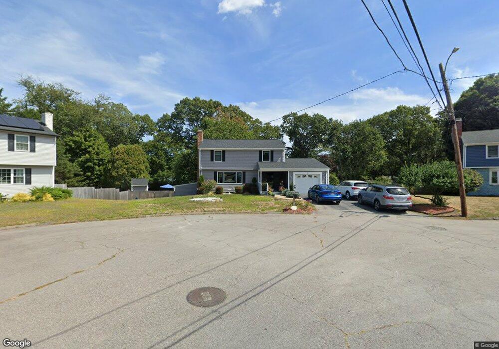
1 Whitehall Dr Warwick, RI 02886
Bald Hill NeighborhoodEstimated Value: $517,000 - $580,000
3
Beds
3
Baths
2,481
Sq Ft
$219/Sq Ft
Est. Value
About This Home
This home is located at 1 Whitehall Dr, Warwick, RI 02886 and is currently estimated at $544,470, approximately $219 per square foot. 1 Whitehall Dr is a home located in Kent County with nearby schools including Islamic School of Rhode Island and St Joseph School.
Ownership History
Date
Name
Owned For
Owner Type
Purchase Details
Closed on
Jun 13, 2016
Sold by
Kolb Michael W and Kolb Deborah L
Bought by
Kolb Michael W
Current Estimated Value
Purchase Details
Closed on
Sep 30, 1993
Sold by
Obrien William M and Obrien Lucille
Bought by
Kolb Michael W and Kolb Deborah
Home Financials for this Owner
Home Financials are based on the most recent Mortgage that was taken out on this home.
Original Mortgage
$158,000
Interest Rate
7%
Mortgage Type
Purchase Money Mortgage
Create a Home Valuation Report for This Property
The Home Valuation Report is an in-depth analysis detailing your home's value as well as a comparison with similar homes in the area
Home Values in the Area
Average Home Value in this Area
Purchase History
| Date | Buyer | Sale Price | Title Company |
|---|---|---|---|
| Kolb Michael W | -- | -- | |
| Kolb Michael W | $167,000 | -- |
Source: Public Records
Mortgage History
| Date | Status | Borrower | Loan Amount |
|---|---|---|---|
| Previous Owner | Kolb Michael W | $100,000 | |
| Previous Owner | Kolb Michael W | $158,000 |
Source: Public Records
Tax History
| Year | Tax Paid | Tax Assessment Tax Assessment Total Assessment is a certain percentage of the fair market value that is determined by local assessors to be the total taxable value of land and additions on the property. | Land | Improvement |
|---|---|---|---|---|
| 2025 | $6,058 | $477,000 | $112,400 | $364,600 |
| 2024 | $6,050 | $418,100 | $97,800 | $320,300 |
| 2023 | $5,933 | $418,100 | $97,800 | $320,300 |
| 2022 | $5,769 | $308,000 | $76,000 | $232,000 |
| 2021 | $5,769 | $308,000 | $76,000 | $232,000 |
| 2020 | $5,769 | $308,000 | $76,000 | $232,000 |
| 2019 | $5,769 | $308,000 | $76,000 | $232,000 |
| 2018 | $5,371 | $258,200 | $69,100 | $189,100 |
| 2017 | $5,226 | $258,200 | $69,100 | $189,100 |
| 2016 | $5,226 | $258,200 | $69,100 | $189,100 |
| 2015 | $4,735 | $228,200 | $67,200 | $161,000 |
| 2014 | $4,578 | $228,200 | $67,200 | $161,000 |
| 2013 | $4,516 | $228,200 | $67,200 | $161,000 |
Source: Public Records
Map
Nearby Homes
- 139 Lancaster Ave
- 403 Commonwealth Ave
- 52 Benefit St
- 36 Great Oak Dr
- 151 Drum Rock Ave
- 27 Great Oak Dr
- 219 Brian Dr
- 0 Centerville Rd
- 237 Commonwealth Ave
- 3399 Post Rd Unit 15
- 11 College Hill Rd Unit 5B
- 11 College Hill Rd Unit 4A
- 155 Birkshire Dr
- 84 Spruce St
- 979 Tollgate Unit 31 Rd
- 333 Greenwood Ave
- 10 Arrowhead Way
- 52 Jambray Ave
- 2907 Post Rd Unit 4
- 2907 Post Rd Unit 2
- 2 Whitehall Dr
- 7 Whitehall Dr
- 25 Becker St
- 15 Becker St
- 100 Granite St
- 6 Whitehall Dr
- 15 Whitehall Dr
- 19 Whitehall Dr
- 20 Whitehall Dr
- 35 Becker St
- 200 Granite St Unit 2
- 200 Granite St Unit 3
- 200 Granite St Unit 8
- 200 Granite St Unit 7
- 200 Granite St Unit 4
- 200 Granite St Unit 6
- 200 Granite St Unit 5
- 200 Granite St Unit 9
- 200 Granite St Unit 1
- 82 Granite St
Your Personal Tour Guide
Ask me questions while you tour the home.