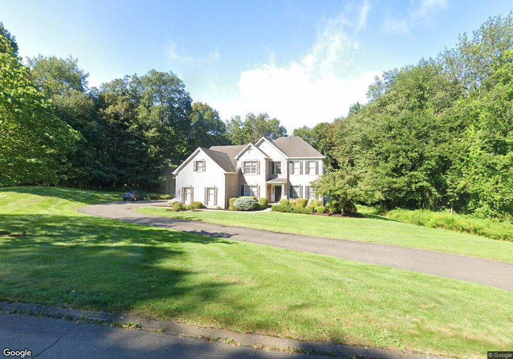
1 Whitewood Rd Newtown, CT 06470
Estimated Value: $915,658 - $1,057,000
4
Beds
3
Baths
3,376
Sq Ft
$292/Sq Ft
Est. Value
About This Home
This home is located at 1 Whitewood Rd, Newtown, CT 06470 and is currently estimated at $986,915, approximately $292 per square foot. 1 Whitewood Rd is a home located in Fairfield County with nearby schools including Reed Intermediate School, Head O'Meadow Elementary School, and Newtown Middle School.
Ownership History
Date
Name
Owned For
Owner Type
Purchase Details
Closed on
Aug 25, 2009
Sold by
Brereton John D and Brereton Karen E
Bought by
Blessey Rodd B and Blessey Kelly
Current Estimated Value
Home Financials for this Owner
Home Financials are based on the most recent Mortgage that was taken out on this home.
Original Mortgage
$520,000
Interest Rate
5.19%
Purchase Details
Closed on
Aug 15, 2002
Sold by
Dinoto John and Dinoto Mary Beth
Bought by
Brereton John and Brereton Karen
Purchase Details
Closed on
Oct 22, 1997
Sold by
Newtown Chase Lp
Bought by
Dinoto John and Dinoto Mary B
Create a Home Valuation Report for This Property
The Home Valuation Report is an in-depth analysis detailing your home's value as well as a comparison with similar homes in the area
Home Values in the Area
Average Home Value in this Area
Purchase History
| Date | Buyer | Sale Price | Title Company |
|---|---|---|---|
| Blessey Rodd B | $650,000 | -- | |
| Blessey Rodd B | $650,000 | -- | |
| Brereton John | $630,000 | -- | |
| Brereton John | $630,000 | -- | |
| Dinoto John | $440,446 | -- | |
| Dinoto John | $440,446 | -- |
Source: Public Records
Mortgage History
| Date | Status | Borrower | Loan Amount |
|---|---|---|---|
| Open | Dinoto John | $500,000 | |
| Closed | Dinoto John | $520,000 |
Source: Public Records
Tax History Compared to Growth
Tax History
| Year | Tax Paid | Tax Assessment Tax Assessment Total Assessment is a certain percentage of the fair market value that is determined by local assessors to be the total taxable value of land and additions on the property. | Land | Improvement |
|---|---|---|---|---|
| 2025 | $13,988 | $486,720 | $133,180 | $353,540 |
| 2024 | $13,127 | $486,720 | $133,180 | $353,540 |
| 2023 | $12,772 | $486,720 | $133,180 | $353,540 |
| 2022 | $11,683 | $336,970 | $89,090 | $247,880 |
| 2021 | $11,676 | $336,970 | $89,090 | $247,880 |
| 2020 | $11,713 | $336,970 | $89,090 | $247,880 |
| 2019 | $11,716 | $336,970 | $89,090 | $247,880 |
| 2018 | $11,538 | $336,970 | $89,090 | $247,880 |
| 2017 | $12,590 | $371,720 | $102,000 | $269,720 |
| 2016 | $12,490 | $371,720 | $102,000 | $269,720 |
| 2015 | $12,293 | $371,720 | $102,000 | $269,720 |
| 2014 | $12,382 | $371,720 | $102,000 | $269,720 |
Source: Public Records
Map
Nearby Homes
- 81 Currituck Rd
- 23 Taunton Ln
- 67 Hanover Rd
- 3 Topside Ln
- 22 Lincoln Rd
- 6 Violette Rd
- 149 Mount Pleasant Rd
- 55 Sugar St Unit 9
- 55 Sugar St Unit 6
- 55 Sugar St Unit 2
- 55 Sugar St Unit 31
- 55 Sugar St Unit 33
- 55 Sugar St Unit 3
- 55 Sugar St Unit 20
- 55 Sugar St Unit 28
- 55 Sugar St Unit 12
- 55 Sugar St Unit 27
- 55 Sugar St Unit 5
- 55 Sugar St Unit 10
- 55 Sugar St Unit 4
- 4 Whitewood Rd
- 2 Blackman Rd
- 1 Blackman Rd
- 32 Whitewood Rd
- 8 Whitewood Rd
- 28 Diamond Dr
- 30 Whitewood Rd
- 8 Middleton Rd
- 58 Mount Pleasant Rd
- 23 Diamond Dr
- 12 Blackman Rd
- 26 Diamond Dr
- 56 Mount Pleasant Rd
- 21 Diamond Dr
- 24 Diamond Dr
- 39 Whitewood Rd
- 10 Whitewood Rd
- 54A Mount Pleasant Rd
- 69 Mount Pleasant Rd