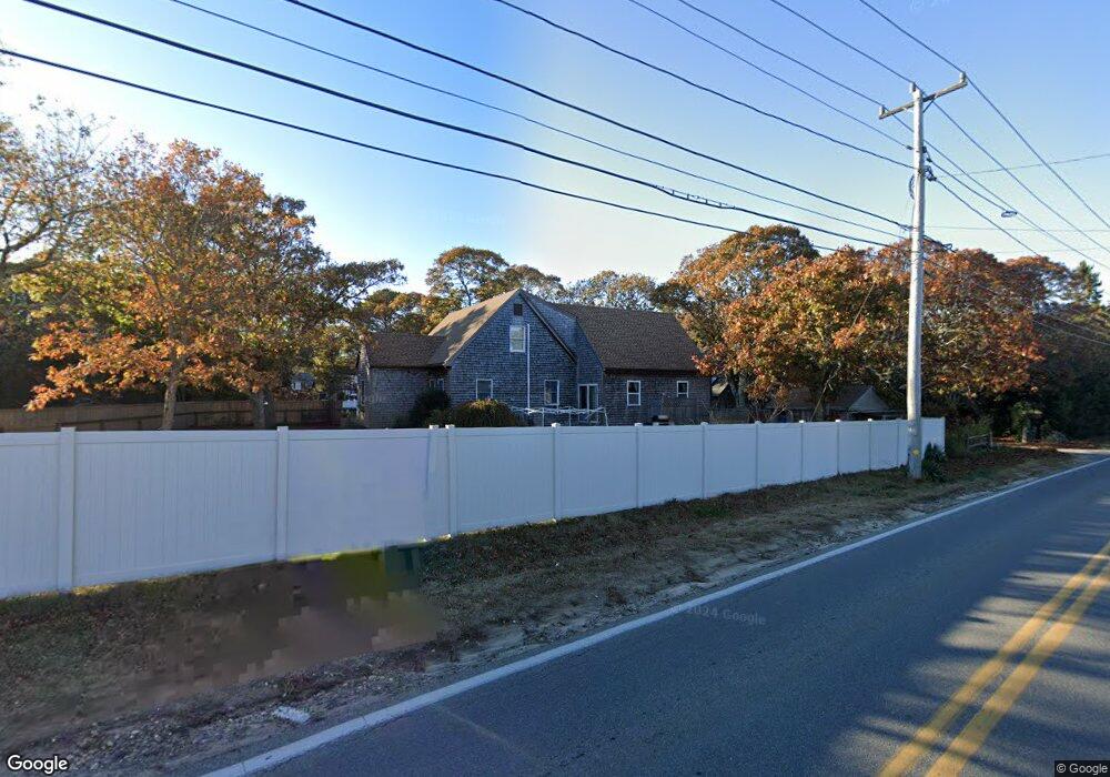
1 Worcester Ave Vineyard Haven, MA 02568
Oak Bluffs NeighborhoodEstimated Value: $1,181,000 - $1,366,000
3
Beds
2
Baths
1,914
Sq Ft
$666/Sq Ft
Est. Value
About This Home
This home is located at 1 Worcester Ave, Vineyard Haven, MA 02568 and is currently estimated at $1,275,677, approximately $666 per square foot. 1 Worcester Ave is a home with nearby schools including Oak Bluffs Elementary School, Martha's Vineyard Regional High School, and Vineyard Montessori School.
Ownership History
Date
Name
Owned For
Owner Type
Purchase Details
Closed on
Jun 22, 1994
Sold by
Anticoli Trs Cara
Bought by
Broadley Shawn
Current Estimated Value
Home Financials for this Owner
Home Financials are based on the most recent Mortgage that was taken out on this home.
Original Mortgage
$96,000
Interest Rate
8.74%
Mortgage Type
Purchase Money Mortgage
Create a Home Valuation Report for This Property
The Home Valuation Report is an in-depth analysis detailing your home's value as well as a comparison with similar homes in the area
Home Values in the Area
Average Home Value in this Area
Purchase History
| Date | Buyer | Sale Price | Title Company |
|---|---|---|---|
| Broadley Shawn | $113,000 | -- | |
| Broadley Shawn | $113,000 | -- |
Source: Public Records
Mortgage History
| Date | Status | Borrower | Loan Amount |
|---|---|---|---|
| Open | Broadley Shawn | $129,000 | |
| Closed | Broadley Shawn | $100,000 | |
| Closed | Broadley Shawn | $93,000 | |
| Closed | Broadley Shawn | $96,000 |
Source: Public Records
Tax History Compared to Growth
Tax History
| Year | Tax Paid | Tax Assessment Tax Assessment Total Assessment is a certain percentage of the fair market value that is determined by local assessors to be the total taxable value of land and additions on the property. | Land | Improvement |
|---|---|---|---|---|
| 2025 | $5,096 | $1,009,200 | $489,400 | $519,800 |
| 2024 | $5,056 | $966,800 | $444,700 | $522,100 |
| 2023 | $5,023 | $951,300 | $432,100 | $519,200 |
| 2022 | $4,847 | $713,800 | $325,500 | $388,300 |
| 2021 | $4,564 | $619,300 | $280,900 | $338,400 |
| 2020 | $4,327 | $581,600 | $267,600 | $314,000 |
| 2019 | $4,163 | $541,300 | $233,300 | $308,000 |
| 2018 | $4,068 | $519,600 | $210,700 | $308,900 |
| 2017 | $3,835 | $470,600 | $199,800 | $270,800 |
| 2016 | $3,550 | $437,700 | $205,900 | $231,800 |
| 2015 | $3,344 | $420,100 | $205,900 | $214,200 |
| 2014 | $3,165 | $405,300 | $188,400 | $216,900 |
Source: Public Records
Map
Nearby Homes
- 60 -R Carol Ln
- 70 Carol Ln
- 60R Carol Ln
- 0-A California Ave Unit Part lot 79
- 0-B California Ave Unit Part lot 79
- 0 California Ave Unit 76 42933
- 25 Windy Hill Rd
- 38 Rogers Way
- 6 Sachem Way
- 72 Washington Ave
- 8 Hitchings Cir
- 9 Bayview Ave
- 28 Barling Ave
- 30 Franklin Ave
- 0 Pennsylvania Ave Unit 43914
- 1 Jessie Leigh Mitchell Way
- 26 Winthrop Ave
- 48 Vineyard Avenue Extension
- 5 Seth's Path
- 113 Dukes County Ave Unit Multi-Family
- 8 Worcester Ave
- 16 Front St
- 180 County Rd
- 180 County Rd
- 184 County Rd
- 191 County Rd
- 176 County Rd
- 67 Front St
- 22 Firehouse Ln
- 112 Washington St
- 24 Summer Rd
- 172 County Rd
- 6 Front St
- 26 Firehouse Ln
- 0 Front St Unit 72304791
- 0 Front St Unit 33225
- 167 County Rd
- 168 County Rd
- 168 County Rd
- 6 Springfield Ave