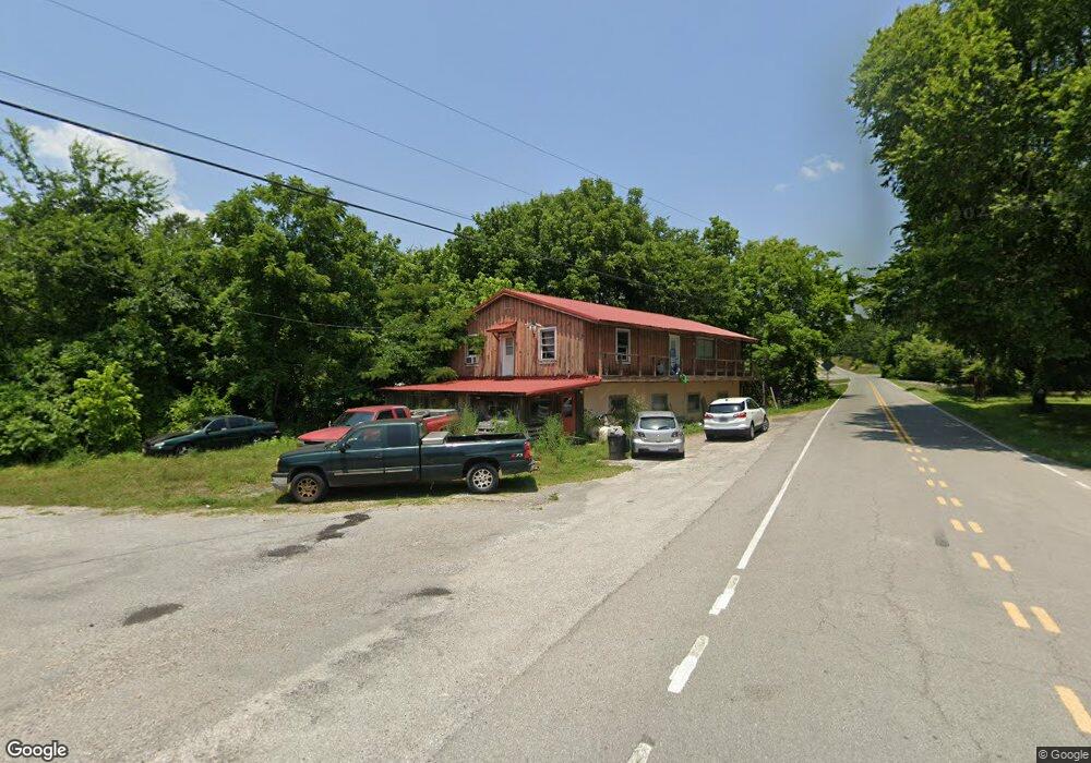
10 Airport Rd Stewart, TN 37175
Estimated Value: $157,524 - $452,000
--
Bed
1
Bath
3,240
Sq Ft
$96/Sq Ft
Est. Value
About This Home
This home is located at 10 Airport Rd, Stewart, TN 37175 and is currently estimated at $309,881, approximately $95 per square foot. 10 Airport Rd is a home.
Ownership History
Date
Name
Owned For
Owner Type
Purchase Details
Closed on
Oct 31, 2024
Sold by
Mathis Dillard Thomas
Bought by
Mathis Thomas William Doug
Current Estimated Value
Purchase Details
Closed on
Oct 24, 2019
Sold by
Mathis Karen Lee Puckett
Bought by
Mathis Dillard T
Purchase Details
Closed on
Nov 19, 2010
Sold by
Hatfield Beverly
Bought by
Mathis Dillard T
Purchase Details
Closed on
Oct 9, 2003
Bought by
Phillips Margie and J D
Purchase Details
Closed on
Jul 19, 2003
Bought by
Jerles George and Jerles Peggy
Purchase Details
Closed on
Jan 21, 2000
Bought by
Jerles George and Jerles Peggy
Purchase Details
Closed on
Oct 2, 1989
Bought by
Phillips Margie and J D
Purchase Details
Closed on
Nov 30, 1987
Bought by
Routledge Edgar D
Purchase Details
Closed on
Jan 1, 1977
Create a Home Valuation Report for This Property
The Home Valuation Report is an in-depth analysis detailing your home's value as well as a comparison with similar homes in the area
Home Values in the Area
Average Home Value in this Area
Purchase History
| Date | Buyer | Sale Price | Title Company |
|---|---|---|---|
| Mathis Thomas William Doug | -- | None Listed On Document | |
| Mathis Thomas William Doug | -- | None Listed On Document | |
| Mathis Dillard T | -- | -- | |
| Mathis Dillard T | $29,500 | -- | |
| Phillips Margie | -- | -- | |
| Jerles George | -- | -- | |
| Jerles George | $50,000 | -- | |
| Phillips Margie | $29,000 | -- | |
| Routledge Edgar D | -- | -- | |
| -- | $5,000 | -- |
Source: Public Records
Tax History Compared to Growth
Tax History
| Year | Tax Paid | Tax Assessment Tax Assessment Total Assessment is a certain percentage of the fair market value that is determined by local assessors to be the total taxable value of land and additions on the property. | Land | Improvement |
|---|---|---|---|---|
| 2024 | $663 | $37,250 | $1,400 | $35,850 |
| 2023 | $663 | $37,250 | $1,400 | $35,850 |
| 2022 | $585 | $20,900 | $950 | $19,950 |
| 2021 | $585 | $20,900 | $950 | $19,950 |
| 2020 | $574 | $20,900 | $950 | $19,950 |
| 2019 | $574 | $18,000 | $850 | $17,150 |
| 2018 | $574 | $18,000 | $850 | $17,150 |
| 2017 | $574 | $18,000 | $850 | $17,150 |
| 2016 | $574 | $18,000 | $850 | $17,150 |
| 2015 | $574 | $18,000 | $850 | $17,150 |
| 2014 | -- | $17,996 | $0 | $0 |
Source: Public Records
Map
Nearby Homes
- 35 Airport Ln
- 0 Highway 232 Unit 25510404
- 10120 Highway 147
- 85 Lakeview Ln
- 71 Overlook Ln
- 67 Overlook Ln
- 79 Overlook Ln
- 372 Cheree Loop
- 8955 Tennessee 147
- 943 Overlook Trail
- 11175 Highway 147
- 0 Rocky Point Rd Unit RTC2700425
- 0 Day Cemetery Ln
- 0 Overlook Trail
- 78 Vista Ridge Dr
- 0 Vista Ridge Dr
- 33 Vista Ridge Dr
- 1025 Vista Ridge Dr
- 27 Vista Ridge Dr
- 0 Lake Ridge Dr Unit RTC3017496
- 1A Airport Rd
- 15 Airport Ln
- 40 White Oak Rd
- 44 Airport Rd
- 78 Airport Rd
- 70 Airport Rd
- 31 White Oak Rd
- 35 Airport Ln
- 90 Airport Rd
- 10074 Highway 147
- 10074 Highway 147
- 0 Highway 232
- 0 W of Highway 232
- 0 Highway 232 Unit 128207
- 0 Highway 232 Unit RTC2448894
- 0 Highway 232 Unit 2142465
- 35 Fisher Rd
- 110 Airport Rd
- 30 Old Mathis Hollow Ln
- 9950 Tennessee 147