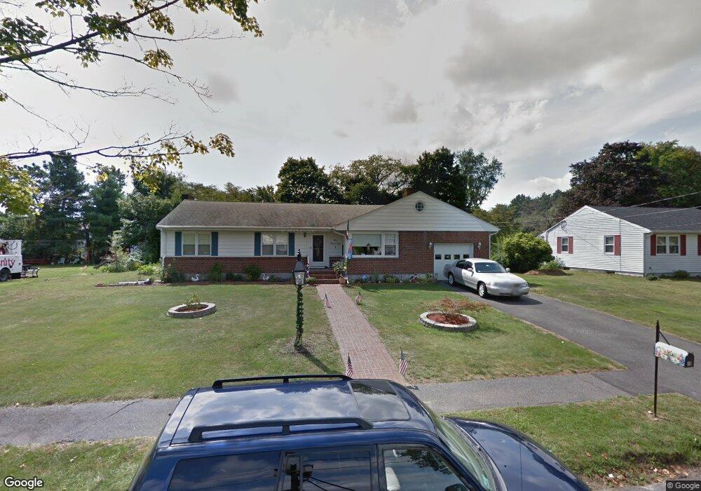
10 Alfred Rd Saugus, MA 01906
North Saugus NeighborhoodEstimated Value: $718,793 - $907,000
3
Beds
2
Baths
1,606
Sq Ft
$487/Sq Ft
Est. Value
About This Home
This home is located at 10 Alfred Rd, Saugus, MA 01906 and is currently estimated at $782,698, approximately $487 per square foot. 10 Alfred Rd is a home located in Essex County with nearby schools including Saugus High School, Pioneer Charter School Of Science II, and Our Lady Of Assumption School.
Ownership History
Date
Name
Owned For
Owner Type
Purchase Details
Closed on
Oct 24, 2013
Sold by
Coviello Paul F and Coviello Dorothy A
Bought by
Coviello Irt and Coviello Linda
Current Estimated Value
Purchase Details
Closed on
Aug 1, 2011
Sold by
Avola Samuel S
Bought by
Coviello Paul F and Coviello Dorothy A
Home Financials for this Owner
Home Financials are based on the most recent Mortgage that was taken out on this home.
Original Mortgage
$100,000
Interest Rate
4.33%
Purchase Details
Closed on
Sep 30, 2010
Sold by
Short Antoinette S
Bought by
Avola Samuel S
Home Financials for this Owner
Home Financials are based on the most recent Mortgage that was taken out on this home.
Original Mortgage
$247,240
Interest Rate
4.44%
Mortgage Type
Purchase Money Mortgage
Create a Home Valuation Report for This Property
The Home Valuation Report is an in-depth analysis detailing your home's value as well as a comparison with similar homes in the area
Home Values in the Area
Average Home Value in this Area
Purchase History
| Date | Buyer | Sale Price | Title Company |
|---|---|---|---|
| Coviello Irt | -- | -- | |
| Coviello Paul F | $368,000 | -- | |
| Avola Samuel S | $350,000 | -- |
Source: Public Records
Mortgage History
| Date | Status | Borrower | Loan Amount |
|---|---|---|---|
| Previous Owner | Avola Samuel S | $100,000 | |
| Previous Owner | Avola Samuel S | $100,000 | |
| Previous Owner | Avola Samuel S | $292,000 | |
| Previous Owner | Avola Samuel S | $247,240 |
Source: Public Records
Tax History Compared to Growth
Tax History
| Year | Tax Paid | Tax Assessment Tax Assessment Total Assessment is a certain percentage of the fair market value that is determined by local assessors to be the total taxable value of land and additions on the property. | Land | Improvement |
|---|---|---|---|---|
| 2025 | $6,791 | $635,900 | $368,000 | $267,900 |
| 2024 | $6,528 | $613,000 | $348,800 | $264,200 |
| 2023 | $6,468 | $574,400 | $319,200 | $255,200 |
| 2022 | $6,004 | $499,900 | $272,400 | $227,500 |
| 2021 | $5,732 | $464,500 | $237,000 | $227,500 |
| 2020 | $5,167 | $433,500 | $215,000 | $218,500 |
| 2019 | $5,181 | $425,400 | $215,000 | $210,400 |
| 2018 | $4,831 | $417,200 | $215,000 | $202,200 |
| 2017 | $4,375 | $363,100 | $200,700 | $162,400 |
| 2016 | $4,468 | $366,200 | $170,900 | $195,300 |
| 2015 | $4,190 | $348,600 | $162,700 | $185,900 |
| 2014 | $3,871 | $333,400 | $162,700 | $170,700 |
Source: Public Records
Map
Nearby Homes
- 8 & 14 Sherbrooke Terrace
- 9 Broadway Unit 305
- 5 Hobson St
- 201 Water St
- 905 Sherwood Forest Ln
- 227 Walnut St
- 527 Salem St Unit 42
- 29 Susan Dr
- 9 Thomas St Unit 11
- 344 Broadway
- 18 Walton St
- 14 Sycamore Rd
- 695 Salem St
- 7 Nirvana Dr
- 148 Forest St
- 244 Moulton Dr
- 70 Old Nahant Rd
- 21 Athens Dr
- 960 Summer St
- 6 Castle Clare Cir