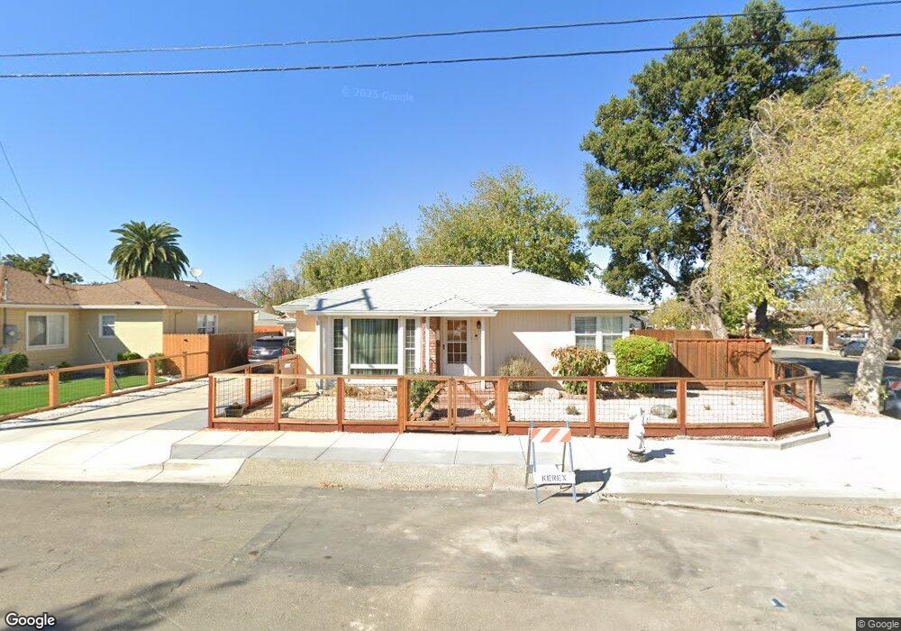
10 Ambrosia Way Bay Point, CA 94565
Bay Point West NeighborhoodEstimated Value: $510,000 - $541,000
2
Beds
2
Baths
1,667
Sq Ft
$315/Sq Ft
Est. Value
About This Home
This home is located at 10 Ambrosia Way, Bay Point, CA 94565 and is currently estimated at $525,453, approximately $315 per square foot. 10 Ambrosia Way is a home located in Contra Costa County with nearby schools including Bel Air Elementary School, Riverview Middle School, and Mt. Diablo High School.
Ownership History
Date
Name
Owned For
Owner Type
Purchase Details
Closed on
Jun 20, 2016
Sold by
Mayfield Melissa D and Mayfield Arthur R
Bought by
The Sundog Revocable Living Trust
Current Estimated Value
Purchase Details
Closed on
Jan 31, 1997
Sold by
Mayfield Arthur R and Mayfield Melissa D
Bought by
Mayfield Arthur R and Mayfield Melissa D
Home Financials for this Owner
Home Financials are based on the most recent Mortgage that was taken out on this home.
Original Mortgage
$34,472
Interest Rate
7.85%
Mortgage Type
Purchase Money Mortgage
Purchase Details
Closed on
Nov 30, 1993
Sold by
Gerhard Clarence P
Bought by
Mayfield Arthur R and Mayfield Melissa Dale
Home Financials for this Owner
Home Financials are based on the most recent Mortgage that was taken out on this home.
Original Mortgage
$114,750
Interest Rate
7.29%
Mortgage Type
Assumption
Create a Home Valuation Report for This Property
The Home Valuation Report is an in-depth analysis detailing your home's value as well as a comparison with similar homes in the area
Home Values in the Area
Average Home Value in this Area
Purchase History
| Date | Buyer | Sale Price | Title Company |
|---|---|---|---|
| The Sundog Revocable Living Trust | -- | None Available | |
| Mayfield Melissa D | -- | None Available | |
| Mayfield Arthur R | -- | Chicago Title Co | |
| Mayfield Arthur R | $112,500 | Old Republic Title Company |
Source: Public Records
Mortgage History
| Date | Status | Borrower | Loan Amount |
|---|---|---|---|
| Closed | Mayfield Arthur R | $34,472 | |
| Previous Owner | Mayfield Arthur R | $114,750 |
Source: Public Records
Tax History Compared to Growth
Tax History
| Year | Tax Paid | Tax Assessment Tax Assessment Total Assessment is a certain percentage of the fair market value that is determined by local assessors to be the total taxable value of land and additions on the property. | Land | Improvement |
|---|---|---|---|---|
| 2025 | $2,967 | $204,840 | $93,461 | $111,379 |
| 2024 | $2,967 | $200,825 | $91,629 | $109,196 |
| 2023 | $2,901 | $196,888 | $89,833 | $107,055 |
| 2022 | $2,882 | $193,028 | $88,072 | $104,956 |
| 2021 | $2,810 | $189,245 | $86,346 | $102,899 |
| 2019 | $2,726 | $183,634 | $83,786 | $99,848 |
| 2018 | $2,636 | $180,035 | $82,144 | $97,891 |
| 2017 | $2,552 | $176,506 | $80,534 | $95,972 |
| 2016 | $2,471 | $173,046 | $78,955 | $94,091 |
| 2015 | $2,439 | $170,448 | $77,770 | $92,678 |
| 2014 | $2,200 | $150,000 | $68,440 | $81,560 |
Source: Public Records
Map
Nearby Homes
- 2867 Willow Pass Rd
- 6 Lancaster Cir Unit 214
- 8 Lancaster Cir Unit 118
- 80 Mims Ave
- 50 Mims Ave
- 2025 Mendocino Dr
- 7 Lancaster Cir Unit 235
- 99 Enes Ave
- 1998 Calaveras Dr
- 2126 Mendocino Dr
- 30 Cypress Ct
- 118 Poinsettia Ave
- 210 N Broadway
- 2044 Cottonwood St
- 478 Kim St
- 2379, 2381, 238 Willow Pass Rd
- 28 Springbrook Ln
- 112 Gibson Ave
- 43 Fern Ln
- 1412 Sanctuary St