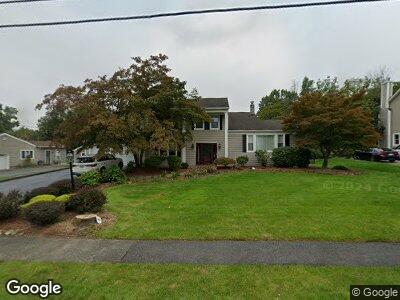
10 Ashwood Place Parsippany, NJ 07054
Parsippany NeighborhoodEstimated Value: $657,989 - $837,000
--
Bed
--
Bath
2,240
Sq Ft
$346/Sq Ft
Est. Value
About This Home
This home is located at 10 Ashwood Place, Parsippany, NJ 07054 and is currently estimated at $774,247, approximately $345 per square foot. 10 Ashwood Place is a home located in Morris County with nearby schools including Lake Hiawatha Elementary School, Central Middle School, and Parsippany High School.
Ownership History
Date
Name
Owned For
Owner Type
Purchase Details
Closed on
Aug 29, 2001
Sold by
Walstedt Scott
Bought by
Bhavsar Karteek and Bhavsar Meera
Current Estimated Value
Home Financials for this Owner
Home Financials are based on the most recent Mortgage that was taken out on this home.
Original Mortgage
$275,000
Interest Rate
6.98%
Purchase Details
Closed on
Nov 25, 1997
Sold by
Porcello Michael A
Bought by
Walstedt Scott and Walstedt Linda
Home Financials for this Owner
Home Financials are based on the most recent Mortgage that was taken out on this home.
Original Mortgage
$197,600
Interest Rate
10.7%
Create a Home Valuation Report for This Property
The Home Valuation Report is an in-depth analysis detailing your home's value as well as a comparison with similar homes in the area
Home Values in the Area
Average Home Value in this Area
Purchase History
| Date | Buyer | Sale Price | Title Company |
|---|---|---|---|
| Bhavsar Karteek | $365,000 | -- | |
| Walstedt Scott | $247,000 | -- |
Source: Public Records
Mortgage History
| Date | Status | Borrower | Loan Amount |
|---|---|---|---|
| Open | Bhavsar Karteek | $357,000 | |
| Closed | Bhavsar Karteek | $373,600 | |
| Closed | Bhavsar Karteek | $424,000 | |
| Closed | Bhavsar Karteek | $275,000 | |
| Previous Owner | Walstedt Scott | $197,600 |
Source: Public Records
Tax History Compared to Growth
Tax History
| Year | Tax Paid | Tax Assessment Tax Assessment Total Assessment is a certain percentage of the fair market value that is determined by local assessors to be the total taxable value of land and additions on the property. | Land | Improvement |
|---|---|---|---|---|
| 2024 | $12,833 | $370,900 | $188,800 | $182,100 |
| 2023 | $12,833 | $370,900 | $188,800 | $182,100 |
| 2022 | $11,973 | $370,900 | $188,800 | $182,100 |
| 2021 | $11,973 | $370,900 | $188,800 | $182,100 |
| 2020 | $11,717 | $370,900 | $188,800 | $182,100 |
| 2019 | $11,390 | $370,900 | $188,800 | $182,100 |
| 2018 | $11,138 | $370,900 | $188,800 | $182,100 |
| 2017 | $10,875 | $370,900 | $188,800 | $182,100 |
| 2016 | $10,678 | $370,900 | $188,800 | $182,100 |
| 2015 | $10,407 | $370,900 | $188,800 | $182,100 |
| 2014 | $10,263 | $370,900 | $188,800 | $182,100 |
Source: Public Records
Map
Nearby Homes
- 12 Farrand Dr
- 115 Cardigan Ct
- 63 Albert Ct Unit 63
- 18 Gordon Cir Unit 18
- 56 Albert Ct Unit 56
- 22 Farrand Dr
- 9 Gordon Cir Unit 9
- 25 Sandalwood Dr
- 25 Ferndale Dr
- 17 Rockaway Blvd
- 3 Woodhaven Rd
- 61 Norman Ave
- 47 Lincoln Gardens
- 65 Norman Ave
- 18 Nokomis Ave
- 15 Seminole Ave
- 8 Ute Ave
- 167 Lake Shore Dr
- 426 Vail Rd
- 18 Lake Shore Dr
- 10 Ashwood Place
- 8 Ashwood Place
- 12 Ashwood Place
- 10 Ser Del Dr
- 14 Ashwood Place
- 2 Greenbriar Rd
- 5 Ashwood Place
- 8 Ser Del Dr
- 1 Greenbriar Rd
- 7 Ashwood Place
- 16 Ashwood Place
- 4 Ashwood Place
- 12 Ser Del Dr
- 14 Ser Del Dr
- 6 Ser Del Dr
- 4 Greenbriar Rd
- 22 Ser Del Dr
- 3 Greenbriar Rd
- 9 Ashwood Place
- 3 Rickland Rd