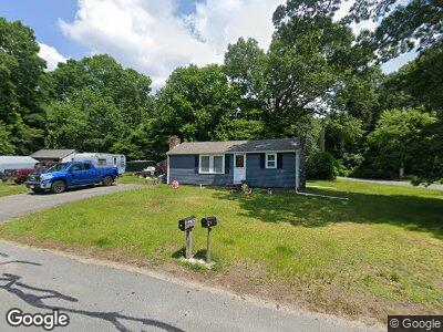
10 Assonet Blvd Assonet, MA 02702
Assonet Bay NeighborhoodEstimated Value: $340,000 - $367,000
2
Beds
1
Bath
612
Sq Ft
$578/Sq Ft
Est. Value
About This Home
This home is located at 10 Assonet Blvd, Assonet, MA 02702 and is currently estimated at $353,759, approximately $578 per square foot. 10 Assonet Blvd is a home located in Bristol County with nearby schools including Freetown Elementary School, George R Austin Intermediate School, and Freetown-Lakeville Middle School.
Ownership History
Date
Name
Owned For
Owner Type
Purchase Details
Closed on
Oct 5, 2004
Sold by
Perry Delores A
Bought by
Wegman Roger A and Stewart Tina M
Current Estimated Value
Home Financials for this Owner
Home Financials are based on the most recent Mortgage that was taken out on this home.
Original Mortgage
$200,000
Interest Rate
5.81%
Mortgage Type
Purchase Money Mortgage
Create a Home Valuation Report for This Property
The Home Valuation Report is an in-depth analysis detailing your home's value as well as a comparison with similar homes in the area
Home Values in the Area
Average Home Value in this Area
Purchase History
| Date | Buyer | Sale Price | Title Company |
|---|---|---|---|
| Wegman Roger A | $200,000 | -- |
Source: Public Records
Mortgage History
| Date | Status | Borrower | Loan Amount |
|---|---|---|---|
| Open | Wegman Roger A | $169,600 | |
| Closed | Wegman Roger A | $204,300 | |
| Closed | Wegman Roger A | $200,000 |
Source: Public Records
Tax History Compared to Growth
Tax History
| Year | Tax Paid | Tax Assessment Tax Assessment Total Assessment is a certain percentage of the fair market value that is determined by local assessors to be the total taxable value of land and additions on the property. | Land | Improvement |
|---|---|---|---|---|
| 2025 | $3,293 | $332,300 | $171,300 | $161,000 |
| 2024 | $3,271 | $313,600 | $161,600 | $152,000 |
| 2023 | $3,139 | $293,100 | $145,500 | $147,600 |
| 2022 | $2,994 | $248,300 | $123,300 | $125,000 |
| 2021 | $2,870 | $226,000 | $112,100 | $113,900 |
| 2020 | $2,777 | $213,300 | $107,800 | $105,500 |
| 2019 | $2,637 | $200,500 | $102,700 | $97,800 |
| 2018 | $2,534 | $190,400 | $102,700 | $87,700 |
| 2017 | $2,483 | $186,400 | $102,700 | $83,700 |
| 2016 | $2,321 | $177,300 | $99,700 | $77,600 |
| 2015 | $2,247 | $174,200 | $99,700 | $74,500 |
| 2014 | $2,116 | $167,800 | $97,700 | $70,100 |
Source: Public Records
Map
Nearby Homes