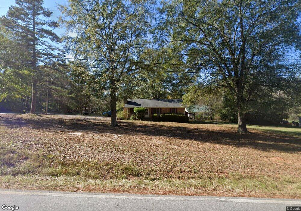
10 Atla Dr Covington, GA 30016
Estimated Value: $178,383 - $228,000
Studio
1
Bath
1,075
Sq Ft
$191/Sq Ft
Est. Value
About This Home
This home is located at 10 Atla Dr, Covington, GA 30016 and is currently estimated at $205,596, approximately $191 per square foot. 10 Atla Dr is a home located in Newton County with nearby schools including Livingston Elementary School, Liberty Middle School, and Alcovy High School.
Ownership History
Date
Name
Owned For
Owner Type
Purchase Details
Closed on
Aug 23, 2004
Sold by
Hegwood Kelly A
Bought by
Williams Pamela J
Current Estimated Value
Home Financials for this Owner
Home Financials are based on the most recent Mortgage that was taken out on this home.
Original Mortgage
$102,794
Outstanding Balance
$50,148
Interest Rate
5.97%
Mortgage Type
VA
Estimated Equity
$155,448
Purchase Details
Closed on
Aug 15, 1996
Sold by
Hegwood Walter D Patricia
Bought by
Hegwood Kelly A
Create a Home Valuation Report for This Property
The Home Valuation Report is an in-depth analysis detailing your home's value as well as a comparison with similar homes in the area
Home Values in the Area
Average Home Value in this Area
Purchase History
| Date | Buyer | Sale Price | Title Company |
|---|---|---|---|
| Williams Pamela J | $103,700 | -- | |
| Hegwood Kelly A | $65,000 | -- |
Source: Public Records
Mortgage History
| Date | Status | Borrower | Loan Amount |
|---|---|---|---|
| Open | Williams Pamela J | $102,794 | |
| Closed | Hegwood Kelly A | $0 |
Source: Public Records
Tax History
| Year | Tax Paid | Tax Assessment Tax Assessment Total Assessment is a certain percentage of the fair market value that is determined by local assessors to be the total taxable value of land and additions on the property. | Land | Improvement |
|---|---|---|---|---|
| 2025 | $342 | $57,400 | $10,000 | $47,400 |
| 2024 | $226 | $50,480 | $7,200 | $43,280 |
| 2023 | $427 | $44,760 | $4,800 | $39,960 |
| 2022 | $245 | $38,040 | $4,800 | $33,240 |
| 2021 | $790 | $29,920 | $4,800 | $25,120 |
| 2020 | $752 | $26,280 | $4,800 | $21,480 |
| 2019 | $728 | $25,240 | $4,800 | $20,440 |
| 2018 | $705 | $24,440 | $4,800 | $19,640 |
| 2017 | $674 | $23,520 | $3,800 | $19,720 |
| 2016 | $674 | $23,520 | $3,800 | $19,720 |
| 2015 | $667 | $23,320 | $3,800 | $19,520 |
| 2014 | $700 | $24,320 | $0 | $0 |
Source: Public Records
Map
Nearby Homes
- 40 Belmont Cir Unit 2
- 585 Cowan Rd
- 230 Belmont Trail
- 75 Cannonade Ct
- 205 Woodcrest Dr
- 225 Oak Hill Dr
- 115 Branchwood Dr
- 10 Oaklake Ct
- 120 Woodcrest Dr
- 15 Glen Echo Dr
- 25 Castlehill Ct
- 70 Countryside Ln
- 50 Glen Echo Dr
- 60 Muirfield Dr
- 25 Woodcrest Dr
- 195 Cedar Rd
- 66 Ellis Trail
- 335 Glen Echo Dr
- 750 Mills Dr
- 800 Mills Dr
- 836 Cowan Rd
- 15 Blackberry Ln
- 15 Atla Dr
- 30 Atla Dr
- 10 Blackberry Ln
- 25 Blackberry Ln
- 239 Oak Hill Rd
- 249 Oak Hill Rd
- 20 Blackberry Ln
- 233 Oak Hill Rd
- 35 Blackberry Ln
- 40 Atla Dr
- 30 Blackberry Ln
- 227 Oak Hill Rd
- 70 Adler Place
- 70 Adler Place Unit 19
- 60 Adler Place Unit 18
- 60 Adler Place
- 45 Blackberry Ln
- 285 Oak Hill Rd
Your Personal Tour Guide
Ask me questions while you tour the home.