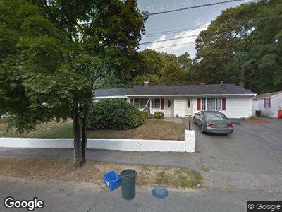
10 Azalea Ln Peabody, MA 01960
West Peabody NeighborhoodEstimated Value: $667,034 - $767,000
3
Beds
2
Baths
1,776
Sq Ft
$400/Sq Ft
Est. Value
About This Home
This home is located at 10 Azalea Ln, Peabody, MA 01960 and is currently estimated at $711,259, approximately $400 per square foot. 10 Azalea Ln is a home located in Essex County with nearby schools including Peabody Veterans Memorial High School, Covenant Christian Academy, and Our Lady Of Assumption School.
Ownership History
Date
Name
Owned For
Owner Type
Purchase Details
Closed on
Aug 29, 2003
Sold by
Fitch Edwin J and Fitch Joyce J
Bought by
Nevins Edward J
Current Estimated Value
Home Financials for this Owner
Home Financials are based on the most recent Mortgage that was taken out on this home.
Original Mortgage
$304,000
Outstanding Balance
$145,508
Interest Rate
5.69%
Mortgage Type
Purchase Money Mortgage
Estimated Equity
$591,458
Create a Home Valuation Report for This Property
The Home Valuation Report is an in-depth analysis detailing your home's value as well as a comparison with similar homes in the area
Home Values in the Area
Average Home Value in this Area
Purchase History
| Date | Buyer | Sale Price | Title Company |
|---|---|---|---|
| Nevins Edward J | $380,000 | -- |
Source: Public Records
Mortgage History
| Date | Status | Borrower | Loan Amount |
|---|---|---|---|
| Open | Dipietro-Nevins Kathleen | $131,273 | |
| Open | Nevins Edward J | $304,000 | |
| Closed | Nevins Edward J | $38,000 |
Source: Public Records
Tax History Compared to Growth
Tax History
| Year | Tax Paid | Tax Assessment Tax Assessment Total Assessment is a certain percentage of the fair market value that is determined by local assessors to be the total taxable value of land and additions on the property. | Land | Improvement |
|---|---|---|---|---|
| 2025 | $5,709 | $616,500 | $319,700 | $296,800 |
| 2024 | $5,759 | $631,500 | $319,700 | $311,800 |
| 2023 | $5,469 | $574,500 | $266,400 | $308,100 |
| 2022 | $5,248 | $519,600 | $231,700 | $287,900 |
| 2021 | $4,767 | $454,400 | $210,600 | $243,800 |
| 2020 | $4,976 | $463,300 | $210,600 | $252,700 |
| 2019 | $4,583 | $416,300 | $210,600 | $205,700 |
| 2018 | $4,692 | $409,400 | $188,000 | $221,400 |
| 2017 | $4,535 | $385,600 | $188,000 | $197,600 |
| 2016 | $4,443 | $372,700 | $188,000 | $184,700 |
| 2015 | $4,032 | $327,800 | $188,000 | $139,800 |
Source: Public Records
Map
Nearby Homes
- 1102 Foxwood Cir
- 5 Normandy Dr
- 3901 Woodbridge Rd
- 4603 Deerfield Cir
- 12 Lake St
- 8 Longbow Cir
- 24 Wildewood Dr
- 21 Wildewood Dr
- 10 Hoover Ave
- 16 Lakeview Dr
- 33 Rockwood Rd
- 11 Clark Rd
- 37 Locksley Rd
- 4 Midland Rd
- 14 Midland Rd
- 48 Pillings Pond Rd
- 37 Locust St
- 1 Colonial Rd
- 252 Newbury St Unit 87
- 6 Fall Way