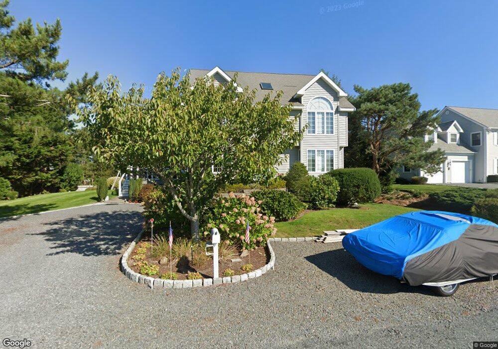
10 Barkentine Cir South Yarmouth, MA 02664
Estimated Value: $1,154,000 - $1,592,000
3
Beds
4
Baths
2,072
Sq Ft
$619/Sq Ft
Est. Value
About This Home
This home is located at 10 Barkentine Cir, South Yarmouth, MA 02664 and is currently estimated at $1,282,101, approximately $618 per square foot. 10 Barkentine Cir is a home located in Barnstable County with nearby schools including Dennis-Yarmouth Regional High School and St. Pius X. School.
Ownership History
Date
Name
Owned For
Owner Type
Purchase Details
Closed on
Feb 19, 2025
Sold by
Soterios L Zaimes Ret and Zaimes
Bought by
Zaimes Soterios L and Zaimes Althea M
Current Estimated Value
Purchase Details
Closed on
Apr 16, 2022
Sold by
Zaimes Soterios L and Zaimes Althea M
Bought by
S L Zaimes 2000 Ret and Zaimes
Purchase Details
Closed on
Jun 12, 1967
Bought by
Zaimes Soterio L and Zaimes Althea M
Create a Home Valuation Report for This Property
The Home Valuation Report is an in-depth analysis detailing your home's value as well as a comparison with similar homes in the area
Home Values in the Area
Average Home Value in this Area
Purchase History
| Date | Buyer | Sale Price | Title Company |
|---|---|---|---|
| Zaimes Soterios L | -- | None Available | |
| Zaimes Soterios L | -- | None Available | |
| S L Zaimes 2000 Ret | -- | None Available | |
| Zaimes Soterio L | -- | -- |
Source: Public Records
Mortgage History
| Date | Status | Borrower | Loan Amount |
|---|---|---|---|
| Previous Owner | Zaimes Soterio L | $120,000 |
Source: Public Records
Tax History Compared to Growth
Tax History
| Year | Tax Paid | Tax Assessment Tax Assessment Total Assessment is a certain percentage of the fair market value that is determined by local assessors to be the total taxable value of land and additions on the property. | Land | Improvement |
|---|---|---|---|---|
| 2025 | $7,606 | $1,074,300 | $460,300 | $614,000 |
| 2024 | $7,021 | $951,300 | $400,500 | $550,800 |
| 2023 | $6,907 | $851,700 | $326,800 | $524,900 |
| 2022 | $6,480 | $705,900 | $293,600 | $412,300 |
| 2021 | $5,852 | $612,100 | $275,800 | $336,300 |
| 2020 | $5,776 | $577,600 | $263,800 | $313,800 |
| 2019 | $5,578 | $552,300 | $263,800 | $288,500 |
| 2018 | $5,547 | $539,100 | $250,600 | $288,500 |
| 2017 | $5,402 | $539,100 | $250,600 | $288,500 |
| 2016 | $5,154 | $516,400 | $250,600 | $265,800 |
| 2015 | $5,235 | $521,400 | $250,600 | $270,800 |
Source: Public Records
Map
Nearby Homes
- 2 Barkentine Cir
- 194 Pawkannawkut Dr
- 12 Barkentine Cir
- 15 Barkentine Cir
- 212 Pawkannawkut Dr
- 188 Pawkannawkut Dr
- 7 Barkentine Cir
- 5 Barkentine Cir
- 19 Barkentine Cir
- 16 Barkentine Cir
- 2 Compass Dr
- 5 Compass Dr
- 216 Pawkannawkut Dr
- 184 Pawkannawkut Dr
- 3 Cape Isle Dr
- 6 Compass Dr
- 24 Barkentine Cir
- 31 Barkentine Cir
- 35 Barkentine Cir
- 34 Barkentine Cir