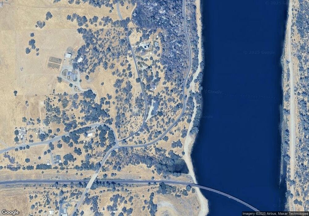
10 Big O Rd Oroville, CA 95965
Estimated Value: $392,000 - $562,000
2
Beds
3
Baths
1,975
Sq Ft
$258/Sq Ft
Est. Value
About This Home
This home is located at 10 Big O Rd, Oroville, CA 95965 and is currently estimated at $509,037, approximately $257 per square foot. 10 Big O Rd is a home located in Butte County with nearby schools including Sierra Avenue Elementary School, Nelson Avenue Middle School, and Oroville High School.
Ownership History
Date
Name
Owned For
Owner Type
Purchase Details
Closed on
Mar 23, 2009
Sold by
Wulbern Richard H and Englund Amber D
Bought by
Colby Cash A and Colby Debra R
Current Estimated Value
Purchase Details
Closed on
Dec 15, 2005
Sold by
Hansell Christine
Bought by
Hansell John B
Home Financials for this Owner
Home Financials are based on the most recent Mortgage that was taken out on this home.
Original Mortgage
$116,250
Interest Rate
6.36%
Mortgage Type
Purchase Money Mortgage
Purchase Details
Closed on
Oct 27, 2005
Sold by
Bank Of America Na
Bought by
Hansell John B and Hansell Elizabeth Joanne
Home Financials for this Owner
Home Financials are based on the most recent Mortgage that was taken out on this home.
Original Mortgage
$116,250
Interest Rate
6.36%
Mortgage Type
Purchase Money Mortgage
Create a Home Valuation Report for This Property
The Home Valuation Report is an in-depth analysis detailing your home's value as well as a comparison with similar homes in the area
Purchase History
| Date | Buyer | Sale Price | Title Company |
|---|---|---|---|
| Colby Cash A | $126,000 | Mid Valley Title & Escrow Co | |
| Hansell John B | -- | Fidelity Natl Title Co Of Ca | |
| Hansell Elizabeth Joanne | -- | Fidelity Natl Title Co Of Ca | |
| Wulburn Richard H | $155,000 | Fidelity Natl Title Co Of Ca | |
| Hansell John B | -- | -- |
Source: Public Records
Mortgage History
| Date | Status | Borrower | Loan Amount |
|---|---|---|---|
| Previous Owner | Wulburn Richard H | $116,250 |
Source: Public Records
Tax History Compared to Growth
Tax History
| Year | Tax Paid | Tax Assessment Tax Assessment Total Assessment is a certain percentage of the fair market value that is determined by local assessors to be the total taxable value of land and additions on the property. | Land | Improvement |
|---|---|---|---|---|
| 2025 | $4,915 | $452,977 | $159,067 | $293,910 |
| 2024 | $4,915 | $444,097 | $155,949 | $288,148 |
| 2023 | $4,845 | $435,391 | $152,892 | $282,499 |
| 2022 | $4,693 | $426,855 | $149,895 | $276,960 |
| 2021 | $4,634 | $418,486 | $146,956 | $271,530 |
| 2020 | $4,613 | $414,196 | $145,450 | $268,746 |
| 2019 | $4,551 | $406,076 | $142,599 | $263,477 |
| 2018 | $4,381 | $398,114 | $139,803 | $258,311 |
| 2017 | $4,224 | $390,309 | $137,062 | $253,247 |
| 2016 | $4,182 | $382,657 | $134,375 | $248,282 |
| 2015 | -- | $376,910 | $132,357 | $244,553 |
| 2014 | -- | $369,528 | $129,765 | $239,763 |
Source: Public Records
Map
Nearby Homes
- 60 La Cresenta Dr
- 322 Lausen St
- 915 Long Bar Rd
- 0 Colina Way
- 135 Morningstar Ave
- 0 Cherokee Rd Unit PA24106650
- 290 Incline Ave
- 0 Mono Ave
- 0 Nelson Ave Unit OR25168133
- 391 Canyon Highlands Dr
- 0 Grand Ave
- 149 Acacia Ave
- 82 Nelson Ave
- 77 Paula Ct
- 0 Paula Ct Unit OR25099943
- 4 Rockridge Rd
- 110 Acacia Ave
- 305 Canyon Highlands Dr
- 9 Linda Dr
- 6 Coventry Ct
- 60 Big O Rd
- 0 Thompson Flat Rd
- 26 Thompson Flat Rd
- 37 Thompson Flat Cemetery Rd
- 61 Thompson Flat Rd
- 66 Thompson Flat Rd
- 0 Big O Rd
- 302 Cherokee Rd
- 14 Blossom Hill Rd
- 15 Blossom Hill Rd
- 90 Big O Rd
- 24 Thompson Flat Cemetery Rd
- 1 Cherokee Rd
- 189 Big O Rd
- 119 Gold Ave
- 101 Gold Ave
- 109 Gold Ave
- 123 Lake Forest Ave
- 116 Lakeland Blvd
- 120 Lakeland Blvd
