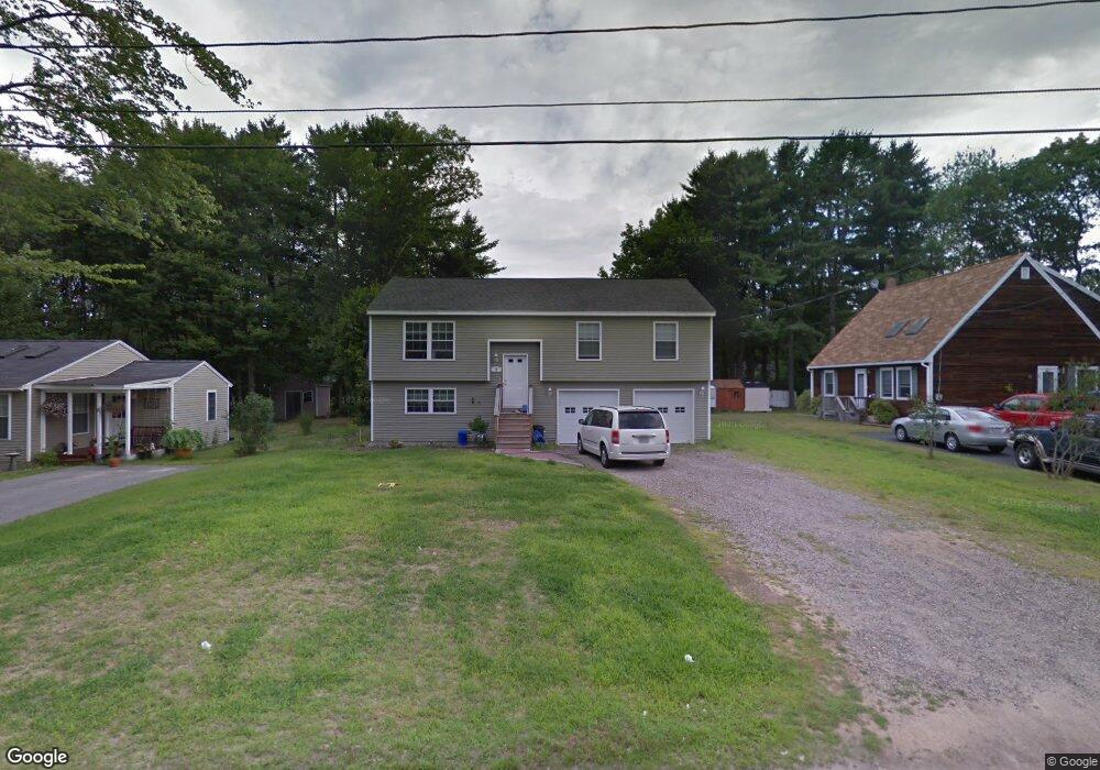
10 Boundary Way Kennebunk, ME 04043
Estimated Value: $417,000 - $844,000
3
Beds
1
Bath
1,100
Sq Ft
$499/Sq Ft
Est. Value
About This Home
This home is located at 10 Boundary Way, Kennebunk, ME 04043 and is currently estimated at $549,159, approximately $499 per square foot. 10 Boundary Way is a home located in York County with nearby schools including Kennebunk High School and The New School.
Ownership History
Date
Name
Owned For
Owner Type
Purchase Details
Closed on
Feb 18, 2014
Sold by
Lapointe James
Bought by
Nadeau Jason M and Nadeau Raymond Stephanie
Current Estimated Value
Purchase Details
Closed on
Apr 6, 2010
Sold by
Labonte Jason
Bought by
Powers Elisabeth T and Santerre Steven A
Home Financials for this Owner
Home Financials are based on the most recent Mortgage that was taken out on this home.
Original Mortgage
$200,214
Interest Rate
4.94%
Mortgage Type
FHA
Purchase Details
Closed on
Sep 18, 2006
Sold by
Labarge Muriel
Bought by
Smith Stephen L and Smith Carol
Create a Home Valuation Report for This Property
The Home Valuation Report is an in-depth analysis detailing your home's value as well as a comparison with similar homes in the area
Home Values in the Area
Average Home Value in this Area
Purchase History
| Date | Buyer | Sale Price | Title Company |
|---|---|---|---|
| Nadeau Jason M | -- | -- | |
| Powers Elisabeth T | $196,000 | -- | |
| Smith Stephen L | -- | -- |
Source: Public Records
Mortgage History
| Date | Status | Borrower | Loan Amount |
|---|---|---|---|
| Previous Owner | Powers Elisabeth T | $200,214 |
Source: Public Records
Tax History Compared to Growth
Tax History
| Year | Tax Paid | Tax Assessment Tax Assessment Total Assessment is a certain percentage of the fair market value that is determined by local assessors to be the total taxable value of land and additions on the property. | Land | Improvement |
|---|---|---|---|---|
| 2024 | $4,232 | $249,700 | $78,000 | $171,700 |
| 2023 | $4,008 | $249,700 | $78,000 | $171,700 |
| 2022 | $3,646 | $249,700 | $78,000 | $171,700 |
| 2021 | $3,558 | $249,700 | $78,000 | $171,700 |
| 2020 | $3,533 | $249,700 | $78,000 | $171,700 |
| 2019 | $3,433 | $249,700 | $78,000 | $171,700 |
| 2018 | $3,260 | $186,300 | $58,500 | $127,800 |
| 2017 | $3,083 | $186,300 | $58,500 | $127,800 |
| 2016 | $2,962 | $186,300 | $58,500 | $127,800 |
| 2015 | $2,850 | $186,300 | $58,500 | $127,800 |
| 2014 | $2,776 | $186,300 | $58,500 | $127,800 |
Source: Public Records
Map
Nearby Homes
- 16 Boundary Way
- 30 York St Unit 1
- 17 Legacy Ln
- 5 Cider Mill Ln
- 3 Cider Mill Ln
- 20 York St
- 7 Water St
- 11 Greenwich Way Unit 43
- 2 Cross St
- 9 Parsons St
- 54 Sycamore Ln Unit 19
- 61 Fletcher St
- 5 Wiggins Pond Ln
- 15 Casey Ln
- 3 Hardwood Dr
- 5 Heath Rd
- 16 Oakwood Ln Unit 16
- 59 Plymouth Grove Unit 11
- 17 Cascade Cir Unit 19
- 108 Hampton Glen Dr Unit 108
- 8 Boundary Way
- 12 Boundary Way
- 116 Boundary Way
- 14 Boundary Way
- 6 Boundary
- 21 Clarkdale Rd
- 32 Mousam Ridge Rd
- 117 Clarkdale Rd
- 30 Mousam Ridge Rd
- 4 Boundary Way
- 23 Clarkdale Rd
- 16 Clarkdale Rd
- 3 Boundary Way
- 3 Boundary Way
- 0 Boundry Way
- 34 Mousam Ridge Rd
- 19 Clarkdale Rd
- 18 Boundary Way
- 17 Clarkdale Rd
- 28 Mousam Ridge Rd