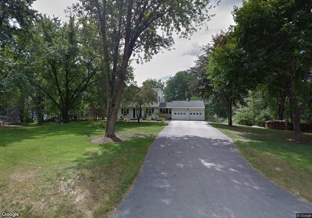
10 Briar Rd Bedford, NH 03110
Bedford NeighborhoodEstimated Value: $576,000 - $671,000
4
Beds
2
Baths
1,988
Sq Ft
$308/Sq Ft
Est. Value
About This Home
This home is located at 10 Briar Rd, Bedford, NH 03110 and is currently estimated at $611,504, approximately $307 per square foot. 10 Briar Rd is a home located in Hillsborough County with nearby schools including Mckelvie Intermediate School, Ross A. Lurgio Middle School, and Bedford High School.
Ownership History
Date
Name
Owned For
Owner Type
Purchase Details
Closed on
Jun 14, 2019
Sold by
Hayes Jeffrey A and Hayes Katherine Z
Bought by
Mclaughlin Michaela R
Current Estimated Value
Home Financials for this Owner
Home Financials are based on the most recent Mortgage that was taken out on this home.
Original Mortgage
$293,600
Outstanding Balance
$258,146
Interest Rate
4.1%
Mortgage Type
Purchase Money Mortgage
Estimated Equity
$353,358
Purchase Details
Closed on
Aug 9, 2004
Sold by
Zisman David L
Bought by
Hayes Jeffrey A and Hayes Katherine Z
Purchase Details
Closed on
Jul 6, 1998
Sold by
Baker Michael D and Baker Claire H
Bought by
Zisman David L
Create a Home Valuation Report for This Property
The Home Valuation Report is an in-depth analysis detailing your home's value as well as a comparison with similar homes in the area
Home Values in the Area
Average Home Value in this Area
Purchase History
| Date | Buyer | Sale Price | Title Company |
|---|---|---|---|
| Mclaughlin Michaela R | $367,000 | -- | |
| Hayes Jeffrey A | $329,900 | -- | |
| Zisman David L | $150,100 | -- |
Source: Public Records
Mortgage History
| Date | Status | Borrower | Loan Amount |
|---|---|---|---|
| Open | Mclaughlin Michaela R | $293,600 | |
| Previous Owner | Zisman David L | $192,500 | |
| Previous Owner | Zisman David L | $200,000 | |
| Previous Owner | Zisman David L | $25,000 |
Source: Public Records
Tax History Compared to Growth
Tax History
| Year | Tax Paid | Tax Assessment Tax Assessment Total Assessment is a certain percentage of the fair market value that is determined by local assessors to be the total taxable value of land and additions on the property. | Land | Improvement |
|---|---|---|---|---|
| 2024 | $8,428 | $533,100 | $236,500 | $296,600 |
| 2023 | $7,814 | $528,000 | $236,500 | $291,500 |
| 2022 | $7,059 | $401,100 | $175,100 | $226,000 |
| 2021 | $6,875 | $401,100 | $175,100 | $226,000 |
| 2020 | $6,629 | $331,100 | $134,600 | $196,500 |
| 2019 | $6,274 | $331,100 | $134,600 | $196,500 |
| 2018 | $6,322 | $309,900 | $134,600 | $175,300 |
| 2017 | $5,860 | $309,900 | $134,600 | $175,300 |
| 2016 | $5,971 | $266,900 | $107,600 | $159,300 |
| 2015 | $6,075 | $266,900 | $107,600 | $159,300 |
| 2014 | $6,005 | $266,900 | $107,600 | $159,300 |
| 2013 | $5,917 | $266,900 | $107,600 | $159,300 |
Source: Public Records
Map
Nearby Homes
- 10 Roosevelt Dr
- 17-4-28 Boiling Kettle Way
- 17-4-28 Boiling Kettle Way Unit 28
- 3 Westview Rd Unit Lot 3 - The Saffron
- 4 Westview Rd Unit Lot 4 - Hannah Floor
- 7 Hamilton Way
- 60 Riddle Dr
- 44-9 Olympus Way
- 32 Wellesley Dr
- 155 Wallace Rd
- 150 Wallace Rd
- 4 Jenkins Rd Unit Lot 31-4 - The Hann
- 20 Ledgewood Rd
- 217 N Amherst Rd
- 52 Hardy Rd
- 38 Old Farm Rd
- 258 N Amherst Rd Unit 34
- 32 Puritan Dr
- 38 Christmas Tree Cir
- 197 Liberty Hill Rd