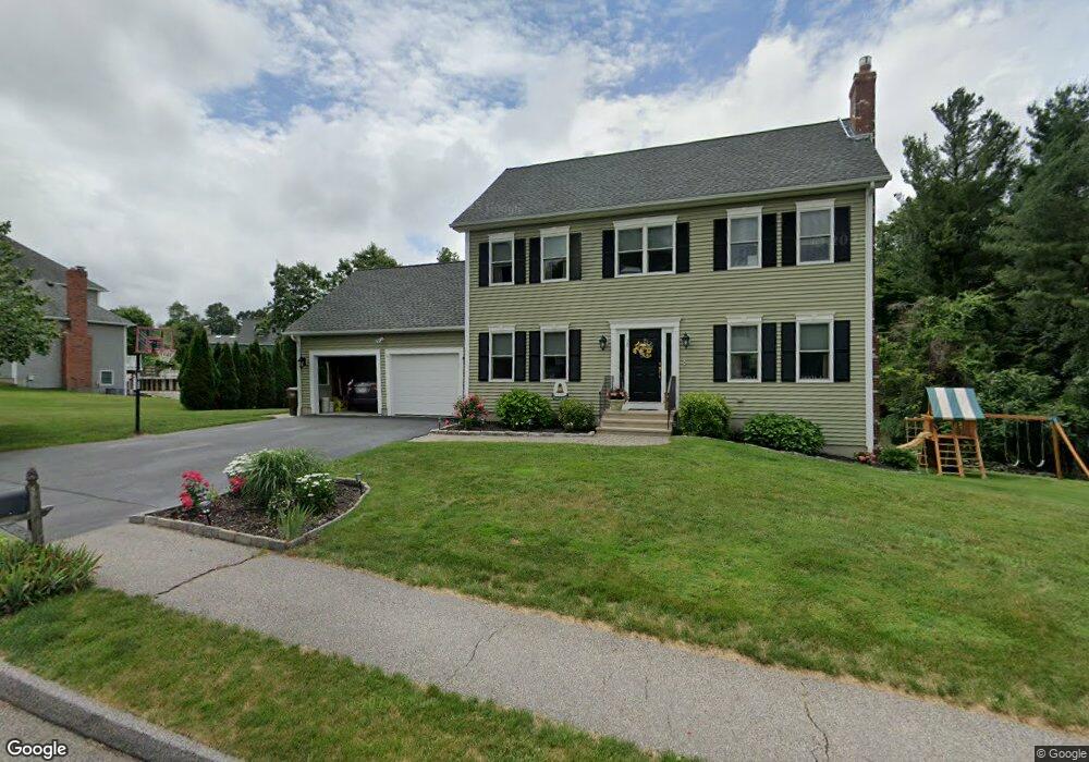
10 Bridle Path Auburn, MA 01501
West Auburn NeighborhoodEstimated Value: $667,000 - $779,000
4
Beds
3
Baths
1,872
Sq Ft
$382/Sq Ft
Est. Value
About This Home
This home is located at 10 Bridle Path, Auburn, MA 01501 and is currently estimated at $714,957, approximately $381 per square foot. 10 Bridle Path is a home located in Worcester County with nearby schools including Auburn Senior High School and Shrewsbury Montessori School - Auburn Campus.
Ownership History
Date
Name
Owned For
Owner Type
Purchase Details
Closed on
Apr 28, 2010
Sold by
Emerson Homes Inc
Bought by
Salvatore Michael W and Salvatore Kristin J
Current Estimated Value
Home Financials for this Owner
Home Financials are based on the most recent Mortgage that was taken out on this home.
Original Mortgage
$341,100
Outstanding Balance
$227,953
Interest Rate
4.99%
Mortgage Type
Purchase Money Mortgage
Estimated Equity
$487,004
Create a Home Valuation Report for This Property
The Home Valuation Report is an in-depth analysis detailing your home's value as well as a comparison with similar homes in the area
Home Values in the Area
Average Home Value in this Area
Purchase History
| Date | Buyer | Sale Price | Title Company |
|---|---|---|---|
| Salvatore Michael W | $379,000 | -- | |
| Emerson Homes Inc | $115,000 | -- |
Source: Public Records
Mortgage History
| Date | Status | Borrower | Loan Amount |
|---|---|---|---|
| Open | Salvatore Michael W | $341,100 |
Source: Public Records
Tax History
| Year | Tax Paid | Tax Assessment Tax Assessment Total Assessment is a certain percentage of the fair market value that is determined by local assessors to be the total taxable value of land and additions on the property. | Land | Improvement |
|---|---|---|---|---|
| 2025 | $87 | $610,900 | $176,000 | $434,900 |
| 2024 | $8,971 | $600,900 | $169,400 | $431,500 |
| 2023 | $8,383 | $527,900 | $143,800 | $384,100 |
| 2022 | $7,813 | $464,500 | $143,800 | $320,700 |
| 2021 | $7,390 | $407,400 | $117,900 | $289,500 |
| 2020 | $7,325 | $407,400 | $117,900 | $289,500 |
| 2019 | $7,208 | $391,300 | $116,900 | $274,400 |
| 2018 | $7,083 | $384,100 | $109,300 | $274,800 |
| 2017 | $6,859 | $374,000 | $99,200 | $274,800 |
| 2016 | $6,395 | $353,500 | $102,300 | $251,200 |
| 2015 | $5,991 | $347,100 | $102,300 | $244,800 |
| 2014 | $5,837 | $337,600 | $97,300 | $240,300 |
Source: Public Records
Map
Nearby Homes
- 104 Appleton Rd
- 4 Athens St
- 0 Athens St
- 808 Washington St
- 49 Prospect St
- 19 Thayer Pond Dr Unit 3
- 17 Thayer Pond Dr Unit 2
- 24 Thayer Pond Dr Unit 17
- 4 Thayer Pond Dr Unit 20
- 6 Thayer Pond Dr Unit 11
- 34 Thayer Pond Dr Unit 8
- 155 Southbridge Rd
- 35 Waterman Rd
- 31-37 Leicester St
- 45 Leicester St
- 634 Oxford St S
- 6 Laurelwood Dr
- 9 B Wellington Rd
- 1 Shady Ln
- 751 Washington St Unit 43A
Your Personal Tour Guide
Ask me questions while you tour the home.