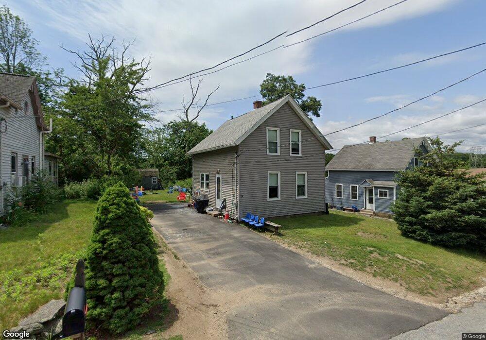
10 Brightside St Millbury, MA 01527
Estimated Value: $322,000 - $361,000
2
Beds
1
Bath
768
Sq Ft
$441/Sq Ft
Est. Value
About This Home
This home is located at 10 Brightside St, Millbury, MA 01527 and is currently estimated at $338,817, approximately $441 per square foot. 10 Brightside St is a home located in Worcester County with nearby schools including Elmwood Street Elementary School, Raymond E. Shaw Elementary School, and Millbury Junior/Senior High School.
Ownership History
Date
Name
Owned For
Owner Type
Purchase Details
Closed on
Feb 12, 1987
Sold by
O'Connor Judith A
Bought by
Shine Paul R
Current Estimated Value
Home Financials for this Owner
Home Financials are based on the most recent Mortgage that was taken out on this home.
Original Mortgage
$83,000
Interest Rate
9.34%
Mortgage Type
Purchase Money Mortgage
Create a Home Valuation Report for This Property
The Home Valuation Report is an in-depth analysis detailing your home's value as well as a comparison with similar homes in the area
Home Values in the Area
Average Home Value in this Area
Purchase History
| Date | Buyer | Sale Price | Title Company |
|---|---|---|---|
| Shine Paul R | $93,000 | -- |
Source: Public Records
Mortgage History
| Date | Status | Borrower | Loan Amount |
|---|---|---|---|
| Open | Shine Paul R | $15,000 | |
| Open | Shine Paul R | $82,500 | |
| Closed | Shine Paul R | $83,000 |
Source: Public Records
Tax History Compared to Growth
Tax History
| Year | Tax Paid | Tax Assessment Tax Assessment Total Assessment is a certain percentage of the fair market value that is determined by local assessors to be the total taxable value of land and additions on the property. | Land | Improvement |
|---|---|---|---|---|
| 2025 | $3,421 | $255,500 | $104,000 | $151,500 |
| 2024 | $3,138 | $237,200 | $96,300 | $140,900 |
| 2023 | $2,842 | $196,700 | $67,500 | $129,200 |
| 2022 | $2,738 | $182,500 | $67,500 | $115,000 |
| 2021 | $2,743 | $177,800 | $67,500 | $110,300 |
| 2020 | $0 | $171,200 | $67,500 | $103,700 |
| 2019 | $2,718 | $171,500 | $61,400 | $110,100 |
| 2018 | $0 | $151,300 | $61,400 | $89,900 |
| 2017 | $2,376 | $144,600 | $61,400 | $83,200 |
| 2016 | $0 | $138,500 | $61,400 | $77,100 |
| 2015 | $2,285 | $138,800 | $65,300 | $73,500 |
| 2014 | $2,156 | $126,100 | $65,300 | $60,800 |
Source: Public Records
Map
Nearby Homes
- 123 Riverlin St
- 64 Millbury Ave
- 15 Rayburn Dr
- 17 Atwood Ave
- 16 Jackie Dr
- 19 Rice Rd
- 20 Woodridge Rd
- 4 Thomas Hill Rd
- Lot 1 Cooper Rd
- 8 Autumn Gate Cir
- 90 Macarthur Dr
- 40 River St
- 10 Leslie Ln
- 16 Elm Ct
- 52 Clearview Terrace Unit 39
- 2 Jessica j Dr
- 4 Jessica j Dr
- 38 W Main St
- 12 Alstead Path
- 5 Mogren Dr
- 12 Brightside St
- 8 Brightside St
- 14 Brightside St
- 6 Brightside St
- 100 Riverlin St
- 11 Brightside St
- 7 Brightside St
- 9 Brightside St
- 95 Riverlin St Unit B
- 95 Riverlin St Unit A
- 95 Riverlin St
- 93 Riverlin St
- 91 Riverlin St
- 99-101 Riverlin St Unit 99
- 99 Riverlin St Unit 101
- 103 Riverlin St
- 105 Riverlin St
- 107 Riverlin St
- 53 Carousel Dr
- 113 Riverlin St